
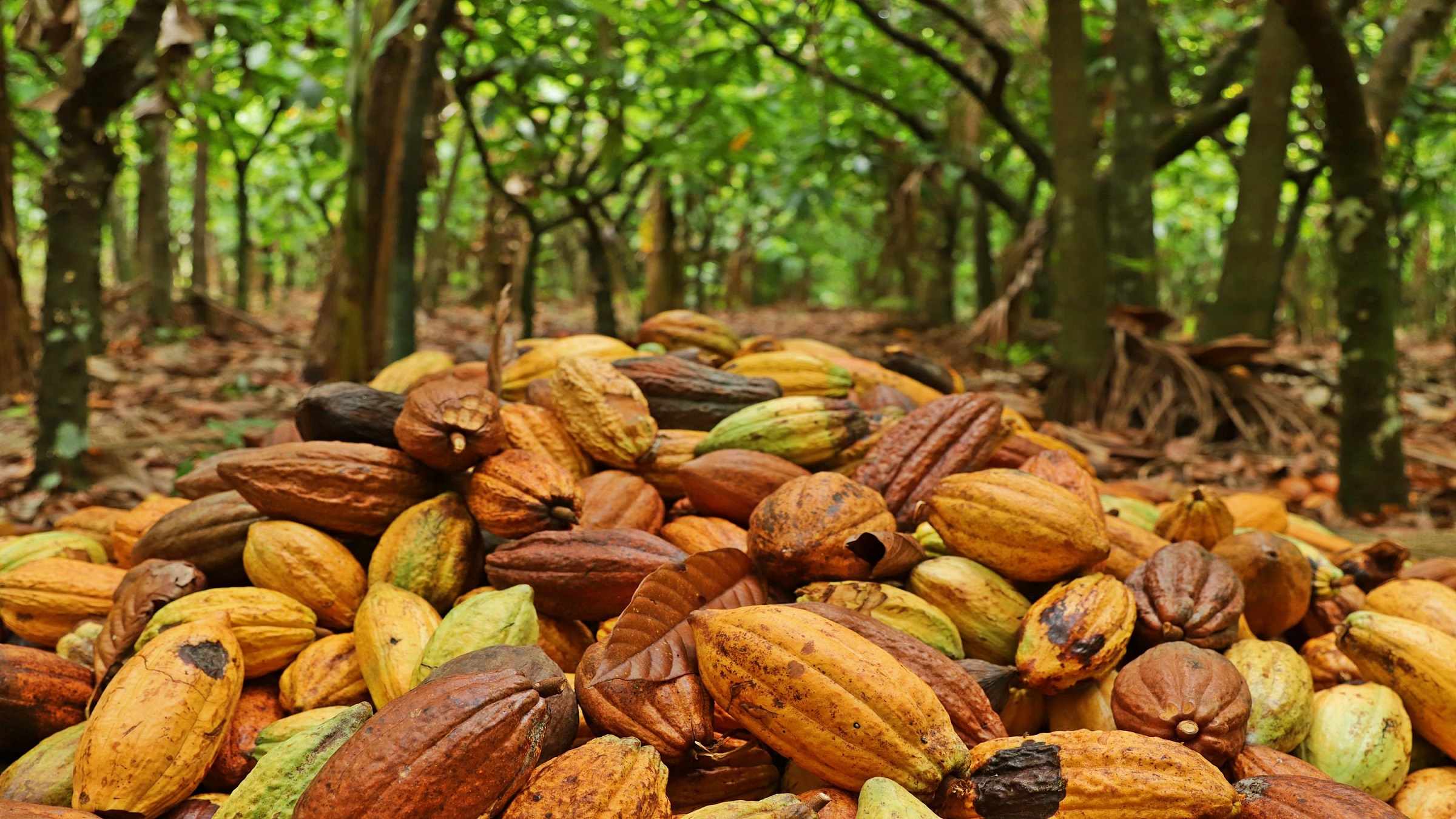
New mapping by Brazil’s agricultural research agency, Embrapa, found that the area on which cacao grows in Pará state rose 33% between 2022 and 2024, with 96% of mapped cacao on land cleared before 2020.That record leaves Amazon cacao well positioned to meet the EU’s new deforestation rules, with the sector keen to secure better prices for farmers who grow cacao without clearing forest.Most new plantings are full-sun monocultures, which are less sustainable than agroforestry, but sources say Brazil is unlikely to follow West African countries in clearing forest for cacao. As record cocoa prices drive farmers in West Africa to clear native forest, a new study suggests the crop is following a different path in the Brazilian Amazon: It’s spreading onto land that was cleared long ago. Mapping by Embrapa, Brazil’s state-run agricultural research agency, found that the area on which cacao was growing in Pará, the country’s top-producing state, grew by a third between 2022 and 2024 to 116,436 hectares (287,700 acres). Nearly all of the cacao was found on old pastures and other previously cleared land, with 96% of the cacao that was mapped in Pará and 98% of it in Rondônia state located in areas deforested before 2020. This is fully compliant with the European Union’s sustainability regulations, strengthening Brazil’s position as a potential cocoa exporter. The study also found a new pattern in how the crop is grown. Until Embrapa’s 2022 mapping, all the cacao it had identified in Pará grew in agroforestry systems. Now almost two-thirds of new plantings are full-sun monocultures, where a single crop is grown in a large area without shade. This type of monoculture yields more beans per tree but is more vulnerable to pests and disease and leaves farmers dependent on a single crop. Cacao mapping in the Amazon traces back to TerraClass, a program run with Brazil’s space agency, INPE, that maps how deforested land in the Brazilian Amazon is used. Adriano Venturieri, a remote sensing specialist at Embrapa Amazônia Oriental in the city of Belém in Pará, led the first version and later led the new study. Over the years, his team added oil palm, citrus and coffee to the TerraClass maps — then came cacao. Pará is Brazil’s top cacao producer, but a decade ago, when Venturieri took on the challenge, no one had mapped where the crop actually grew in the state. The first satellite images were baffling, he told Mongabay, “We didn’t understand anything.” Plots that looked like secondary forest turned out to be cacao growing under taller trees in agroforestry systems known in Brazil by the acronym SAF. These systems mix cacao with other crops and native trees that shade the cacao, keep pests and disease in check, and give farmers extra income from products such as açaí, bananas and Brazil nuts. An agroforestry system (SAF) with açaí, cacao, cupuaçu, andiroba, taperebá and banana. This type of land use combines different crops in the same area. Image courtesy of Embrapa. To get it right, the team went to the field. Venturieri — alongside technicians from CEPLAC, the federal cacao agency, and Emater, Pará’s rural advisory service — showed printed images to farmers so they could point out their plots. By 2021, the work was scaling up, with Embrapa teaming up with Naiara Pinto, a Brazilian ecologist at NASA, and moving the work to Google Earth Engine. Still, interpreters needed to check the models produced from the images by eye, and doubtful areas went to field checks. The first full results came out in 2022. Using data from 2004 to 2020, the team mapped nearly 70,000 hectares (173,000 acres) of cacao in Pará and found it had mostly replaced pasture. Almost 89% sat on land cleared by 2008, the cutoff set by Brazil’s Forest Code, legislation which aims to balance the protection of native vegetation with rural, private land use; and 99.5% lay outside protected areas, Indigenous territories and Quilombola lands. Nearly all of it grew in agroforestry systems. The findings caught the attention of CocoaAction Brasil, a public-private initiative of the World Cocoa Foundation, an international association of cocoa and chocolate companies. “We knew the potential, and we knew agroforestry was cacao’s main production model, but we didn’t understand some of these issues,” said Vítor Stella, technical coordinator at CocoaAction Brasil, which helped Venturieri publish the results in international journals. For the industry, the map also has a practical use. “This mapping lets you prove not only the origin of the cacao, but the path it takes to reach the final consumer,” Stella told Mongabay. “When you understand where it is, it’s much easier to do all the traceability.” That is no small task in the Amazon. Stella said he sometimes drives 150 kilometers (93 miles) down dirt side roads off the Trans-Amazonian Highway to reach a farmer with a single hectare of cacao. “How do you trace that? It’s complex,” he said. “But we have been advancing.” New production on old pastures In 2025, CocoaAction agreed to fund an updated study. Venturieri’s team now had new methods and more precise equipment. It combined radar with high-resolution imagery from several satellites and is now in the process of moving its models to SITS, open-source software developed by INPE. The results, presented in August at the ExpoCacau 2026 trade fair in Bahia state, covered about 121,000 hectares (299,000 acres) across the states of Pará and Rondônia. In Pará, cacao crops increased by 33.26%, from 87,309 hectares (215,700 acres) in 2022 to 116,436 hectares (287,700 acres) in 2024, spread over 61 municipalities. Most farms are small and family-run: 84.6% of Pará’s cacao properties cover 5 hectares (12 acres) or less, according to the study. CocoaAction also asked for one addition: Rondônia, a state in the southwest of the Brazilian Amazon whose cacao had never been mapped. Despite the distance from its base in Belém, the team ran field surveys there, and the first baseline found 5,340 hectares (13,200 acres) of cacao across 51 municipalities, mostly on family plots. As in the 2022 study, the new mapping found some of the cacao hidden under forest. Some 11,444 hectares (28,300 acres) in Pará, about 10% of the mapped area, and 148 hectares (366 acres) in Rondônia still show up as forest. Farmers planted cacao under a thinned canopy without clearing it entirely, a technique similar to the traditional cabruca system deployed in the Atlantic Forest in Bahia. Stella sees this as part of a broader pattern he calls “productive conservation”: Where there’s cacao, he said, “the forest is still standing.” Cacao is native to the Amazon and has grown there for some 5,000 years. In Pará, for example, farmers are allowed to restore the legal reserve every Amazon property must keep, 80% of its area, with cacao as one of the species, and still harvest it. Why cleared land pays off The latest cacao-growing expansion rode a global price boom. After crop disease and extreme weather wrecked harvests in Côte d’Ivoire and Ghana, cocoa futures in New York soared nearly fourfold, from an average of about $3,300 per metric ton in 2023 to a record about $12,900 in December 2024. They have since fallen back to around $5,800, still about 75% above the 2023 average. Even so, Venturieri said the new crops in Brazil grew over previous pasture, and the reason comes down mostly to economics. “Cutting down a forest isn’t cheap,” he said. Pará has vast areas of degraded and unproductive pasture, and planting there is cheaper and faster. Where cacao grows also decides where it can be sold. The EU is the world’s largest cocoa importer, accounting for about 60% of global imports. Its Deforestation Regulation (EUDR), set to apply to large operators from Dec. 30, 2026, bars cocoa grown on land deforested after Dec. 31, 2020. That’s where the Amazon’s record pays off. Venturieri’s presentation at ExpoCacau 2026 calls the results a “compliance shield.” In Pará, about 80% of mapped cacao sits on land cleared before 2008, which Venturieri calls a “safe zone,” and 17% on land cleared between 2009 and 2020. Only 3.9% falls in the post-2021 “risk zone.” In Rondônia, the split is 92%, 6% and 2%. Stella said Brazil can grow far more cacao without new clearing. The country has about 600,000 hectares (1.5 million acres) of cacao, with an average yield of around 350 kilograms per hectare (312 pounds per acre). He said basic soil correction and pruning could double or triple that, and higher yields on existing land make opening new areas far less attractive. “Brazil doesn’t need to cut down a single tree to become self-sufficient and return to being an exporter,” he said. He also sees the Amazon’s record as a selling point. He said some 75-80% of Brazil’s cacao grows in agroforestry systems, which sets it apart from many other origins. “In today’s world, sustainability is a license to operate,” Stella said. Farmers who don’t adapt, he added, could lose access to markets. Agroforestry systems diversify production, generate income, and protect soil and water. The photo shows a system that includes crops such as cacao, pineapple, black pepper, andiroba, and acerola. Image courtesy of Embrapa. Cacao under the sun Most of the new cacao, though, is growing without shade. Of the roughly 29,100 hectares (72,000 acres) planted in Pará between 2022 and 2024, 63% was full-sun monoculture and only 37% agroforestry. Venturieri estimates that 85% of the state’s total cacao area remains agroforestry, but earlier maps found no full-sun cacao, suggesting a recent shift. Rondônia shows the opposite pattern, with 62% of its cacao being agroforestry, which small farmers there find more profitable. Elsewhere, the price boom has pushed cacao into the forest. In Liberia, Mongabay reported that southeastern Grand Gedeh county lost more forest in 2025 than any Liberian county in any year since 2002, much of it cleared by migrant workers for new plantations. This means that the EU rule could now shut Liberian cocoa out of its biggest market. Stella rejects the idea that Brazil could follow that path. “Liberia is completely the opposite of what we have in Brazil,” he said. “Here, we start from areas that have already been deforested.” Venturieri is more cautious. “There’s always a risk,” he said. But with so much open land, clearing forest makes little economic sense. The numbers back them up. In Pará alone, Venturieri and anthropologist Eduardo Brondízio identified about 13 million hectares (32 million acres) that could shift to more sustainable uses. The state’s entire cacao area would fit in less than 1% of it. Across the Amazon, pasture covers some 56 million hectares (138 million acres), according to MapBiomas. For Stella, even full-sun cacao on an exhausted pasture is a gain. “You go from an extremely degraded area, with no commercial use, to a simple system, yes, but one that also makes its contribution,” he said. “Ideally, we would work with more diverse systems, but given where we start from, I think it’s a great evolution for that land.” Venturieri acknowledges the reasons why farmers make the switch. A cacao tree in full sun can yield 2.5-3 kg (5.5-6.6 lbs) of dried beans, compared with about 900 grams (2 lbs) in an agroforestry system, though it also brings more pests and disease. Buyers pay the same either way. In this context, Venturieri said long-term environmental impact isn’t on farmers’ minds when they make their choices, “They’re thinking about paying their bills at the end of the month.” A plan for 2030 Brazil was a major cacao exporter in the 1970s, when yields averaged about 700 kg per hectare, double today’s average yield. But for Stella, more than increasing volume, the aim is to secure better prices for farmers using the conservation-based model. “We don’t want to be the biggest producer. We want to be the best positioned,” he said. The national Inova Cacau 2030 plan, made official policy in May, sets that course: production above 400,000 metric tons a year, 120,000 new hectares (296,526 acres) under sustainable models and 70% of output traceable, all by 2030. All this comes under the program’s stated goal to make Brazil “the benchmark of sustainable cocoa origin for the world.” The vast area identified in Venturieri and Brondízio’s work suggests there’s room to grow the right way. “We don’t need to cut a single tree,” Venturieri said. “We have enough land for a revolution in the Amazon.” What’s missing, he said, is money and people to put existing technology to work, along with models that fit each place: “There are many Parás within Pará, many Amazons within the Amazon.” Banner image: Cacao expansion in Pará is taking place almost entirely on land degraded before 2020, ensuring compliance with the European Union’s environmental rules, the largest cocoa-buying market. Image courtesy of Embrapa. The vanishing forests on Liberia’s cocoa frontier FEEDBACK: Use this form to send a message to the author of this post. If you want to post a public comment, you can do that at the bottom of the page. Credits Topics
Amazon mapping shows cacao expansion without deforestation in Brazil
Full Article
Original Source
Read the full article at News →KhanList aggregates and links to publicly available news content. We do not host full articles from third-party sources. Always verify important information with original sources.