
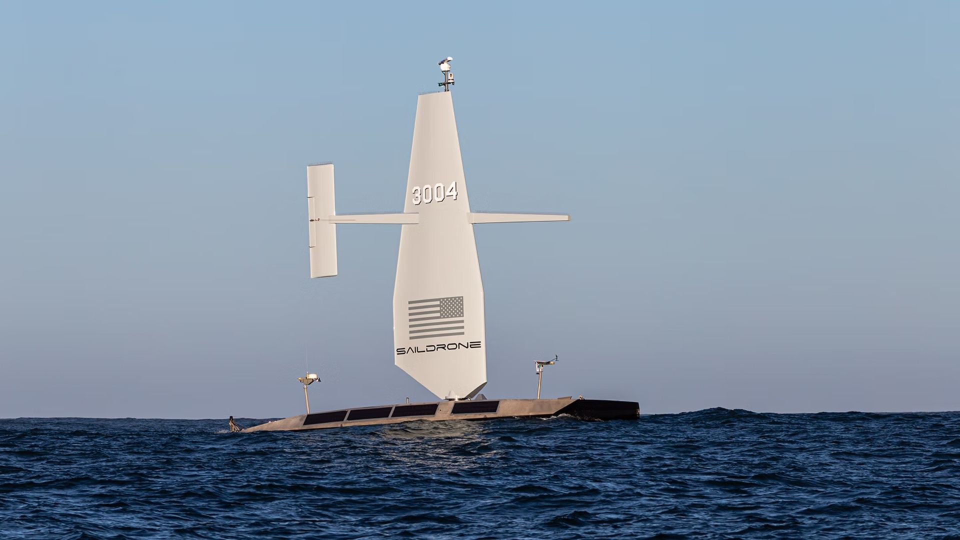
The US Navy has awarded California-based Saildrone a $10 million contract to map parts of the Atlantic Ocean floor using autonomous vessels, expanding the military’s knowledge of terrain beneath strategically important waters. Assigned by the Naval Oceanographic Office, the survey will begin in 2026 and continue through most of 2027. Saildrone’s Surveyor unmanned surface vessels (USVs) will collect high-resolution bathymetric data across international waters. The information will support safe navigation, submarine missions, anti-submarine warfare, critical infrastructure protection, rescue operations, and vessel route planning. Saildrone said the deployment will build on its ocean-mapping work for the US government, which began in 2019. Closing gaps in ocean-floor knowledge Bathymetry measures the depth and physical shape of the seafloor, revealing underwater mountains, trenches, ridges, and canyons that can affect naval operations. Only 28.7 percent of the world’s oceans have been mapped to modern standards. Much of the remaining seabed is understood through lower-resolution estimates that may not capture hazards or terrain features in sufficient detail. For submarines and surface vessels, those knowledge gaps can create operational risks. High-resolution maps help crews identify submerged obstacles, update navigation charts, and plan routes through unfamiliar waters. The data can also support submarine and anti-submarine operations because underwater terrain influences acoustic propagation and maneuvering. Better environmental knowledge may give naval forces a clearer understanding of how sound travels through a particular area. “High-resolution ocean mapping is vital to the US Navy’s maritime superiority and strategic advantage, enabling safe navigation, effective submarine operations, and fleet lethality,” said Kitch Kennedy, senior director of ocean mapping at Saildrone. Autonomous vessels extend survey reach The Navy has traditionally relied on crewed survey ships and oceanographic specialists to gather seabed data. Long-endurance autonomous vessels can supplement those ships by covering large and remote areas without requiring personnel to remain aboard. This approach allows Navy crews and specialists to concentrate on regions that require direct human expertise while autonomous platforms conduct lengthy surveys elsewhere. In addition to mapping seafloor features, the Surveyor can measure ocean currents to depths of about 3,280 feet. Current data can assist search-and-recovery teams by helping them estimate how people, aircraft debris, or other objects may drift after entering the water. A 100-day drone ship Saildrone’s Surveyor is a 66-foot-long unmanned vessel weighing about 15 tons. Its wing rises approximately 43 feet and is made from carbon-fiber and fiberglass composites, while the hull uses marine-grade aluminum. The platform can carry infrared cameras, radar, satellite communications, transreceivers, and machine-learning systems designed to detect potential threats. Its modular configuration supports both scientific surveys and intelligence, surveillance, and reconnaissance missions. An 80-horsepower diesel generator helps the vessel operate when winds are weak. The Surveyor can travel at up to 6 knots, or roughly 7 miles per hour, and has a range exceeding 2,500 nautical miles.With an endurance of as much as 100 days, the vessel is designed to remain at sea through long surveys and unpredictable Atlantic conditions.Get the latest in engineering, tech, space & science - delivered daily to your inbox.Atharva is a full-time content writer with a post-graduate degree in media & amp; entertainment and a graduate degree in electronics & telecommunications. He has written in the sports and technology domains respectively. In his leisure time, Atharva loves learning about digital marketing and watching soccer matches. His main goal behind joining Interesting Engineering is to learn more about how the recent technological advancements are helping human beings on both societal and individual levels in their daily lives.
US to deploy 2,877-mile-range vessels to map Atlantic seabed for submarine navigation
Full Article
Original Source
Read the full article at Interestingengineering →KhanList aggregates and links to publicly available news content. We do not host full articles from third-party sources. Always verify important information with original sources.