
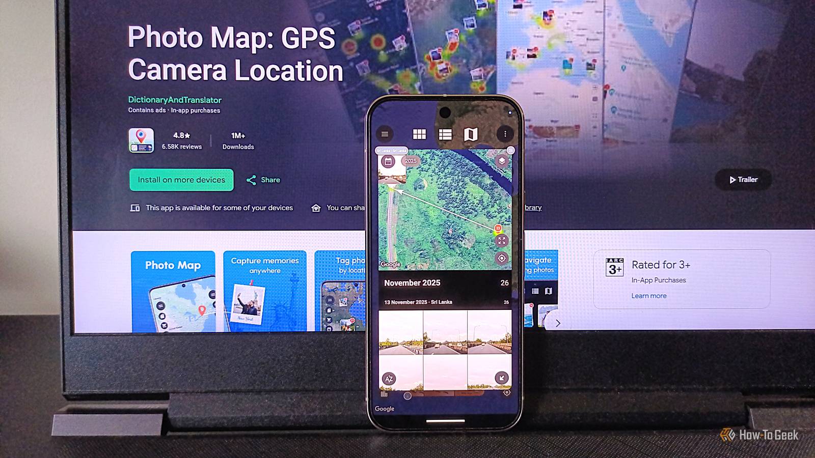
Published Nov 3, 2026, 1:00 PM EST Namerah Saud Fatmi has been writing about smartphones, accessories, e-readers, and apps for nearly a decade. She occasionally branches out into sects like gaming, software, hardware, smart home, and wearables. Before How-To Geek, she was a senior editor at Android Central, and has had bylines at other respectable publications such as Windows Central, iMore, XDA Developers, Neowin, and Good e-Reader. When she isn't writing or testing yet another weird and wonderful new gadget, she spends her free time snuggling with her grumpy feline life partner. Her hobbies include casual gaming, traveling, attempting to pet anything classified as an animal, unnecessarily complicated craft projects, and hunting for the next great bowl of noodles. Google Photos is an excellent gallery app for Android, and it's been my go-to photo viewer for nearly a decade now. I use a Pixel 10 Pro, so I enjoy the extra perks of using Google's suite of apps on my device. Despite all of its add-ons and upsides, Google Photos is missing a feature that could take the app to a whole new level: an interactive map. You can already save each image's location data on your phone and view it in your image gallery. Google Photos creates albums based on certain locations, but there's no way to view the map of a place, area, city, country, or even the entire world in the app. The Timeline feature in Google Maps comes pretty close, but it doesn't plot all your images on a world map, just your location history. Not to mention, the privacy risks and fickle issues like random loss of user data are possible occurrences. If you would like to follow the trail of your pictures in this fashion, there's an app called Photo Map available for Android users. Photo Map lets you trace your photos on a map It even lets you go back in time Created by an XDA Developers forum member, Photo Map is a safer Timeline alternative with better features and an image overlay. Though the original creator has since sold the app, it lives on strong on the Play Store. It places all your pictures on a map, and you can zoom in to see the location of each image down to the street it was shot on. Imagine if Google Photos and Google Maps had a baby — this app would be the result. Let's start with the most important point. Why would you want this app? The answer is multifaceted: to keep track of your travels and discoveries, for research purposes, to log your favorite hiking spots or eateries based on pictures alone, or maybe just to walk down memory lane and indulge in nostalgia. The creator of the app explained that they designed it for travelers, archaeologists, and environmental entities to track locations and routes based on images, and to document when and where the pictures were captured. I can see a wider subset of individuals benefiting from the Photo Map, such as photographers, marine biologists, divers, search and rescue teams, journalists, students, teachers, foragers, farmers, roadworks and construction contractors, firefighters, forest rangers, and a thousand other professionals. Undoubtedly, the demand is there. It's easy to use and stores data locally Privacy is not a concern An app that is useful to so many people needs to be easy to use, with a straightforward UI that doesn't have a learning curve attached to it. Photo Map is just that. Setting up takes a few simple taps after installation. You can choose the free basic version or go for the paid package. The difference between the two is that the premium subscription removes ads, unlocks VIP customer support, and lets you view more than 500 images at a time on the map. The core elements, such as viewing pictures on the map and detailed photo metadata, are free for all, so the subscription doesn't gatekeep the primary purpose of the app. You can search images by name or location within the app and import GPX, KML, and KMZ routes. In addition to local storage, it supports a cloud connection to Google Drive. You can draw your own layers, tag and star photos, and customize dots or heat on the map. File formats like w3w, GIFs, and videos are supported, as is EXIF data reading and writing. You can create location clusters to view pictures from a certain trip, combining timestamp data as well. Because it doesn't use any intermediary servers, it caches all data locally on your device. So you can lay any fears regarding privacy to rest. The map can be viewed in several modes, including satellite, terrain, hybrid, and more. The app has quite an extensive set of settings, features, and customizability options. What holds it back from greatness... Almost perfect As handy as the app is, it certainly needs improvement in a few main areas. Places where a bunch of pictures are taken generate automatic clusters and automatically populate location folders. However, you can't share the location of an image with others unless you manually note the location and then type it out and send it to someone. It only makes sense for a person who wants to track their location history based on images to be on the hunt for a specific place, probably somewhere they went on a specific day. Following along those lines, the ability to share the location is the natural next step. The developer last updated the app in October 2026, but the UI still looks very dated. I don't think the app has gotten a major visual overhaul since its inception in 2019. Another opportunity for the developer is to add a web companion app or website, so the map is available across platforms. Pricing differs slightly per region, but it isn't affordable. My regional pricing is equivalent to about $16 per week. I expect better cross-platform support at such a steep price. It fills a niche at the end of the day Though it isn't without its flaws, the Photo Map app fills a unique niche. There aren't many reliable alternatives on the Google Play Store that offer such a robust combination of features. PhotoPills is a similar app that you could consider, but it is also very expensive. Just like Photo Map, it too lacks any web companion service or platform. PhotoPills focuses on photography, so I still recommend Photo Map for most other professionals or hobbyists. The free basic version performs satisfactorily, though the ads get on my nerves. If you're unsure about the value of going premium, you can always try the paid version free for three days.
This Android app turned my photos into an interactive map of everywhere I've been
Full Article
Original Source
Read the full article at Howtogeek →KhanList aggregates and links to publicly available news content. We do not host full articles from third-party sources. Always verify important information with original sources.