
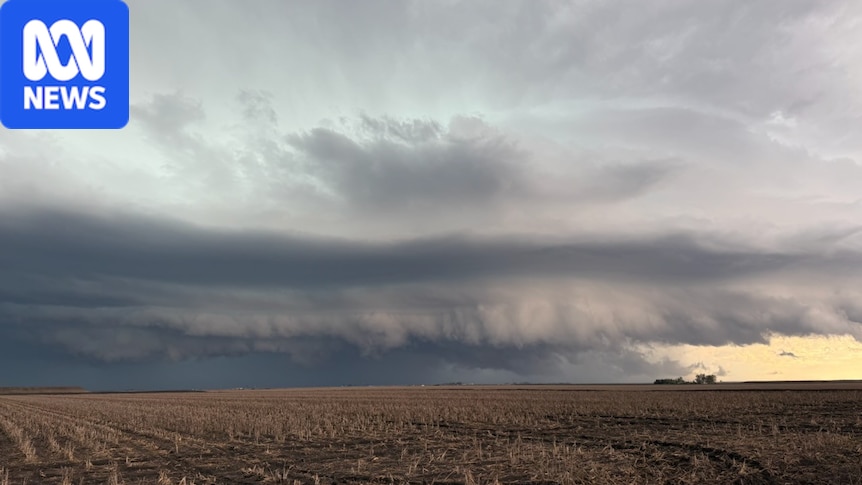
Warm temperatures to follow supercell storms in south-east Queensland as activity moves northBy Emma JohnsonTopic:WeatherPosted Wed 4 Nov 2026 at 7:35amWed 4 Nov 2026 at 7:35amStorm clouds seen near Norwin, south of Dalby, on Tuesday afternoon. (Supplied: Nicholas Thompson)In short:Temperatures are set to rise in south-east Queensland as the risk of storm activity shifts north.Areas between Hervey Bay and Proserpine and inland to the central highlands could see severe storms develop on Wednesday afternoon and evening.The storms could bring damaging winds, large hail and heavy rainfall.Warm temperatures will set in across south-east and southern Queensland today as storms move north.Yesterday a line of thunderstorms rolled over the region, lashing areas with strong winds and heavy rain.Senior forecaster at the Bureau of Meteorology Harry Clarke said the flip in conditions was "classic spring weather"."In the southern parts of the state, we're actually going to start getting quite hot," he said."These thunderstorms are being driven by a trough, and once that moves through, we'll have a warmer, drier westerly wind behind it."The bureau says Brisbane is set to reach 35 degrees on Thursday. (ABC News: Liz Pickering)Mr Clarke said temperatures were set to reach the low 30s along the coast, and into the mid-30s inland.The hot weather is forecast to build on Thursday, with Brisbane expected to reach a top of 35 degrees Celsius, before cooling off on Friday.Storm risk shifts northAs southern parts of the state see the mercury rise, central Queensland could be in line for more storms.Storms could hit parts of central Queensland on Wednesday afternoon and evening. (Supplied: Bureau of Meteorology)Areas from Hervey Bay to Proserpine and inland to the Central Highlands may see storms, possibly severe, develop in the afternoon or evening on Wednesday.But Wednesday's storms will be less severe than those earlier in the week, Mr Clarke said.Wind gusts of more than 100 kilometres per hour were recorded at Wellcamp Airport in Toowoomba, west of Brisbane, yesterday afternoon.Mr Clarke said while storms were common in spring in Queensland, the frequency of events was "notable".Australia remains on track to record its wettest El Niño year ever."We've seen pretty active thunderstorm conditions now for a number of weeks."Heatwave develops in Far NorthFurther north, parts of the Cape York Peninsula continue to swelter through heatwave conditions.A severe heatwave is continuing to develop over parts of Far North Queensland. (Supplied: Bureau of Meteorology)A severe heatwave warning covers Aurukun, Kowanyama, Pormuraaw and Weipa.Inland parts will see maximum temperatures in the low forties, while areas closer to the coast could reach the low to high thirties.The scorching temperatures are expected to intensify and persist into the weekend.
Storm activity to ease in south-east Queensland as heat sets in
Full Article
Original Source
Read the full article at Abc →KhanList aggregates and links to publicly available news content. We do not host full articles from third-party sources. Always verify important information with original sources.