
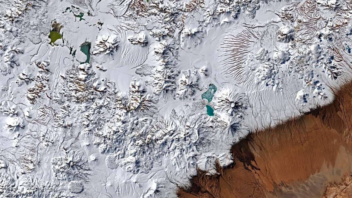
Nasa satellite images captured snow covering parts of Chile's Atacama Desert after an unusual series of winter storms hit the region. Here's what went down.Part of northern Chile in seen covered in snow in this satellite image. (Photo: Nasa)Snow has covered parts of Chile’s Atacama Desert, one of the driest places on Earth, in a rare burst of winter weather that stretched from the Andes across the desert and almost to the Pacific coast.The unusual snowfall came during a series of storms in August 2026.Nasa satellite images captured the rare transformation, with landscapes that are normally almost completely barren turning white.The event was unusual not because it snowed in a desert, but because of how far the weather system reached. An image show snow spanning a vast area of northern Chile, from the Andes to near the Pacific coast. (Photo: Nasa) A DESERT TURNS WHITEThe Atacama Desert is famous for its extreme dryness.So much so that some parts of the desert receive almost no rain. Some parts of the Atacama are so arid that Nasa has used its Mars-like terrain to test spacecraft and instruments. But just weeks ago, in August, a powerful sequence of winter storms brought snow across large parts of northern Chile.One storm particularly affected the high-altitude Chajnantor plateau, home to the Atacama Large Millimeter/submillimeter Array, or ALMA, a major astronomical observatory.Heavy snow and strong winds forced ALMA to suspend operations and place its antennas in a protective mode.A second storm later in August spread snow much farther west, crossing the arid heart of the Atacama and approaching the Pacific coast near Antofagasta.WHY DID IT SNOW IN ATACAMA DESERT?The answer to the obvious question of why it snowed in a desert lies in an unusual atmospheric setup.The storms were associated with a cutoff low, a pocket of low pressure that had separated from the main jet stream.In this case, it developed from an exceptionally large trough stretching across a vast part of the Southern Hemisphere.At the same time, there was abundant moisture near the Chilean coast. Together, these conditions allowed rain and snow to reach areas that normally remain exceptionally dry. A picture compares the Atacama Desert region where snow fell. (Photo: Nasa) The result was extraordinary rainfall as well.In Taltal, nearly 40 mm of rain fell over three days, roughly 10 times the city's average annual rainfall.The strengthening El Nino also provided an important backdrop.The climate phenomenon weakened the subtropical Pacific high-pressure system that normally helps keep the Atacama dry, while shifting storm tracks closer to northern Chile.SNOW IN DESERTS NOT THAT RAREIt's also true that snow falling in a desert is rare, but not unheard of.In December 2025, northern Saudi Arabia also saw snowfall, including in the Tabuk and Hail regions. Camels are seen in Saudi Arabia amid rare snowfall. (Photo: X) On December 17, snow covered the Trojena highlands and parts of Jabal Al-Lawz, where temperatures fell to around -4°C.Saudi Arabia's National Centre for Meteorology said the conditions were linked to a very cold air mass and atmospheric instability.Atacama itself has also experienced another snowstorm in June 2025.The 2026 event, however, stands out for its sheer reach, showing how even Earth's most reliably dry landscapes can occasionally be transformed by an unusual combination of cold air, moisture and atmospheric circulation.- EndsPublished On: Sep 2, 2026 12:29 IST
Snowfall in the desert: Chile's Atacama turns white in rare winter weather
Full Article
Original Source
Read the full article at Indiatoday →KhanList aggregates and links to publicly available news content. We do not host full articles from third-party sources. Always verify important information with original sources.