
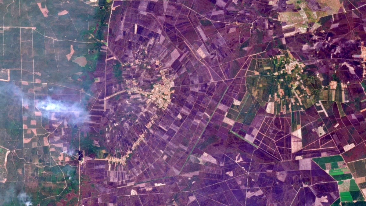
Satellite images taken a week apart show a fast-moving wildfire tearing through land near Bordeaux. The comparison underscores how heat, dry conditions and wind are intensifying fires across Europe.The region around Bordeaux is known for its extensive forests and vineyards. Satellite image shows the charred remains of the wildfire. (Photo: X/Planet)Newly released satellite images have captured the dramatic expansion of a fast-moving wildfire near Bordeaux in southwestern France, highlighting the speed at which the blaze engulfed vast stretches of land within just one week amid Europe's scorching summer.The two images, taken on July 21 and July 28, 2026, reveal a stark transformation. The earlier image shows a patchwork of green agricultural fields and forests surrounding towns near Bordeaux.However, by July 28, much of the landscape had turned dark brown and black, with extensive burn scars stretching across the countryside. Thick plumes of smoke are also visible rising from multiple active fire fronts.The comparison from space shows the scale of destruction caused by the wildfire, which has rapidly spread across forests, farmland and rural communities as France battles one of its most severe fire seasons in recent years. The two satellite images taken a week apart show the impact of the Gironde wildfire near Bordeaux, France. (Photo: X/@Planet) The satellite imagery also reveals how the fire carved a massive swathe through the landscape, leaving behind scorched terrain where vegetation once stood. The smoke columns indicate that the blaze was still active when the second image was captured.The wildfire comes as Europe continues to grapple with repeated heatwaves, prolonged dry conditions and strong winds that have created ideal conditions for fires to ignite and spread rapidly. Scientists have repeatedly warned that hotter summers and drier vegetation are increasing both the frequency and intensity of wildfires across southern Europe.The region around Bordeaux is known for its extensive forests and vineyards, making large wildfires particularly dangerous due to the mix of dense vegetation and nearby settlements. Firefighters have been working to contain the blaze while protecting homes and critical infrastructure from advancing flames.Satellite observations have become a crucial tool in tracking wildfire behaviour, allowing emergency responders to monitor active fire fronts, assess damage and identify areas at greatest risk. By comparing images taken days apart, authorities can accurately measure how quickly fires are spreading and allocate firefighting resources more effectively.As extreme weather events become increasingly common across Europe, the latest images from Bordeaux point to the severity of how rapidly wildfires can transform entire landscapes, leaving lasting ecological, economic and human impacts in their wake.- EndsPublished By: Sibu Kumar TripathiPublished On: Aug 3, 2026 15:00 IST
Satellite images reveal explosive spread of French wildfire within days
Full Article
Original Source
Read the full article at Indiatoday →KhanList aggregates and links to publicly available news content. We do not host full articles from third-party sources. Always verify important information with original sources.