
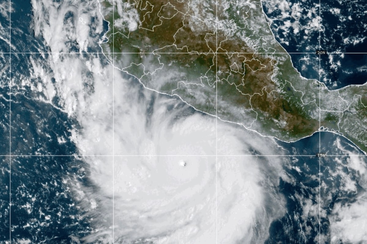
Open this photo in gallery:This photo provided by NOAA shows Hurricane Polo strengthening in the Pacific Ocean off the coast of Mexico on Tuesday.Uncredited/The Associated PressPolo has grown into one of the most powerful Pacific cyclones in decades and was expected to skirt Mexico’s southwestern coast as a major hurricane, while another Pacific system, Odalys, strengthened Wednesday from a tropical storm to a hurricane without threatening land.The U.S. National Hurricane Center in Miami has called Polo an “extremely dangerous” storm and forecast the system would turn sharply to the northwest before moving west-northwest over the next several days.Early Wednesday, Polo was about 300 kilometres south of Zihuatanejo and 540 kilometres southeast of Manzanillo moving north at four kph with maximum sustained winds of 255 kph, the center reported. That put it near the top of Category 4 strength, after earlier being a Category 5 storm.“Fluctuations in intensity are expected, but Polo is expected to remain a very powerful major hurricane during the next few days,” the NHC said.Odalys was a Category 1 hurricane and was about 2,085 kilometres off the southern tip of the Baja California peninsula of Mexico, moving east-northeast at 15 kph with maximum sustained winds of 120 kph, the hurricane center said.Mexican President Claudia Sheinbaum said experts indicated Polo was not likely to touch land. Still, hurricane-force winds extend up to 65 kilometres from the storm’s center and tropical storm-force winds up to 169 kilometres from the eye, the U.S. center said.Tropical storm conditions were expected along the Pacific coast in Guerrero, Michoacan and Colima states Wednesday into Thursday.The hurricane set residents along Mexico's Pacific coast on edge once again after being walloped by powerful cyclones a number of times in recent years. Beaches emptied out and dark clouds swirled above choppy seas, while Mexican authorities temporarily suspended classes Tuesday in a number of areas.The Associated PressPolo on Tuesday became the third Category 5 hurricane of the Pacific season, following Genevieve and Lowell earlier this year. Category 5 is the highest level on the Saffir-Simpson scale, reflecting that a storm has maximum sustained winds exceeding 253 kph.The hurricane set residents along Mexico’s Pacific coast on edge once again after being walloped by a number of powerful cyclones in recent years. Beaches emptied and dark clouds swirled above choppy seas, while Mexican authorities temporarily suspended classes Tuesday in a number of areas. Mexico’s navy shut down ports in the states of Guerrero and Michoacán and warned civilians and fishermen to take care.Concepción López Villegas was busily preparing her seaside restaurant for what may come. Strong waves were already lapping at the coastline of her city Lázaro Cárdenas in Michoacán. As men and children watched the stirring waters behind her, López Villegas said she feared powerful waves would destroy the small business she has worked decades to build.“We’re worried and trying to protect our businesses,” López Villegas said. “And of course, we’re sad because it’s our heritage, our legacy that from one moment to another could be destroyed.”U.S. National Hurricane Center data shows Polo’s winds reached speeds comparable to only a few hurricanes in the region in recent decades, primarily Hurricane Patricia, which had winds that reached 346 kph in 2015.“This is one of the strongest storms ever in the (Pacific) Basin,” said Kristen L. Corbosiero, professor at the University at Albany’s Department of Atmospheric & Environmental Sciences.Heavy rain could produce flash flooding and mudslides. About eight to 15 centimetres of rain was forecast for Guerrero and Michoacán states, with smaller amounts possible for coastal portions of Oaxaca, Colima and Jalisco states.The U.S. Embassy in Mexico issued a weather alert, instructing citizens to avoid water and beaches and to heed warnings from Mexican authorities.“Even if the storm does not make direct landfall, heavy rain may produce life-threatening flooding and mudslides. Hazardous ocean conditions – intensified by storms – may result in deadly rip currents and rogue waves,” the embassy wrote in a statement.The rapid intensification of the storm has stunned scientists and authorities alike, with the NHC writing in a report that it was “truly remarkable” how quickly Polo gained strength in 24 hours.Philip Klotzbach, research scientist in the Department of Atmospheric Science at Colorado State University, attributed the intensification to the weather phenomenon known as El Niño, which has fuelled crippling droughts in Mexico and Central America and floods in other parts of the region. In the Pacific, it has resulted in warmer waters and wind patterns that act as fodder for hurricanes, he said.“There are all the ingredients that hurricanes need to get really strong really fast,” Klotzbach said.No Atlantic hurricanes have formed yet this year, and this year has set a record for the longest start to a season without a hurricane. The effects of this year’s El Niño crush storms before they get going.
Polo off Mexican coast grows into one of the most powerful Pacific cyclones in decades
Full Article
Original Source
Read the full article at Theglobeandmail →KhanList aggregates and links to publicly available news content. We do not host full articles from third-party sources. Always verify important information with original sources.