
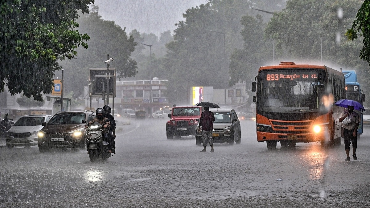
The IMD has forecast widespread rain, thunderstorms and isolated very heavy showers across several regions on Tuesday. An active monsoon trough, a Madhya Pradesh low-pressure area and a developing Bay system are set to keep rainfall elevated.Vehicles wade during monsoon showers near Connaught Place, in New Delhi. (Photo: PTI)India is set for another day of active monsoon weather on Tuesday, August 11, with the India Meteorological Department (IMD) forecasting widespread rainfall across several regions and heavy to very heavy showers in parts of north, central, east and western India.The monsoon trough remains active and south of its normal position, while a low-pressure area over north Madhya Pradesh and adjoining areas continues to influence weather over central India.Another cyclonic circulation over the northwest Bay of Bengal is expected to strengthen into a low-pressure area around August 12, potentially sustaining rainfall over eastern and central parts of the country.HOW WILL THE WEATHER BE IN NORTH INDIA?Delhi, Haryana, Chandigarh and Punjab are likely to receive fairly widespread to widespread rainfall on August 11, with isolated heavy rainfall also possible. The region could see thunderstorms and sudden intense showers during the day. Uttarakhand is also expected to receive widespread rain, with isolated heavy rainfall likely. Himachal Pradesh and Jammu & Kashmir, Ladakh and adjoining areas will remain under an extended spell of monsoon activity.In Rajasthan, East Rajasthan is the major concern, with isolated very heavy rainfall possible on August 11. CENTRAL INDIA TO BE HITThe low-pressure system over Madhya Pradesh will continue to drive rainfall across the region. West Madhya Pradesh is expected to receive fairly widespread to widespread rain, while East Madhya Pradesh could see widespread rainfall as well.Chhattisgarh is also likely to experience heavy showers, thunderstorms and lightning. The IMD has warned of heavy to very heavy rainfall in parts of central India, with localised intense spells possible.A WET DAY FOR EAST AND NORTHEAST INDIAOdisha, Gangetic West Bengal and Sub-Himalayan West Bengal and Sikkim are expected to remain wet. Heavy rainfall is likely over Gangetic West Bengal and Odisha, while thunderstorms and gusty winds could accompany showers.Bihar and Jharkhand could also see thunderstorms and lightning, with rainfall activity expected to increase further in the coming days. The low-pressure system over Madhya Pradesh will continue to drive rainfall across the region. (Photo: PTI) In the Northeast, Assam, Meghalaya and Arunachal Pradesh may receive scattered showers, with heavy rain likely in Assam-Meghalaya and Arunachal Pradesh.WIDESPREAD RAIN LIKELY OVER WEST AND SOUTH INDIAThe Konkan and Goa region will remain under widespread rainfall, while Gujarat could see heavy rain on August 11. Madhya Maharashtra is also likely to receive heavy showers.Southern India will continue to see widespread rain along the Coastal Karnataka, Kerala and Lakshadweep belt, accompanied by thunderstorms, gusty winds and strong surface winds in several coastal areas.Overall, Tuesday is expected to remain wet and stormy across large parts of India, with the active monsoon trough and developing Bay of Bengal system keeping rainfall activity elevated.- EndsPublished By: Sibu Kumar TripathiPublished On: Aug 10, 2026 19:30 IST
Monsoon to charge ahead: Heavy rain, storms to sweep India on Tuesday
Full Article
Original Source
Read the full article at Indiatoday →KhanList aggregates and links to publicly available news content. We do not host full articles from third-party sources. Always verify important information with original sources.