
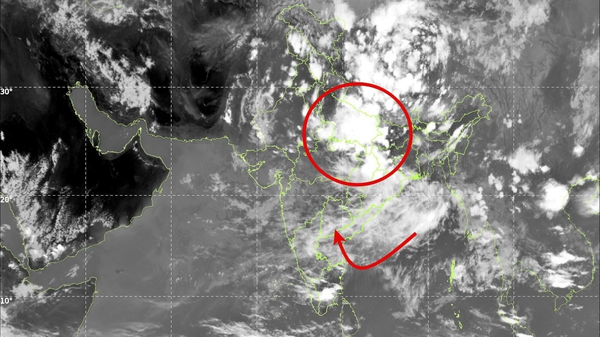
Weather models indicate the Bay of Bengal could keep spawning low-pressure systems through the rest of August. The pattern may prevent a prolonged monsoon break and help cut rainfall deficits across several regions.The outlook is particularly encouraging as it shows no major break phase developing over the country's core monsoon region. (Photo: IMD)India's monsoon may be gearing up for one of its most active phases of the season, with weather models indicating a hyperactive Bay of Bengal that could continuously generate low-pressure systems through the rest of August.According to rainfall projections from the European Centre for Medium-Range Weather Forecasts (ECMWF), analysed by Weathernerds, the next 15 days could bring widespread and sustained rainfall across large parts of central, eastern and northern India.Meteorologists say the outlook is particularly encouraging as it shows no major break phase developing over the country's core monsoon region. The Bay of Bengal, often referred to as the monsoon's "rain factory," is expected to remain unusually active, creating conditions favourable for the formation of multiple low-pressure systems one after another. These weather systems are the primary drivers of widespread monsoon rainfall over the Indian subcontinent.Forecast charts indicate that fresh systems could emerge in quick succession and move inland, carrying enormous amounts of moisture into Odisha, West Bengal, Jharkhand, Bihar, Chhattisgarh, Madhya Pradesh, Uttar Pradesh and parts of northeast India. There is a possibility of sustained rain-bearing systems continuing well into the final weeks of August.The development is particularly significant because concerns had persisted over the influence of El Nio-like conditions on monsoon performance. While El Nio typically suppresses rainfall over India, the expected parade of Bay of Bengal systems could help offset some of that impact by maintaining an active monsoon circulation.Current model guidance suggests that the absence of a prolonged break phase could prevent the monsoon from slipping into a larger seasonal deficit. If the forecast verifies, the successive low-pressure systems may even help reduce existing rainfall deficits in several regions.The strongest impact is expected over east, central and north India, where repeated rounds of rain could replenish reservoirs, improve soil moisture and provide a boost to the ongoing kharif cropping season.While forecasts beyond a week carry some uncertainty, meteorologists are increasingly confident that the Bay of Bengal will remain the key driver of India's weather through the remainder of August, keeping the monsoon engine running at full strength.- EndsPublished By: Sibu Kumar TripathiPublished On: Aug 14, 2026 07:00 IST
Monsoon engine roars: Bay of Bengal set to birth back-to-back rain systems
Full Article
Original Source
Read the full article at Indiatoday →KhanList aggregates and links to publicly available news content. We do not host full articles from third-party sources. Always verify important information with original sources.