
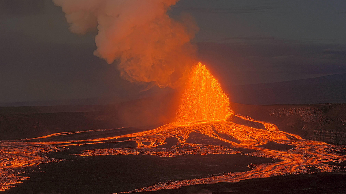
A fountain of lava rises from Kīlauea’s Halemaʻumaʻu crater on 17 October 2026. Credit: Hawaiian Volcano Observatory, USGS , Public Domain Source: Journal of Geophysical Research: Solid Earth The Hawaiian volcano Kīlauea is among the most active on Earth. Not only did it erupt almost continuously from 1983 to 2018, it began a new series of eruptions in late 2024 that continue as of late 2026. The activity and accessibility of the volcano have enabled scientists to collect a wealth of data. However, the resolution of seismic images of the subsurface has been limited by sparse sensor coverage. That meant, despite decades of data, scientists lacked a sharp seismic image of how magma is stored beneath the summit. Lin et al. used a large network of seismometers to map the magma storage beneath Kīlauea’s summit at high resolution. Using a seismic array that tracked both natural seismic activity and controlled artificial vibrations, the researchers identified two reservoirs for magma: one beneath the Halemaʻumaʻu crater in the main Kīlauea caldera and the other beneath the south caldera. The researchers’ dense seismic array consisted of 1,815 small seismometers arranged to make a mesh roughly 12 kilometers on each side. To the natural seismic signals from Kīlauea itself, they added artificial signals generated by the giant T-Rex vibroseis truck, which produces a range of controlled vibrations for active-source seismology. The combination of natural and generated seismic waves with a dense sensor configuration provided sufficient data to identify the two distinct magma reservoirs. The two reservoirs are separate near the surface but may connect at greater depth, and the work represents important progress toward understanding the exact underground plumbing. This hybrid methodology has already proven fruitful for other studies at Kīlauea, which indicates it could be implemented at other active volcanoes or other seismically interesting sites around the planet, the authors say. (Journal of Geophysical Research: Solid Earth, https://doi.org/10.1029/2026JB034515, 2026) —Matthew R. Francis (@BowlerHatScience.org), Science Writer Citation: Francis, M. R. (2026), Mapping Kīlauea’s magma reservoirs, Eos, 107, https://doi.org/10.1029/2026EO260347. Published on 3 November 2026. Text © 2026. AGU. CC BY-NC-ND 3.0Except where otherwise noted, images are subject to copyright. Any reuse without express permission from the copyright owner is prohibited.
Mapping Kīlauea’s Magma Reservoirs
Full Article
Original Source
Read the full article at Eos →KhanList aggregates and links to publicly available news content. We do not host full articles from third-party sources. Always verify important information with original sources.