
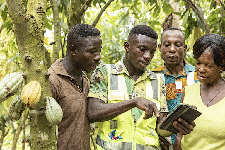
The new standard world map adopted at the recent U.N. General Assembly more accurately depicts the size of Africa, which is in reality much larger than formerly standard Mercator projection maps.A new op-ed argues that there is now an urgent need for large-scale participatory mapping of community lands and resources in places like the Congo Basin — as well as accompanying legal and policy reforms to formally recognize these areas — as technologies and regional expertise now exist to put thousands of forest communities on the map.“A radically different and fairer vision of the Congo Basin is within grasp, and it starts with putting communities on the map,” the writers argue.This article is a commentary. The views expressed are those of the authors, not necessarily of Mongabay. The U.N. General Assembly’s recent adoption of a new standard world map, more accurately reflecting the true size of Africa than depicted in the Eurocentric 16th-century Mercator projection, is great news and a welcome reminder that multilateralism isn’t dead yet. It also doesn’t tell the whole story. We’re not talking about how the continent was carved up between the former colonial powers through such events as the Berlin conference of 1884-1885, though the social, economic and political impacts of the often straight and artificial lines drawn on those maps are still felt today. No, we’re talking about how maps of Central African states are still used by foreign interests and political elites as tools to perpetuate power — with control of natural resources and the benefits they generate tending to flow outwards and upwards — rather than to the people living in these areas. Resource map of the Congo Basin. Graphic courtesy of Earth Insight. Today, much of the Congo Basin, the world’s second largest rainforest, resembles a patchwork of extractive industry concessions, strictly protected areas and an ever-increasing array of carbon offset projects which our organization has documented. These have largely failed to stem deforestation and biodiversity loss, while delivering few or no benefits to local populations, and in many cases, causing severe impacts on human rights and food security. What maps typically don’t show are the systems of longstanding customary rights and usage by Indigenous and local communities (IPLCs) that extend across the vast region, and which have been little documented, let alone formally recognized. By our estimates, only around 5% of the forest is currently under formal community tenure or management rights, significantly less than the estimated 35% under Indigenous title in the Amazon despite a much higher population density. Most of these come in the form of community forests in the Democratic Republic of the Congo (DRC), while other countries in the region either have very ill-adapted legal frameworks for community tenure (Gabon or Cameroon) or no enforceable legislation at all (Central African Republic and Republic of Congo). The continued absence of forest community tenure from maps is not only deeply socially unjust, but it also goes against the evidence that the best and fairest way to protect forests is to place them under the formal control of the people who live there. Lack of tenure clarity and security is also one of the biggest impediments to self-determination and responsible investment in the region, including a new wave of payment for environmental service schemes planned in the region. A participatory mapping exercise in Lobaye, southwestern Central African Republic. Image courtesy of Rainforest Foundation UK. So, what needs to happen? First, governments and donors in the region need to accelerate and implement legal and policy reforms related to community land tenure. Encouragingly, several important steps have recently been taken in this direction. Last November at the climate COP in Belem, Brazil, the DRC government committed to placing more than 50 million hectares (over 123 million acres) under the control of IPLCs, a tenfold increase on the current area, alongside other reforms it is advancing on Indigenous rights and land-use planning. Other positive examples include draft legislation on community forests in the Central African Republic and on community managed protected areas in Gabon and Cameroon. These are all promising developments, but laws are only powerful insofar as they are enforceable. To turn these commitments into tangible and enforceable tenure rights for forest-dwelling communities, there is an urgent need to scale up demarcation and recognition of these areas. That is why the second key need is to greatly expand provision for participatory mapping tools and support, so that communities themselves can demonstrate their presence in the forest and for policy makers and the private sector to take account of and recognize this presence. A map produced by a DRC community via participatory process in support of their claim for community forest rights. Graphic via Rainforest Foundation UK. Our MappingForRights program has supported hundreds of communities in the Congo Basin to produce highly accurate and detailed maps of their resources and territories, but this covers only a fraction of what is needed. Thankfully, advances in mapping technologies are breaking down cost barriers and making it easier for communities to generate, control and manage their data and to integrate this into government cadasters. There is also a large pool of untapped civil society capacity in the region to facilitate participatory mapping processes. The challenge now is to bring all this altogether and make these resources widely available to forest peoples and grassroots organizations across the region, to enable the vital mapping of thousands of ‘invisible’ communities and to turn promising laws and policies into enforceable rights. A radically different and fairer vision of the Congo Basin is within grasp, and it starts with putting communities on the map. Georges Thierry Handja is senior manager of the Land and Livelihoods program for Rainforest Foundation UK, where Joe Eisen is executive director. Banner image: New technologies paired with regional expertise can help put thousands of forest communities on the map of Africa. Image courtesy of Cargill. See related coverage: Indigenous peoples near Congo parks propose diverse solutions for the future of conservation ‘Cocoa fever’ in Liberia’s Grand Gedeh is wiping out native forests Indigenous territories maintain Amazon forest just as well as protected areas, study finds Credits Topics
It’s time to put Africa’s forest communities on the map (commentary)
Full Article
Original Source
Read the full article at News →KhanList aggregates and links to publicly available news content. We do not host full articles from third-party sources. Always verify important information with original sources.