
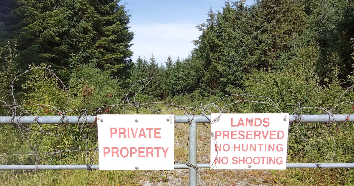
Those hunting for Ireland’s huge network of vanished footpaths walkers will find none of the ‘right to roam’ available elsewhere'I don’t want to trespass, don’t want to stride out with haughty entitlement, convinced that I should have the right to “roam” across all of this. I just want a way through – a way that countless others have walked before me.' Photograph: Tim Hannigan I need to get away from my desk. For the past three years I have been obsessively researching the complex history of Ireland’s vanished footpaths, trying to work out how this country has ended up with probably the worst public access to the countryside in Europe: none of the “right to roam” in the woods and mountains that you’d find in Scotland and Scandinavia; no network of rights of way along the field edges of the sort that you’d encounter in France or England. That research involved a 678km walk from the tip of the Dingle Peninsula to Burr Point in Co Down to find out how much – or how little – of Ireland remains accessible to an off-road walker in the 21st century. But the blisters have long since healed, and for months I’ve been stuck indoors, grappling with the meaning of “trespass” in the Brehon Laws, searching 19th-century Irish novels for mentions of footpaths, wrangling with the finer details of the 1995 Occupiers’ Liability Act, and poring over digital copies of old Ordnance Survey maps. This morning I need a break. I need to get out into the fresh air and go pathfinding.I drop my daughter at preschool, and then, instead of heading straight back to my desk, I drive up to the far end of the small east Galway town where I live. I park near the GAA pitch, dash across the busy main road, and walk north on a meandering lane.I’ve never been this way before, and the sudden elevation is unexpected. This is esker country, rumpled by the vanished glaciers. An ascent of just a few metres can throw an astonishing distance into view. It’s a grey morning, with a fine gauze of mizzle in the air. But I can see the dark crenellations of the Maamturks and the Twelve Bens, 90km away in Connemara. It’s like looking into another continent.READ MOREA big ringfort comes into view beside the road, a double rampart with a deep fosse between. I stop here, and look out uneasily across the land to the east. One of the lines I want to follow runs that way. But there are two men digging foundations for a new house in the road frontage right next to the ringfort. So I stay going, stick to the road, turn right and then right again.Two white dogs rush out from an enormous roadside newbuild to proclaim my passing. A green lane strikes off southward here. It’s blocked by a rusty gate, but there’s no sign forbidding trespass, so I squeeze past. The green lane ends at the head of a big field. There’s another big ringfort 700m away across country with a small block of forestry behind it. But all the roadside bungalows look onto the land here. I’d be in view the whole way. I suck my teeth, frustrated by my own lack of boldness. But this is the point: I don’t want to trespass, don’t want to stride out with haughty entitlement, convinced that I should have the right to “roam” across all of this. I just want a way through – a way that countless others have walked before me. I go back towards the road and flinch at the sight of a figure watching me from a huge floor-to-ceiling window in the house with the dogs.[ Ireland’s ancient pilgrim paths: 14 trails to walk across the countryOpens in new window ]The lane brings me back around to the main road, a kilometre and a half from where I started. Morning traffic streaks along it at 100km an hour. But there’s a wide shoulder on either side and it’s safe enough to walk here; people stride this way in their hi-vis vests every evening. I’m almost back at the car now, and it looks like the morning will be a disappointment. But there’s one last chance – a lane striking back inland from the main road, hemmed with blackthorns. Where it ends, a new farm track cuts away to the right. Tim Hannigan: 'A map is a many-layered thing, and as it moves from current document to archival matter – which happens inevitably even before it is complete – it quickly escapes the intentions of its makers.' Photograph: Cara Glynn I steel myself, climb the gate and hurry along it to a ruined cottage nestled in a little hollow. I follow a wall north from the ruin, cross a low ridge – and there it is, right where it should be: a simple step-across stile; a long slab of limestone set crossways through the wall to allow a walker to pass easily into the next field. I give a little whoop of triumph, stamp down the nettles and step onto the stile myself – the first person to do so in how many decades? I have never been here before. But I knew I would find this smallest and simplest piece of infrastructure right here – because I am following a footpath marked on a six-inch map published in 1920. An old stile in a wall in East Galway, adjacent to a stream and covered in foliage, where a vanished footpath once crossed the fields. Photograph: Tim Hannigan The problematic colonial context of the 19th-century mapping of Ireland – the context famously explored in Brian Friel’s 1980 play, Translations, and more recently in Maggie O’Farrell’s novel, Land – is well known. But a map is a many-layered thing, and as it moves from current document to archival matter – which happens inevitably even before it is complete – it quickly escapes the intentions of its makers. It carries secrets and subversions for future generations. [ Leitrim’s ‘stairway to heaven’ gets upgrade in bid to lure touristsOpens in new window ]When discussing the vexed issue of countryside access, people sometimes insist to me that Ireland never had footpaths across the landscape, that for some reason they “weren’t needed here”, that they are a uniquely “English thing”. But the second large-scale Ordnance Survey map of the 1880s plainly records a huge network of Irish footpaths, a network confirmed in later updates, well into the 20th century: a record of persistent human movement across the landscape, regardless of the iniquities of its ownership. Once you know to look, you can find this archival record confirmed in the field-scape all over Ireland.If people know of these old Irish paths at all, they usually refer to them as “mass paths”. But these were not exclusively routes connecting outlying settlements with places of worship. Some run across fields to the former site of a shop or pub or post office. Others are simply general-purpose lines of least resistance for those travelling across country on foot. A disused stile in a wall in a remote corner of East Galway, marked on a 19th-century map where a now-vanished footpath crossed a stream and is still visible in the landscape. Photograph: Tim Hannigan What happened to these paths is no great mystery. They were there in the 1880s and they were there into the 1940s, and there are still fading memories of their use in some rural communities today. But as emigration emptied the countryside in the mid-20th century, and as those who remained got bicycles and cars, the ways through the fields fell out of use, and the “no trespassing” signs went up in the gateways. 'The second large-scale Ordnance Survey map of the 1880s plainly records a huge network of Irish footpaths, a network confirmed in later updates, well into the 20th century: a record of persistent human movement across the landscape, regardless of the iniquities of its ownership.' Photograph: Tim Hannigan The stile I found this morning lay on a path that led towards a former schoolhouse. It was surely heavily used each morning and afternoon by local children. But once that school closed in the mid-20th century, fewer and fewer people walked it. In the same period, the exact same thing was happening to the old customary footpaths in Wales and England. But the 1949 National Parks and Access to the Countryside Act ensured that the surviving British path network was recorded and protected for future generations before the atrophy was complete. In Ireland that never happened. [ Ireland’s lost roads: pathways to our pastOpens in new window ]This is a peculiarity – a perversity, even – in the long story of Irish land reform. In its radical redistributions, the Land Commission at times allowed the old landlord class to retain their rights of access to hunt and shoot and fish on land that had been handed over to their former tenants. But it had no interest in formalising and protecting a far more important and democratic right: the right of all people to move along the time-honoured ways through the countryside – whether they led to a Mass rock or a holy well or simply to the local pub.A roadside 'no trespassing' sign on display in Co Westmeath. Photograph: Tim Hannigan But the presence of these lost paths is still fossilised in their simple stiles. The little rectangle of road-bounded East Galway countryside I circuited this morning covers just 2.5 square kilometres. But when I measure up all the footpaths recorded on the old map – the cross-country route running towards the school, a shortcut from the main road at the eastern edge of the rectangle, two dead-end doglegs leading to springs in the boggy centre and a short line in the northwest corner giving access to a cillín – they add up to 5km. Five kilometres of forgotten footpaths, just in this one tiny postage stamp of land. Now zoom out – zoom out to parish level, county level, zoom out to take in the whole island of Ireland. Imagine the tens of thousands of kilometres of paths, clearly recorded on the old maps and still just about tangible in the landscape.Tim Hannigan teaches writing and literature at Atlantic Technological University Sligo. His book, The Pathless Land: Finding A Way Across Ireland, is published by Bloomsbury Apollo.IN THIS SECTION
Ireland has the worst public access to countryside in Europe. How did this happen?
Full Article
Original Source
Read the full article at Irishtimes →KhanList aggregates and links to publicly available news content. We do not host full articles from third-party sources. Always verify important information with original sources.