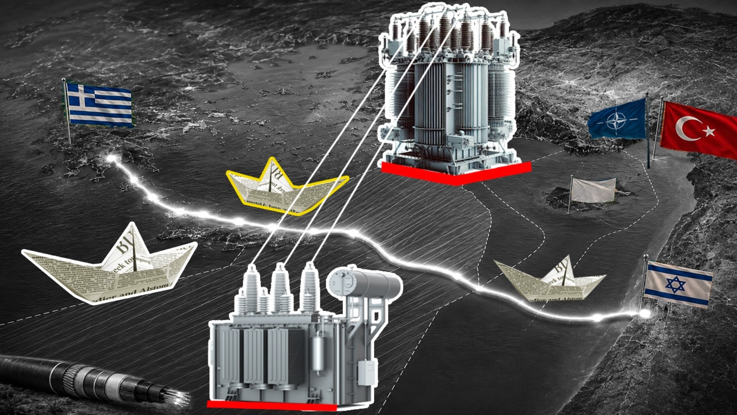
The Great Sea Interconnector is usually presented as an electricity project. That description is accurate, but incomplete. On paper, it is a planned 1,208-kilometer (750-mile) high-voltage direct current link connecting Greece, the Greek Cypriot administration and Israel, with a design capacity of 1,000 megawatts, depths approaching 3,000 meters (9,840 feet) on the Crete-Cyprus section, a 657 million euro ($750 million) EU grant and a total estimated cost of approximately 1.9 billion euros. Strategically, however, it is more than a cable. It is the infrastructural expression of a Greece-Greek Cypriot-Israeli alignment in the Eastern Mediterranean. The interconnector would connect Cyprus to the European electricity system, offer Israel a maritime backup channel toward Europe and create a corridor where energy resilience, digital control and strategic dependence converge. For Greece, the Greek Cypriot administration and Israel, the logic is clear: A partnership connected by critical infrastructure is more durable than one expressed only through summits, exercises or communiques, while Israel gains not only an energy option but strategic depth in a crisis. The project belongs to a wider regional architecture: the Greek-Greek Cypriot-Israeli trilateral format, EastMed pipeline diplomacy, joint military exercises and the broader effort to consolidate a strategic infrastructure axis in the Eastern Mediterranean. For Türkiye, the issue is not simply exclusion from that architecture, but the legal route, security function and critical undersea character of the corridor itself. The most sensitive part of this design is the Crete-Cyprus leg, an approximately 898-kilometer segment crossing deep and politically exposed waters. At such depths, a cable route must be surveyed, mapped, insured, protected and repaired by specialized vessels. Bathymetry, slope stability, seismic exposure, anchoring risks and repair access determine whether the route is technically executable and financially bankable. In contested waters, survey activity is therefore not a preliminary formality; it is the moment at which a proposed corridor begins to acquire operational reality. Jurisdiction, consent This is where Türkiye entered the sequence. In July 2024, when a survey vessel arrived southeast of Kasos and Karpathos for seabed reconnaissance, Türkiye deployed warships and communicated through established channels that survey activity on the contested shelf without Turkish consent would not proceed. The survey stopped. This was the operational enforcement of a documented maritime position, deposited with the United Nations and anchored in the Türkiye-Libya maritime delimitation memorandum of November 2019. The message was clear: a strategic infrastructure corridor cannot be drawn through an area of registered Turkish continental shelf claims as though Ankara were absent from the map. The project’s subsequent suspension confirmed the significance of that message. Greece and the Greek Cypriot administration have emphasized cost escalation, technical review and cost-allocation disputes. These are real factors, but they are inseparable from the route’s legal and strategic exposure. Survey, installation, insurance and maintenance in waters subject to active coastal-state objection carry risks that a delimited and politically accepted corridor does not. Capital does not like unresolved sovereignty; engineering does not cancel geography; EU financing does not substitute for consent. The legal issue is more complex than the project’s sponsors imply. Submarine cables enjoy freedoms under the law of the sea, but this case is not simply a cable crossing uncontested seabed. It requires survey operations, route selection, maintenance access, security planning and long-term emplacement in an area of overlapping claims. Under the continental shelf regime reflected in the United Nations Convention on the Law of the Sea (UNCLOS) and customary international law, marine scientific research on the shelf engages coastal-state consent, and states with overlapping claims must refrain from acts that jeopardize final agreement. Türkiye is not a party to UNCLOS, but continental shelf rights are customary, predate the convention and exist ipso facto and ab initio, as the International Court of Justice (ICJ) recognized in the North Sea Continental Shelf cases. Türkiye’s objection is therefore not a rejection of law; it is a demand that the law’s logic of restraint, consent and equitable settlement be applied consistently in the Eastern Mediterranean. In such a setting, coastal-state consent is not a formality but the legal threshold through which infrastructure becomes permissible. Undersea infrastructure There is also a newer dimension that makes this case more sensitive than earlier pipeline debates. A modern subsea power cable is not only an energy conduit. High-Voltage Direct Current (HVDC) interconnectors carry integrated or co-routed fiber for control, telemetry and communications. Under certain technical configurations, seabed fiber can also become a sensing medium. Distributed acoustic sensing uses laser pulses through optical fiber to register vibrations along the cable route, turning the cable into a long array of virtual sensors capable of detecting seismic activity, vessel movement and acoustic signatures in the water column. This does not mean every electricity cable is automatically an intelligence system. It does mean that in the age of critical undersea infrastructure, energy transfer, data transfer, control systems and sensing potential can no longer be separated as neatly as civilian project documents suggest. A line of this length, crossing this geography and linking this strategic triangle, cannot be treated as an ordinary power asset. NATO’s own practice confirms. After the Nord Stream sabotage and the Balticconnector incident, the alliance created mechanisms dedicated to critical undersea infrastructure, treating cables and pipelines not merely as commercial assets but as strategic systems whose vulnerability and placement matter to national and alliance security. If this logic applies in the Baltic, it applies no less in the Eastern Mediterranean. Maritime order This is where the Blue Homeland doctrine and Türkiye’s emerging Maritime Jurisdiction Framework Law enter the picture. The law does not invent Türkiye’s maritime position. It consolidates one already expressed through diplomatic notes, naval practice, the Türkiye-Libya delimitation memorandum, the defense of the rights of the Turkish Republic of Northern Cyprus (TRNC), and Türkiye’s long-standing posture in the Aegean and Eastern Mediterranean. Its importance lies in codification: it converts dispersed positions into a published, legible and administrable framework. The issue, therefore, is not whether Türkiye was merely consulted after the project had already been designed. Ankara’s position concerns the nature of the project itself: a Greece-Greek Cypriot-Israeli strategic corridor whose route, security implications and critical undersea functions intersect directly with Türkiye’s continental shelf claims, naval operating environment and Eastern Mediterranean posture. Türkiye is not a routine coastal stakeholder asking to be consulted as a matter of diplomatic courtesy. It is the principal military and geopolitical actor of the Eastern Mediterranean: a state with the region’s most capable naval posture, an indigenous deepwater energy fleet of four drillships and dedicated seismic vessels, a defense-industrial base able to sustain its maritime doctrine, a treaty-based position with Libya, a security relationship with the TRNC, and the political will to make its registered legal positions effective at sea without uncontrolled escalation. The Great Sea Interconnector may yet be completed. But it will not be completed as a project that simply bypasses Türkiye, nor is the issue limited to finding a technical formula after the fact. A project designed as a Greece-Greek Cypriot-Israeli strategic corridor cannot be treated as a purely technical infrastructure file once it enters a maritime geography where Türkiye has registered rights, security interests and operational capacity. The question is not how Türkiye can be added to a design made elsewhere, but whether such a corridor can be reconciled with the maritime order Türkiye is actively defending. The lesson is broader than one cable. From the Aegean island geography to the Eastern Mediterranean, from the rights of the TRNC to the Türkiye-Libya delimitation line, Ankara’s maritime posture is no longer episodic. It is becoming doctrinal, statutory and operational. This applies not only to the interconnector, but to any major Eastern Mediterranean design that touches energy, security, jurisdiction or critical infrastructure. The Great Sea Interconnector therefore illustrates a broader rule of the Eastern Mediterranean. Strategic corridors cannot be designed as though maritime jurisdiction, coastal-state consent and naval power were secondary considerations. Where Türkiye’s continental shelf claims, security interests and operational reach converge, infrastructure planning becomes a question of regional order. Any actor that fails to account for this will not merely face operational delay; it will confront the limits of a design that misread the strategic geography from the outset.
Great Sea Interconnector: Assets, jurisdiction, maritime posture
Full Article
Original Source
Read the full article at Dailysabah →KhanList aggregates and links to publicly available news content. We do not host full articles from third-party sources. Always verify important information with original sources.