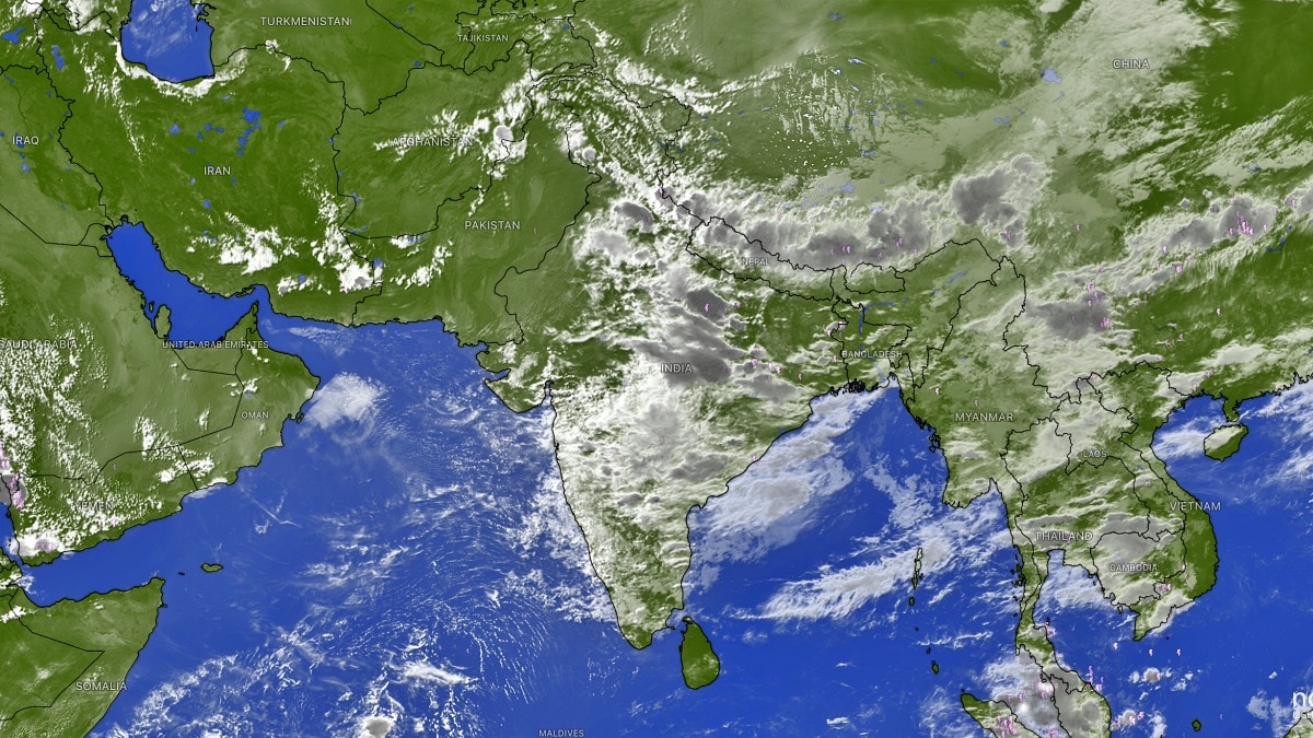
El Niño is disrupting the southwest monsoon, leaving India under widespread cloud cover but uneven rainfall. The pattern is raising flood risks in some states while others remain hot, humid and relatively dry.Latest satellite images reveal extensive cloud cover from central India to the Indo-Gangetic plains and the eastern coast. (Photo: Windy)Despite satellite imagery showing thick rain-bearing clouds stretching across much of the Indian subcontinent, the southwest monsoon continues to behave unevenly, with several regions witnessing below-normal rainfall even as others brace for flooding.Meteorologists say the developing El Nio is influencing the monsoon's circulation, leading to an erratic distribution of rainfall rather than a uniform spread.Latest satellite images reveal extensive cloud cover from central India to the Indo-Gangetic plains and the eastern coast. However, the presence of clouds has not translated into widespread heavy rain, with several northern and northwestern states continuing to experience humid conditions and scattered showers.According to the India Meteorological Department (IMD), the current weather is being driven by the monsoon trough, which extends from Amritsar across northern India to West Bengal. This alignment is concentrating moisture over eastern and peninsular India while leaving other regions waiting for sustained rainfall. IMD Senior Scientist Dr. Naresh Yadav said very heavy rainfall exceeding 12 centimetres is expected over Odisha and Chhattisgarh in the coming days, as the active monsoon trough enhances convection over the region."More than 12 cm of rainfall is also likely over Kerala and coastal Karnataka, and heavy rainfall activity is expected to continue over these regions during the next few days," he said.The Himalayan belt is also likely to remain under the influence of active monsoon conditions, with heavy to very heavy rainfall forecast for the next seven days. The prolonged wet spell raises the risk of landslides, flash floods and river swelling across Uttarakhand, Himachal Pradesh and adjoining hill states.In contrast, Delhi-NCR is expected to receive only light showers, offering little relief from the prevailing heat and humidity. The IMD has issued a heat and humidity alert for the next three days, warning that temperatures and moisture levels will remain above normal despite occasional rain.Punjab and Haryana, which have so far experienced relatively subdued rainfall, may see heavier showers after the next two to three days as the monsoon trough gradually shifts northwestward.Meteorologists say this patchy rainfall pattern is consistent with the influence of El Nino, which often weakens or redistributes the Indian monsoon rather than shutting it down completely.Instead of widespread, evenly distributed rain, moisture tends to become concentrated in specific regions while neighbouring areas remain relatively dry.With El Nio expected to strengthen further in the coming months, weather experts warn that India could continue to witness sharp regional contrasts in rainfall, making flood management in some states and water conservation in others equally critical through the remainder of the monsoon season.- EndsPublished By: Sibu Kumar TripathiPublished On: Jul 18, 2026 07:30 IST
El Nino has disrupted Monsoon: Rain clouds blanket India, but downpour uneven
Full Article
📰 Original Source
Read full article at Indiatoday →KhanList aggregates and links to publicly available news content. We do not host full articles from third-party sources. Always verify important information with original sources.