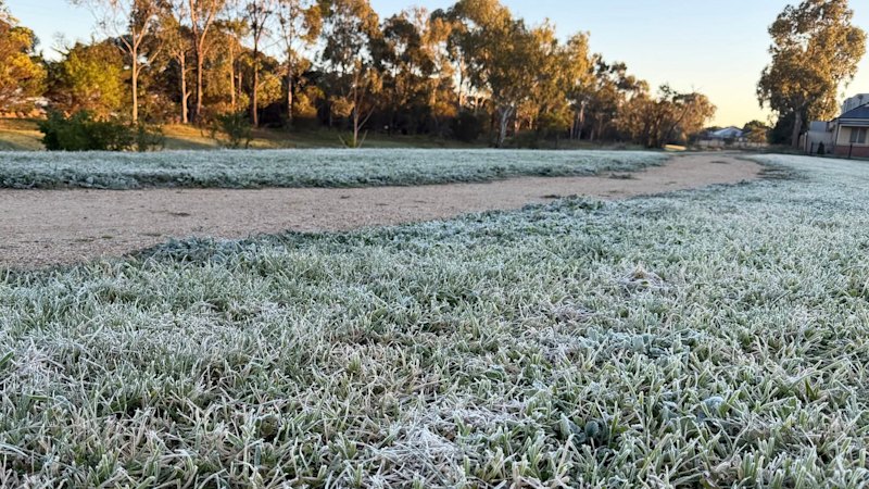
It’s been a morning for snuggling under the doona across Victoria, with some parts of Melbourne recording their coldest days of the year.The Bureau of Meteorology has confirmed a climatic pinch and punch punctuated the first of the month, with parts of the city blanketed in fog and almost at freezing point.Fog hung over the city of Melbourne to start the last month of winter.Michelle Learmonth, DoncasterLaverton, in the city’s west, reached 0.8 degrees, while Scoresby in the east dropped to 0.7, its coldest day since August 20 last year.In the city centre, the Olympic Park gauge dropped to 2.6 degrees about 7.30am, though it felt like minus 0.6 degrees.That marks the coldest temperature recorded there since August 19 last year, and notably colder than Hobart, 800 kilometres further south, which at the same time on Saturday was 5.4 degrees.Frost blanketed windscreens, grass and playground equipment on Saturday morning.Lloyd Mouat, Caroline SpringsWhile Saturday’s lowest temperature anywhere in the metro area was at Avalon (minus 0.7), that spot had its coldest day of the year on July 10, when the mercury dropped to minus 1.Meteorologist Daniel Sherwin-Simpson said despite the windscreen-frosting temperatures on Saturday, winter this year in Melbourne had been slightly warmer than usual.“Melbourne’s [winter] temperatures haven’t been too different to the long-term average: the average minimum temperature is 0.2 degrees warmer so far, and the average maximum 0.4 degrees [warmer],” he said.Other parts of regional Victoria were even colder on Saturday morning: Omeo, in the state’s east, reached minus 3.3 at 2.45am, while Mount Hotham dropped to minus 5 degrees. No rain was recorded at Hotham.Sherwin-Simpson said parts of Victoria’s alpine region had experienced one of their warmest winters on record so far, including “close to if not the hottest July on record”.He said maximum temperatures at Mount Hotham were more than three degrees above average this winter, and they were two degrees above average at Mount Buller.“Rain has been falling [over the Alps], but it hasn’t been the right type of rain,” he said.“The rain has had tropical connections, so it’s been too warm in the upper atmosphere and it has all fallen as liquid water rather than snow.“This will probably go down as one of the worst snow seasons in recent history.”Nonetheless, Sherwin-Simpson said a reasonable base of snowfall now covered parts of the Alps, and was likely to “stick around for a bit”.Start the day with a summary of the day’s most important and interesting stories, analysis and insights. Sign up for our Morning Edition newsletter.From our partners
You weren’t imagining things. It was colder in Melbourne than Hobart
Full Article
Original Source
Read the full article at Smh →KhanList aggregates and links to publicly available news content. We do not host full articles from third-party sources. Always verify important information with original sources.