
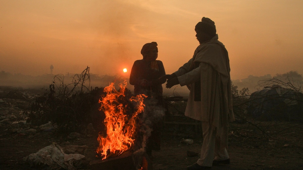
Winter conditions are gradually becoming noticeable across parts of India, with below-normal temperatures recorded in several regions, even as a developing weather system over the Bay of Bengal prepares to bring widespread rainfall to the Andaman and Nicobar Islands and parts of southern India.The India Meteorological Department (IMD), in its November 13 bulletin, forecast rainfall across parts of northern and southern India on Saturday, November 14.While the western Himalayan region is expected to experience showers and thunderstorms, the plains of northwest India could also see isolated rainfall. People warm themselves around a bonfire as temperatures begin to drop. (Photo: PTI) Much of central, western and northeastern India is likely to remain dry. The lowest minimum temperature across the Indian plains on November 13 was 11°C, recorded at Ambikapur in Chhattisgarh.RAIN AND THUNDERSTORMS IN NORTH INDIAOn November 14, isolated to scattered rainfall is likely over Jammu and Kashmir, Ladakh, Himachal Pradesh and Uttarakhand. Haryana, Chandigarh, Delhi and Punjab may also receive isolated showers, while parts of western Uttar Pradesh and western Rajasthan are likely to witness rainfall. A satellite image shows the weather systems over the Indian subcontinent. (Photo: IMD) Thunderstorms accompanied by lightning and gusty winds reaching 40-50 kmph, with gusts up to 60 kmph, are likely at isolated places over Jammu and Kashmir and Ladakh.Western Rajasthan may also experience thunderstorms, lightning and gusty winds reaching 30-40 kmph, with gusts up to 50 kmph.In southern India, isolated to scattered rainfall is forecast over Tamil Nadu, Puducherry, Kerala, Coastal Andhra Pradesh and Rayalaseema.The Andaman and Nicobar Islands are likely to receive fairly widespread rainfall, with isolated heavy spells and thunderstorms. A satellite image shows the system intesifying in the Bay of Bengal. (Photo: IMD) BAY SYSTEM LIKELY TO TURN INTO CYCLONEThe most significant weather development is unfolding over the southeast Bay of Bengal, where a low-pressure area persisted on November 13.The IMD expects the system to become a well-marked low-pressure area on November 14 before intensifying into a depression around the morning of November 15.It is then likely to move north-northwestwards and strengthen further into a cyclonic storm over the central Bay of Bengal around the evening of November 16.The system is expected to influence rainfall activity across southern and eastern India in the coming days. People gather around a bonfire to keep warm on a cold morning. (Photo: PTI) Tamil Nadu is likely to witness fairly widespread rainfall on November 15, while Kerala could see increasing rainfall activity from November 16 to 19.The IMD has also forecast isolated heavy rainfall over coastal Andhra Pradesh and Odisha on November 18 and 19.- Ends
Winter chill sets in as Bay system prepares to grow stronger on Saturday
Full Article
Original Source
Read the full article at Indiatoday →KhanList aggregates and links to publicly available news content. We do not host full articles from third-party sources. Always verify important information with original sources.