
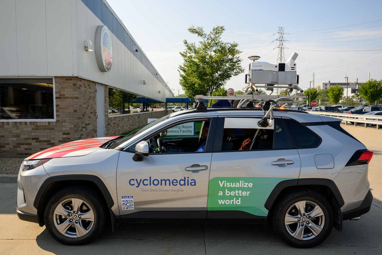
MetroCyclomedia cars equipped with cameras and LiDar equipment will be out taking pictures of homes through October, as part of the county's 3-year property assessment update.Courtesy of Cuyahoga CountyBy Michael Johnson, cleveland.comcleveland.com Express DeskCLEVELAND, Ohio — Cuyahoga County authorized a property-imaging contract worth up to about $2.59 million for two countywide surveys using camera-equipped vehicles, along with several years of data hosting and software access.The current survey will support the county’s 2027 property-value update. A second is planned for 2029, ahead of the next six-year reappraisal in 2030.These are five takeaways from the original article, which examined what the county is buying and how the data will be used.1. Most of the contract pays for two countywide surveysCounty officials estimated each survey will cost about $1.1 million.Cyclomedia Technology Inc. is expected to travel roughly 7,100 miles and photograph about 565,000 parcels during each pass.In years without a new survey, the county expects to spend about $110,000 annually for data hosting and software access through Dec. 31, 2030.2. The contract is not being paid from the county’s general fundThe work is funded through Cuyahoga County’s Real Estate Assessment Fund.That fund receives fees that Ohio law allows to be used for appraisals, property appeals, mapping, geographic information systems and related work.Spending on the contract could reduce money otherwise available for later distribution to local taxing authorities, depending on the fund’s other expenses and remaining balance.3. The vehicles collect more than street photographsCyclomedia’s vehicles capture high-resolution, 360-degree street-level images and LiDAR measurements.LiDAR uses laser pulses to measure distances, allowing appraisers to check features such as building dimensions, decks, windows and driveways.The street imagery will supplement existing property records and aerial photography rather than replace them.4. The system will help appraisers, but it will not set property valuesCounty appraisers will continue using sales information, existing records, aerial images, field inspections and other data when determining property values.County officials said Cyclomedia’s system gathers measurements and images but does not determine valuations.The technology could allow employees to check some conditions or measurements from their desks instead of automatically making field visits, although officials did not estimate how many trips or staff hours it could save.5. Other public agencies may get access, while residents will see lessThe contract allows the county to share access with municipalities and other public partners if appraisal work is not disrupted.Officials said police, fire and emergency medical agencies could potentially use the imagery for planning, although those were described as possible uses rather than existing arrangements.Residents are expected to be able to view street-level images through the county’s public GIS system, but not the LiDAR measurement tools available to appraisers and eligible public partners. Faces and license plates will be blurred in public images.Michael Johnson brings nearly four decades of newspaper experience in reporting, editing, newsroom leadership, page design and digital publishing. He has led daily and weekly newsrooms in Pennsylvania,...
What we learned about Cuyahoga County’s $2.59 million property-imaging contract
Full Article
Original Source
Read the full article at Cleveland →KhanList aggregates and links to publicly available news content. We do not host full articles from third-party sources. Always verify important information with original sources.