
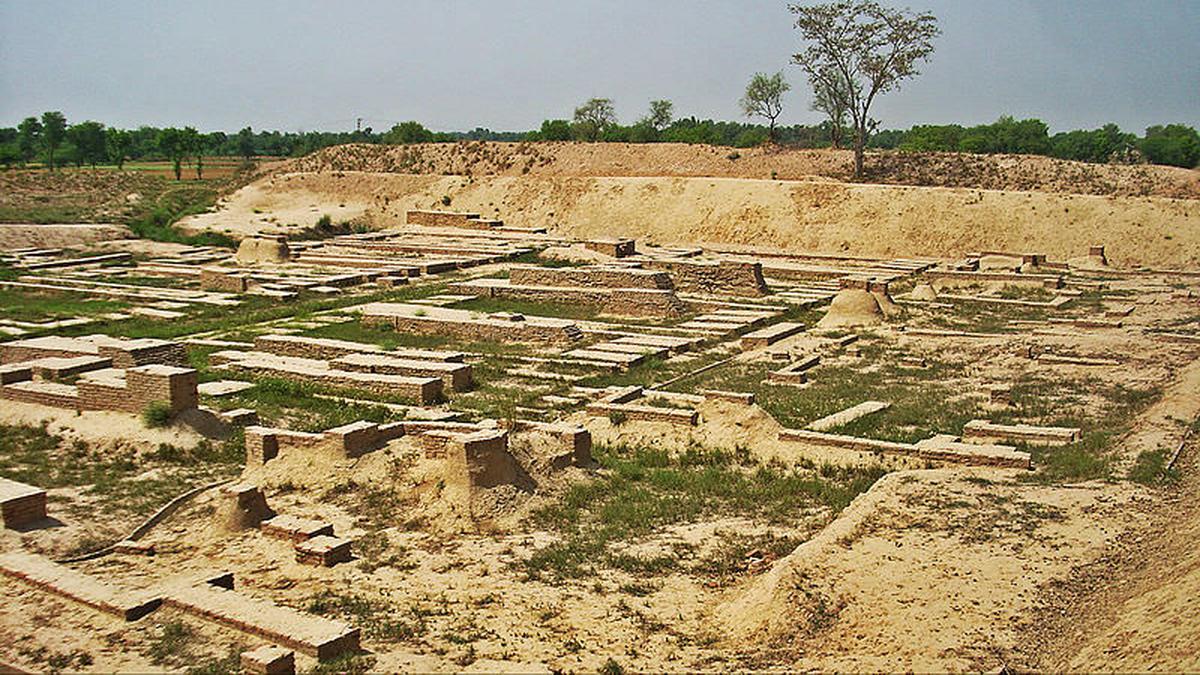
The city of Harappa | Photo Credit: Hasan Nasir Have you ever looked at the aerial view of the city you live in? While flying on an aeroplane or looking at a map, we can see how a city is laid out, whether the roads are straight or winding, and which parts have the larger and taller buildings.Throughout the history of humankind, people have tried to introduce some form of ‘city planning’ to organise cities: Where to locate people’s houses? How to move from one place to another? How to handle problems like rain and floods? What happens to the water coming out of toilets? Whether it is modern metros like New York and Shanghai, or ancient civilisations like Egypt and Mesopotamia, city maps take unique forms.New York, for instance, uses a ‘grid’ system for its streets. New York’s grid was introduced in 1811, when the area of Manhattan was developed as a strict grid intersecting at right angles, dividing the city into clear blocks. The streets are numbered in order, with names like 25th Street and 57th Street, and intersect with broader avenues. So, if you use logic, it is probably almost impossible to get lost in the grid. Residences, public places, and offices are all organised within this grid.Back in time A map of New York City | Photo Credit: Wikimedia Commons The grid is not unique to New York. It was used in ancient Greek and Roman cities and, closer to home, was one of the trademarks of ancient cities of the Indus Valley Civilisation in the northwest of India, which are some of the earliest examples of organised, modern town planning; something which most Indian cities still struggle with today!Excavations in these sites have revealed a simple grid: main roads intersect at right angles, dividing the area into blocks. The blocks have smaller lanes with houses. Houses looked fairly similar and were built mostly of burnt bricks. The most fascinating thing about these 4,000-year-old cities is that houses often had their own private toilets! So, under the planned grid lay a drainage system that carried dirty toilet water away from the houses. Sounds very modern, doesn’t it?A grid is just one way — and not the only way — to organise a city: several important cities like London and Rome are organised with winding streets and plazas. But a grid is often the easiest and is still used by planners across the world. Go to Google Maps and check out grid-based cities like Manhattan and Chicago. Now look at your own city and neighbourhood and study the arrangement of streets. What are the streets like? Published - September 18, 2026 10:00 am IST
What goes into arranging a city
Full Article
Original Source
Read the full article at Thehindu →KhanList aggregates and links to publicly available news content. We do not host full articles from third-party sources. Always verify important information with original sources.