
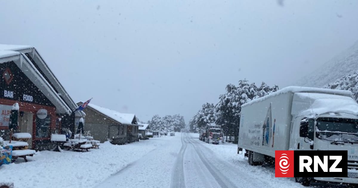
People were evacuated in Queenstown overnight as a significant winter storm battered the South Island.Firefighters went to about 16 flooding-related jobs during Thursday night across Queenstown, Frankton, Arrrowtown, Wanaka and Lake Hāwea.In some cases, water went into homes.Fire and Emergency says a number of properties were evacuated around Fernhill because of concerns about slips and land instability.It says there were many other calls about flooded roads and sections that firefighters didn't attend.More than 300 millimetres of rain has fallen in Franz Josef while more than 20 centimetres of snow fell in some parts of the South Island on Thursday.Queenstown Lakes District Council says its emergency operations centre has been busy overnight responding to issues caused by heavy rain.It has set up a civil defence welfare hub in Queenstown overnight to support people.In a social media post, it says multiple slips, washouts, rockfalls, and surface flooding are affecting the roading network, particularly on Haast Pass Road, Luggate Hill, Tarras Road, and Kingston Road. "Expect delays, traffic management, and ongoing disruptions throughout the day," the post says.The council is asking people to avoid unnecessary travel and take extra care on the roads.Surface flooding, debris, and other hazards may still pose some risks.Highway closuresState Highway 6 between Makarora and Lake Hāwea has been closed due to a slip on Friday morning.Motorists were urged to avoid the area or delay their trip.The Transport Agency said slips, rockfalls and treefalls were a continuing concern.State Highway 94 to Milford Sound remains closed from the Lower Hollyford Road intersection to Donne River due to the avalanche risk.It is not expected to reopen until Saturday.The Crown Range Road was closed on Friday morning between Eastburn Road and Cardrona.The Transport Agency has area warnings for surface flooding for State Highway 6 from Haast to Hokitika, State Highway 8A from Tarras to Luggate, State Highway 8 from Omarama to Clearburn, and for snow from Springfield to Otira on State Highway 73.Snow on SH73 on Thursday.NZTA / Waka KotahiWorst over for South IslandMetService's head of weather Heather Keats told Morning Report the snow had more or less finished while the rain band was tracking north.The "decent totals" of rainfall in the last 12 hours included 90-130mm for the Westland Ranges and the Canterbury headwaters while 90mm had fallen in Whataroa nearer to the coast."So those river networks are really high, they're going to take quite a few days to clear out but the heavy rain warnings will all have expired by midday."The wind watches would be affecting "the usual suspects" and had included gusts of 230km/h for the Canterbury high country overnight."So a bit breezy for your Friday."The northerly feed was hitting the Alps and becomes a norwester which would see Christchurch hit a high of 20 degrees Celsius today, she said.However, a new low will move over Northland, Auckland and the Coromandel heading on to Gisborne and bringing heavy rain for those areas over the weekend."The weather has decided the meteorological spring has started - we're going to see those relentless westerlies, fast-moving features and this weekend is going to be one of those weekends."Keats expected heavy rain watches to be issued on Saturday but the positive was that any bad weather would be fast-moving.She said Christchurch would be "the pick of the bunch" over the weekend while Auckland would be "a bit of a write-off".Rain warnings, wind watchesOrange heavy rain warnings cover Westland and headwaters of lakes and rivers in Otago and Canterbury with a separate warning starting from midnight for the Grey and Buller ranges.An area warning for surface flooding remained overnight for State Highway 6 from Haast to Hokitika.The Transport Agency says all highways except part of State Highway 94 to Milford Sound are open.Strong wind watches are also in place for Wairarapa south of Masterton, Wellington and the Marlborough Sounds from 6am to 8pm on Friday. Northwest winds may approach severe gale in exposed places, MetService says.A strong wind watch is also in place until 8am for the Canterbury High Country north of Mt Cook.High avalanche riskThe Mountain Safety Council has warned of high avalanche danger across the Southern Alps.The council says naturally triggered avalanches are likely and human-triggered avalanches are very likely across the Arthur's Pass, Aoraki /Mt Cook, Ohau, Queenstown, Wanaka, and Aspiring regions.NZ Ski chief executive Paul Anderson said Mt Hutt was closed this morning, Coronet Peak was open, and the road to the Remarkables was still being assessed before a decision was made on opening the skifield.He said the avalanche conditions were unusual at present because the snowfall had been followed by rain saturating the snow and making it heavier and increasing the avalanche risk.Patrol teams were monitoring the conditions 24/7 to ensure the skifields were safe, he said.He did not expect explosives would need to be used to move some of the snow, instead, skicutting (skiing across a diagonal angle across the slope to assess its stability) and trails would have been groomed overnight."Our focus will be on the known avalanche zones within our ski area boundaries."He said if the skifields were open customers could be confident they were safe.
Wet weekend in store for Northland, Auckland; worst over for South Island
Full Article
Original Source
Read the full article at Rnz →KhanList aggregates and links to publicly available news content. We do not host full articles from third-party sources. Always verify important information with original sources.