
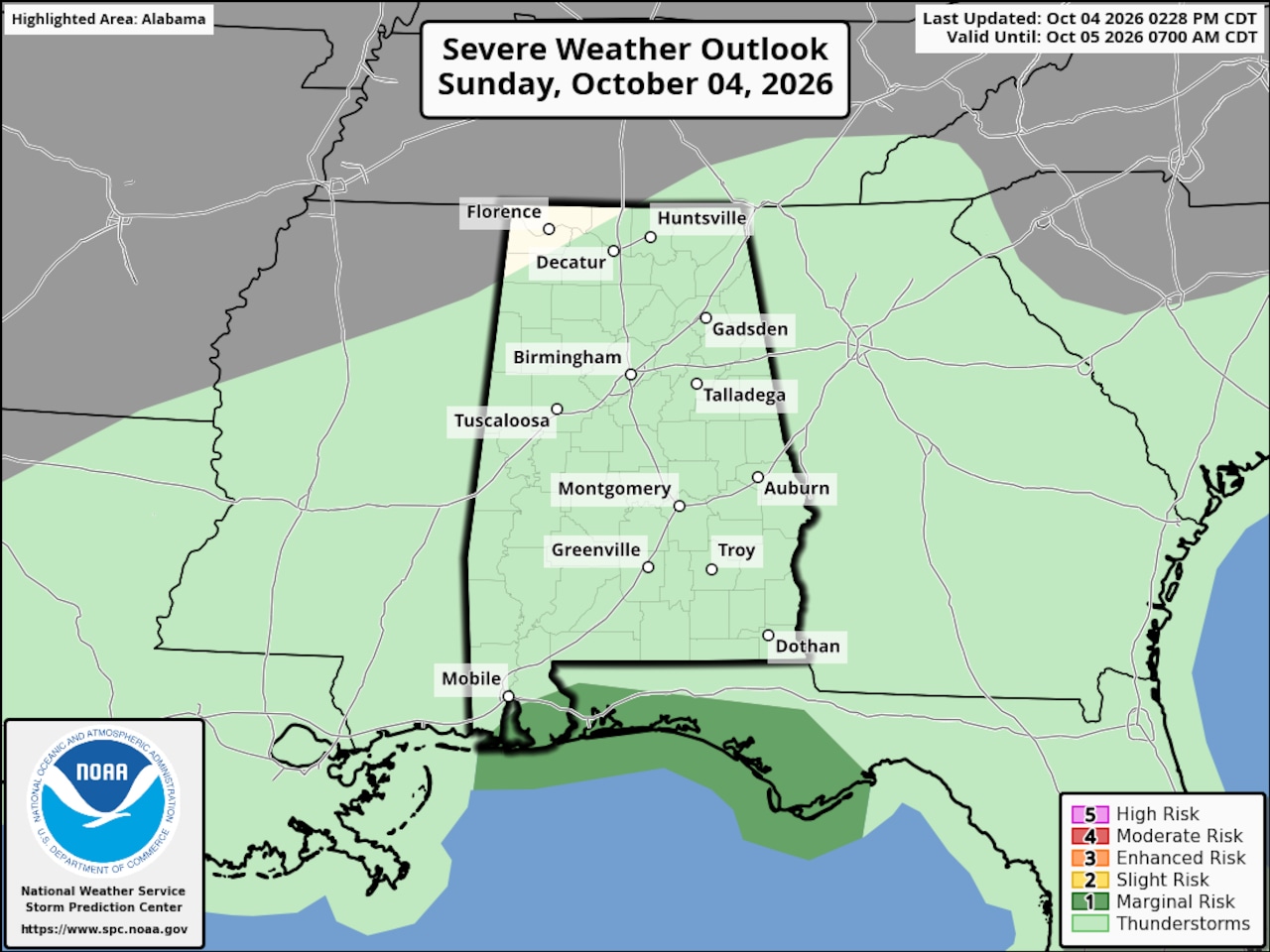
WeatherA Level 1 out of 5 (marginal) severe weather risk remains in the forecast for a small part of south Alabama as of Sunday afternoon.Storm Prediction CenterSouth Alabama continued to deal with some rough weather on Sunday evening.The National Weather Service issued several tornado warnings earlier Sunday for parts of coastal Alabama as waterspouts threatened onshore areas.The Storm Prediction Center has maintained a Level 1 out of 5 (marginal) severe weather risk for areas near the coast. A Level 1 risk means that isolated severe storms are possible. The SPC thinks there was a low-end tornado risk for that same area:Areas in green in the map above continue to have a low-end risk for a tornado on Sunday.SPCIn addition sometimes heavy rain continued to fall on the same areas, leading to reports of flash flooding and several flash flood warnings.The weather service said rain rates were estimated around 2-5 inches per hour in the heaviest storms.If that wasn’t enough, the weather service was also continuing to deal with a radar issue that has prevented the public from seeing radar imagery from five sites across south Alabama, the Florida Panhandle and south Georgia.Restoration of radar service may not come until late Sunday.NWSThe weather service said it could see radar data from the Mobile site but it was not available to the public. The weather service issued an update on Sunday afternoon and said there was no estimated restoration time:The weather service in Mobile said rounds of heavy rain will continue to be possible across through early Monday, “with flooding remaining possible, mainly along the coast.”Forecasters think the region will have a chance to dry out starting on Tuesday, but forecasters will be closely watching an area of disturbed weather that is expected to form in the southern Gulf that could become a tropical depression later this week.It’s too soon to say if it could affect Alabama.A disturbance, indicated by the orange circle, could form in the southern Gulf this week. Forecasters now say it has a medium chance to become a tropical depression in the next seven days.National Hurricane CenterLeigh Morgan is an Alabama native. She has written about weather for AL.com since 2013 and has been a weather nerd since Hurricane Frederic slammed into the Alabama coast in 1979. She started out in journalism...
Waterspouts and flash flooding in south Alabama
Full Article
Original Source
Read the full article at Al →KhanList aggregates and links to publicly available news content. We do not host full articles from third-party sources. Always verify important information with original sources.