
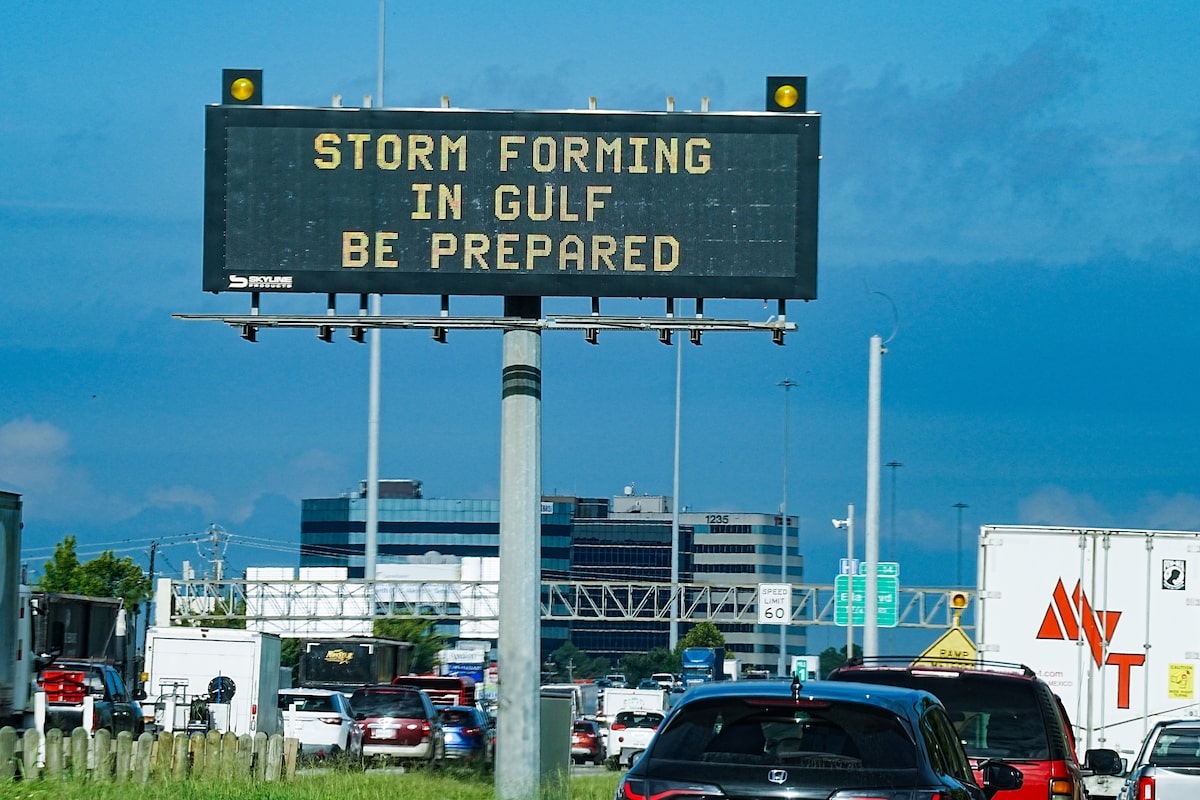
Open this photo in gallery:Motorists drive by Texas Department of Transportation signs on I-610 in Houston on Tuesday as Tropical Storm Edouard approaches.Elizabeth Conley/The Associated PressTropical Storm Edouard made landfall Tuesday afternoon along the Texas-Louisiana border after picking up a late burst of strength in the Gulf of Mexico, bringing ashore heavy rains and setting off flood warnings along the coast.The storm made landfall in the small coastal community of Johnson Bayou, Louisiana, and was expected to rapidly weaken. The National Hurricane Center said the storm arrived with maximum sustained winds of 95 km/h and had become slightly stronger as it neared landfall. In the meantime, several storms were brewing in the Pacific Ocean, including Lowell, which reached hurricane strength Tuesday morning.The hurricane center said Edouard was expected to dump 8 to 17 centimetres of rain with up to 30 centimetres. Southwestern Louisiana was expected to see lesser amounts.“That rainfall could produce some flash flooding and river flooding,” said Brad Reinhart, a senior hurricane specialist at the National Hurricane Center.Storm makes landfall along Texas-Louisiana borderMike Gilbert decided ahead of the storm to close his surf shop on Texas’ Crystal Beach because he didn’t want to risk his employees having a difficult time getting home. But, he said, it had ended up just being gray skies and drizzly rain there Tuesday as Edouard made landfall about 96 kilometres northeast of his shop.“You literally never know,” Gilbert said. “It could have all of a sudden moved over 50 miles and picked up 20 mph in wind and it could have been a whole different story.”In Cameron, Louisiana, the winds had picked up by Tuesday morning and rain was coming through on and off, said Connor Salvador, who owns an RV park there near the coast. He said while there could be a “little bit” of flooding if they get a lot of rain, he wasn’t too worried about Edouard.“We’re pretty used to all these types of storms that come through,” he said.Several storms in the Pacific OceanForecasters said newly formed Hurricane Lowell in the Pacific Ocean was expected to remain several hundred miles away from Hawaii for the next several days at least, but swells from the hurricane were likely to impact parts of the islands beginning Wednesday.“This hurricane is likely to increase the surf and make for dangerous beach conditions and marine conditions for any boaters near the Hawaiian islands over the next few days,” said Andrew Hagan, a forecaster with the National Hurricane Center.Tropical Storm Marie formed in the Pacific Ocean early Tuesday well offshore of southwest Mexico, the center said. Forecasters said it was expected to become a hurricane by Wednesday night, and swells generated by the storm were expected to affect parts of the coast in southwestern Mexico and the Baja California peninsula over the next few days.Elsewhere in the Pacific, Karina became a hurricane Sunday, fueled by warm waters far from any shore. It strengthened Monday into a powerful Category 4 storm but forecasters said Tuesday that it was expected to weaken.Meanwhile, the remnants of Tropical Storm Dolly brought rain and thunderstorms to parts of Haiti and the Dominican Republic, the Turks & Caicos, and the Bahamas, the hurricane center said.
Tropical Storm Edouard arrives on the Texas and Louisiana coasts after gaining strength in the Gulf
Full Article
Original Source
Read the full article at Theglobeandmail →KhanList aggregates and links to publicly available news content. We do not host full articles from third-party sources. Always verify important information with original sources.