
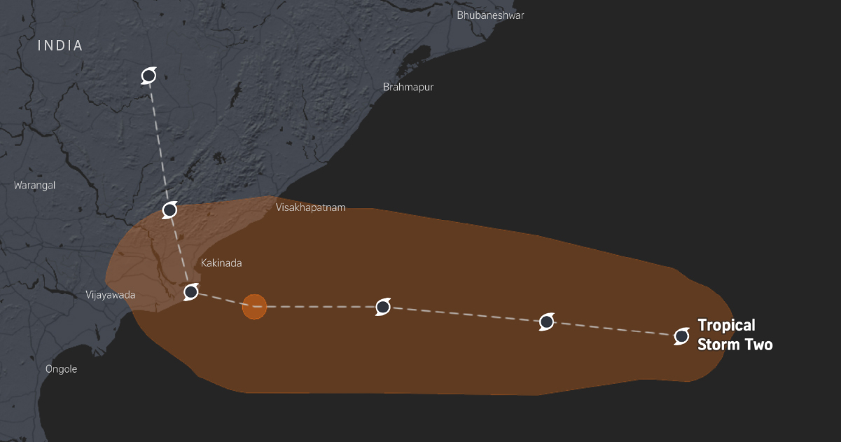
Produced by: Lily Yu, Roman Sverdan, Winnie Tan and Youjin Shin. Methodology: The Joint Typhoon Warning Center’s (JTWC) forecast advisories report the maximum radial extent of the 34, 50 and 64 knot wind thresholds in four quadrants (NE, SE, SW, NW). The map uses the 34 and 64 knot wind radii to create polygons at each forecast position, which are combined along the forecast track to form a shaded area showing the storm's maximum wind extent. Quadrant radii are connected with angular blending near each boundary, constrained to avoid overshooting and to retain the reported JTWC maximum within each quadrant.The resulting shaded area represents approximate deterministic wind extent envelopes, not a continuous wind field or probability forecasts. Locations within it are not necessarily forecast to experience the corresponding wind threshold, and uncertainty in track, intensity or wind radii is not included.Note: All times listed follow Singapore time unless otherwise stated. The borders follow United Nations guidelines.
Tropical cyclone Two: Track the cyclone’s path
Full Article
Original Source
Read the full article at Straitstimes →KhanList aggregates and links to publicly available news content. We do not host full articles from third-party sources. Always verify important information with original sources.