
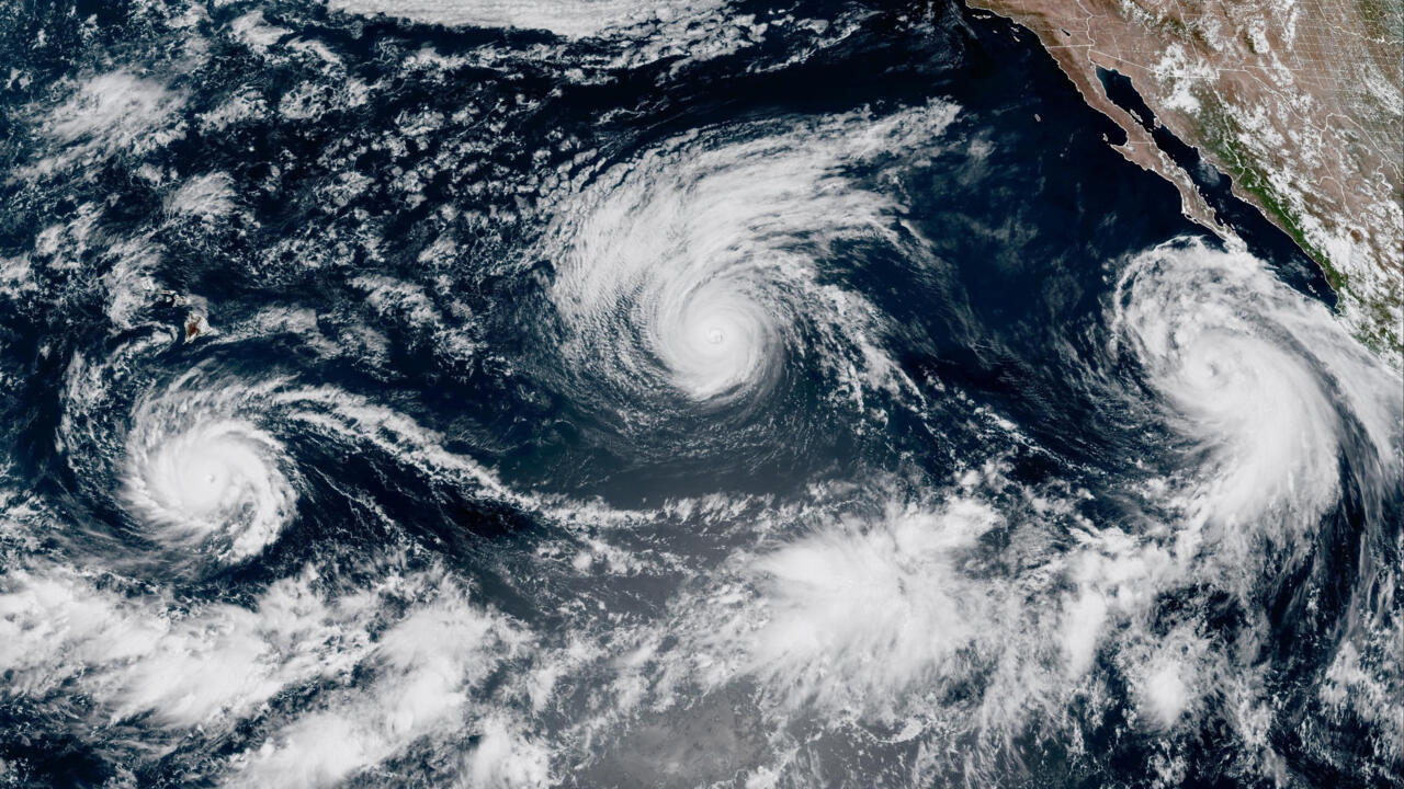
The current El Nino could become the strongest on record as the natural climate pattern that warms the tropical Pacific intensifies, with three hurricanes churning across the ocean on Thursday. The United Nations has warned of growing extreme weather risks into 2027. Issued on: 03/09/2026 - 12:43 2 min Reading time The World Meteorological Organisation (WMO), the UN body that coordinates weather and climate forecasting, said there was a near 100-percent chance El Nino would persist through February 2027. It is expected to strengthen further before peaking towards the end of this year. “If this trajectory continues, it may be stronger than anything since our monitoring began. So literally off the charts we have used for the past four decades,” WMO Secretary-General Celeste Saulo told a press conference in Geneva on Thursday. UN Secretary-General Antonio Guterres said in a statement released by the WMO: “El Nino is being supersized before our eyes. The science leaves no room for doubt: The planet is in uncharted waters, and those waters are heating up.” World set to breach 1.5C climate limit as UN urges rapid reversal Three storms at once Tropical Storm Marie strengthened into a hurricane late Wednesday off Baja California, joining Hurricanes Karina and Lowell, both rated Category 4. Three hurricanes at the same time are “definitely rare to see”, University of Michigan climate scientist Julia Cole told the French news agency AFP. “El Nino warming sets the stage for these storms, which are fuelled in large part by warm waters – when the tropical Pacific is warmer than normal we see an increase in strong storms,” Cole said. Lowell was about 710 kilometres south of Hilo, Hawaii, and was expected to remain a major hurricane for several days as it moved west, the US National Hurricane Centre said. Swells were likely to cause “life-threatening surf and rip current conditions” in parts of Hawaii. Marie was about 600 kilometres southwest of the southern tip of Baja California and was expected to strengthen through Friday. Karina had weakened slightly but was likely to remain a hurricane for the next couple of days. Climate change is ‘very visible from space’, France's Sophie Adenot tells RFI Warmer waters Warm ocean water provides fuel for storms. El Nino also reduces changes in wind speed and direction with height over the Pacific, creating favourable conditions for hurricanes to intensify. The phenomenon occurs naturally every two to seven years. It develops when east-to-west trade winds weaken, allowing warm water that normally builds up in the western Pacific to move east and rise to the surface. Climate change increases El Nino’s impacts. A warmer atmosphere holds more moisture, making El Nino-linked rainfall more extreme, while hotter conditions can dry soils and deepen drought. “El Nino has the potential to deliver a massive blow to communities and economies across the world,” Saulo said. “We are already seeing disruption and devastation from droughts and floods and we expect these impacts to increase as El Nino intensifies.” (with newswires)
Three Pacific hurricanes gather strength as El Nino intensifies
Full Article
Original Source
Read the full article at Rfi →KhanList aggregates and links to publicly available news content. We do not host full articles from third-party sources. Always verify important information with original sources.