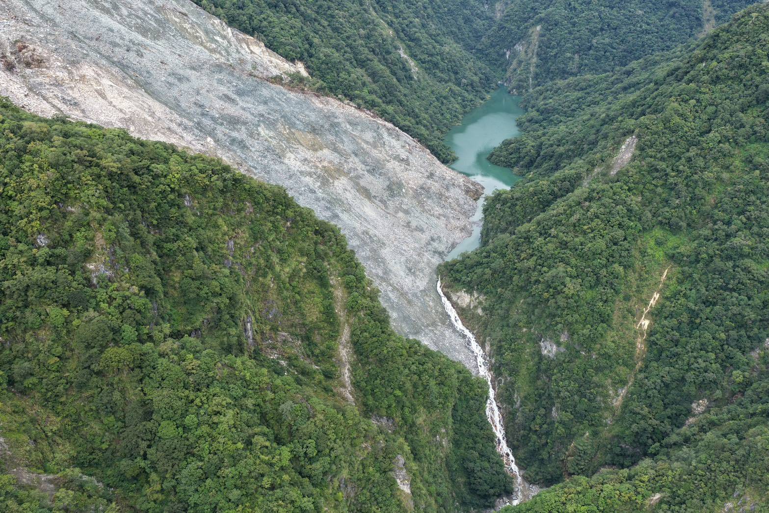
Aerial image of the Wanlixi landslide and lake as of 30 July 2026. Image from the Forestry and Nature Conservation Agency, Taiwan, In Taiwan, a large rockslide last month, the Wanlixi landslide, has blocked a river, creating a barrier lake with a volume of about 6 million cubic metres. In Taiwan, a large landslide has blocked the Wanli river in Hualien County. The hazard is being actively monitored by the Forestry and Nature Conservation Agency, who are referring to it as the Wanlixi landslide. The landslide dam was first spotted on 21 June 2026. There is a Planet Labs image from 20 June 2026 that shows the slope was intact (although there were many signs of deformation – I may return to this next week), so the timing of the failure is 20-21 June 2026. The location of the landslide is 23.78859° N, 121.27236° E (for machine readable text that is: [23.78859, 121.27236] ). This is a few kilometres north of the large Matai’an landslide that occurred last year. The Forestry and Nature Conservation Agency are posting a daily update on the landslide on their webpage (in Mandarin, but Google Translate works fine). The 30 July 2026 update includes this image:- Aerial image of the Wanlixi landslide and lake as of 30 July 2026. Image from the Forestry and Nature Conservation Agency, Taiwan, The Forestry and Nature Conservation Agency report that as of 31 July 2026 the lake volume is 6.1837 million cubic meters. As the image above shows, the lake has overtopped the dam but at present the natural spillway is in a stable overflow state. Rainfall input to the system at the moment is low. The lake is being actively monitored 24 hours a day and downstream communities are aware of the potential need for action. The lake is not on the scale of some that I have featured on this site, but the Taiwan government is being appropriately cautious in managing the risk. This Google Map shows the downstream geography (the landslide is at the location of the marker to the northwest of the map):- Google Map of the area downstream of the Wanlixi landslide. Note that the Matai’an landslide is also clearly visible in this image. Text © 2026. The authors. CC BY-NC-ND 3.0Except where otherwise noted, images are subject to copyright. Any reuse without express permission from the copyright owner is prohibited.
The valley-blocking Wanlixi landslide in Taiwan
Full Article
Original Source
Read the full article at Eos →KhanList aggregates and links to publicly available news content. We do not host full articles from third-party sources. Always verify important information with original sources.