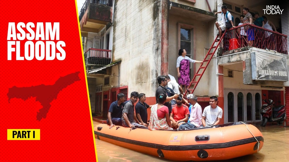
For more than 25 years, Sivasagar had forgotten what a flood felt like. The old Ahom capital, with its tanks and temples and tea gardens, sat on ground the water had spared for a generation. Then, on a July night in 2026, the water came back, and it came for everything.It rose through Sivasagar, Charaideo and Jorhat, districts that rarely appear on the annual flood maps of Assam. It swallowed nearly 800 villages, pushed past the highest flood marks ever recorded on the Dikhow river, and left thousands of families sleeping on embankments and roadsides, their homes packed with mud.The official explanation arrived quickly. A cloudburst, it was said, which is a freak wall of rain over the hills. It is a tidy story, and it lets a great many people off the hook. There is only one problem with it. According to the scientists who study these rivers and this monsoon, the rain was not the villain.The truly frightening part of the 2026 Assam floods is not that the sky did something monstrous. It is that the sky did something quite ordinary, and the land could no longer cope. THE HILLS THAT COULD NO LONGER HOLDTo understand why, you have to leave the plains and climb into the hills where these rivers are born.The rivers that flooded Upper Assam do not start in Assam at all. They begin their lives in the young, low hills where the Himalayas taper away into Nagaland and Arunachal Pradesh. The land that feeds a river with its rainwater is called a catchment, or a watershed. Picture the rim of a giant bowl. Every drop of rain that falls anywhere inside that bowl trickles downhill and collects into the same river at the bottom. That whole bowl of land is the watershed. Damage the sides of the bowl, and you change what reaches the river. And this particular bowl has been badly damaged. The rock in these hills is soft and immature, the soil loose, and for centuries it was held together mainly by the roots of trees. Strip the trees, cut the slopes for roads, gouge them for coal and stone, and you remove the very thing holding the hillside in place. A woman carries her belongings to safety through chest-deep water, one of thousands displaced as the floods swept through Sivasagar, Charaideo and Jorhat. (Credit: Reuters) Professor Arup Kumar Sarma, a hydrologist and professor of civil engineering at IIT Guwahati, who has spent decades studying the Brahmaputra system, has watched this unfold across the region. A hydrologist, in plain terms, is a scientist who studies how water moves across and through the land."The amount of water yield and sediment yield depends on the slope of the hill, deforestation and the type of soil," Professor Sarma tells India Today Digital.Two terms there are worth unpacking. Water yield is simply how much water a patch of land sends into the river. Sediment yield is how much soil, sand and mud it sends down along with that water. And here is the part that surprises people. When you clear a hillside, the extra water it sheds is real but modest. The extra soil it sheds is enormous.Professor Sarma points to a study his team carried out years ago in a watershed at Geetanagar in Guwahati, a small hill catchment they used as a warning of what stripping a slope bare would do. The results are stark. When the slope was covered by vegetation, it released about 5.27 cubic metres of water per second and roughly 7,900 tonnes of sediment a year. Remove the vegetation, and the water rose only a little, to about 7.25 cubic metres per second. The sediment, however, exploded to nearly 2,90,000 tonnes a year. A study of a Guwahati watershed shows how stripping a hillside of vegetation multiplies its sediment yield many times over, even when the extra water stays modest. (Credit: Professor Arup Kumar Sarma, IIT Guwahati) Sit with those numbers for a moment. The water increased by less than half. The soil loss multiplied almost 37 times over. That is the hidden danger of a bare hillside. Not so much the flood of water, but the flood of mud. His broader research on how hill catchments shed water and sediment, and how they can be nursed back to health, has been published in peer-reviewed journals including Water Resources Management and the Journal of Hydrologic Engineering.Not all of that mud reaches the plains, and Professor Sarma is careful not to overstate it. "For a large river like a tributary of the Brahmaputra, sediment yield may become 4 to 10 per cent of the actual eroded sediment," he says.A tributary is simply a smaller river that feeds into a bigger one, as the Dikhow feeds the Brahmaputra. Even at that fraction, for a river the size of the Dikhow, it is a colossal load. And that load has to go somewhere.THE RIVERS THAT LOST THEIR DEPTHWhere it goes is the riverbed.Year after year, the sediment washed down from the wounded hills settles on the bottom of the Dikhow, the Disang and their sister rivers. The bed rises. The channel, which is the trench the river flows through, grows shallower. And a shallower channel can carry less water before it spills."Sediment blocks the channel and contributes greatly to the flood, as the river loses its flow-carrying capacity," Professor Sarma tells India Today Digital.This is the quiet mechanism at the heart of the disaster. A river is like a drain. Fill the drain with silt, and the same rain that once passed through harmlessly now overflows. The river did not get more water in 2026. It got less room. Schoolchildren cross a vast sheet of floodwater by country boat, a reminder that in a flash flood, a timely warning can matter more than any wall. (Credit: Reuters) And when the erosion turns violent, Professor Sarma warns, it does something worse than silting."Severe erosion leads to gully formation and landslides, causing the river to block, which can make a landslide dam in an interior area and can eventually collapse to release a huge volume of water suddenly," he says.A gully is a deep channel gouged into a hillside by running water, the kind of raw scar you see on a bare slope after heavy rain. When enough of that loosened earth slides down at once, it can pile up across a river and act like a natural dam. Hold on to that image of the landslide that becomes a dam, and the dam that suddenly bursts. We will meet it again, from a second scientist, entirely independently.But first, how much has the bed actually risen? The men who maintain these embankments have a number, and it is alarming.THE EMBANKMENTS BUILT FOR ANOTHER CENTURYThe embankments meant to hold these rivers back are old. An embankment is simply a raised wall of earth built along a riverbank to stop the water from spilling onto the land. Samiran Deka, Additional Chief Engineer of the Upper Assam Zone at the Water Resources Department, laid out their vintage for India Today Digital. The Desang embankment was built between 1951 and 1978, the Dikhow between 1955 and 1979, and the Jhanji as far back as 1953. Since then, he says, "no major repairing by raising and strengthening was done," beyond a stretch of about 18 km of the Dikhow raised in the last three years.Every embankment is designed with something called freeboard. Freeboard is the gap between the top of the wall and the highest level the water is expected to reach. It is the safety margin, the extra height that keeps a swollen river from slopping over the top. These walls were built with a freeboard of 1 to 1.5 metres.But the bed has been rising all along. As silt lifts the riverbed, the water rides higher, and the safety margin shrinks. By the time the 2026 flood arrived, Mr Deka says, that margin had all but vanished."Prior to the flood of July 2026, the average freeboard was 0.30 to 0.45 metres," he tells India Today Digital. This year alone, he estimates, the rivers dumped around 45 cm of fresh silt on their beds. Desilting, or dredging, means digging out that accumulated silt to deepen the channel again, and Mr Deka says no such dredging of these rivers has ever been carried out. Cars lie overturned and half-buried in silt, a measure of the sudden, GLOF-like surge that scientists say tore downstream when a landslide-blocked river gave way. (Credit: AP) The walls were built to hold back a flood of the kind expected once in 25 or 50 years. What came, in Mr Deka's assessment, was closer to a once-in-a-hundred-year event. Against a margin of a few centimetres, the water simply climbed over the top. This climbing over the top of a wall, rather than bursting through it, is called overtopping. He records overtopping along 4.75 km of the Dikhow, 3.18 km of the Desang, and, most strikingly, along 14.34 km of the small Darika embankment, whose total length is just 14.40 km. Almost the entire wall was submerged.Here the official record corrects a widely believed version of events. For all the talk of collapsing embankments, Mr Deka is precise about what actually broke. A breach, unlike overtopping, is when the wall itself fails and the river tears an opening through it."Despite this being the highest flood ever, there was no breach of embankment on the Dikhow and Desang," he tells India Today Digital. "There were only two breaches in the Jhanji embankment, one on the left bank and another on the right bank, downstream of the National Highway."The rivers, in other words, did not mostly smash through their walls. They rose over them, because the walls had quietly been left too low by a bed that no one had cleared.THE RAIN THAT WAS NOT A CLOUDBURSTSo if the walls were merely overtopped by an ordinary river carrying an ordinary rain, just how ordinary was that rain? In the days after the flood, one figure was repeated everywhere, that rainfall in the hills had run 300 or even 400 per cent above normal. It sounds apocalyptic. It is also, to a monsoon scientist, close to meaningless.Professor Bhupendra Nath Goswami is one of India's most respected climate scientists and a former director of the Indian Institute of Tropical Meteorology. He wants that framing retired."I am concerned by media reports describing the risk of these rain events as 300 per cent or 400 per cent above the mean, because 300 per cent or 400 per cent above normal rainfall does not even qualify as an extreme event," he tells India Today Digital. "The risk of a hydrological disaster needs to be communicated by the actual daily accumulated rainfall, like what the risk is if it is 70 mm a day, or 100 mm a day, or 150 mm a day." A family salvages what it can along a flooded village road, as the swollen tributaries of the Brahmaputra turned streets into channels. (Credit: AP) So look at the honest number. Hydrologists have a strict definition of an extreme rainfall day. It is a day when the rain crosses what they call the 99.5th percentile. In simple terms, that means a day so wet that only about one day in 200 has ever been wetter at that place. For the Sivasagar area, Professor Goswami explains, that threshold sits at about 88 mm in a day. The satellite estimate for the actual rain on 18 and 19 July was around 70 mm a day."This event did not even qualify as a hydrological extreme event," he says. "Even if it technically qualifies as an extreme event, unless the actual rainfall is more than 100 mm a day, the risk of a flash flood is not high. That is why such rainfall events in the area occur frequently, every year, and no catastrophic event takes place every year."Read that again. The district receives rain like this most years and does not drown. Which forces the real question. If the rain was survivable, what turned it into a catastrophe?A FLOOD WITHOUT A LAKEProfessor Goswami's answer reaches for a chilling comparison, borrowed from the Himalayas."The disastrous event was akin to a glacial lake outburst flood, a GLOF, without a lake in the area," he tells India Today Digital.A GLOF, or glacial lake outburst flood, is one of the mountain's most feared events. High in the peaks, a natural dam of ice and rubble holds back a lake of meltwater. When that dam fails, the whole lake empties at once, and a wall of water tears down the valley. The point is the suddenness. Not a steady rise, but a violent release. An elderly resident wades past his half-submerged home in flood-hit Upper Assam, where the July 2026 waters rose higher than any flood in 25 years. (Credit: AP) Upper Assam had no glacial lake. What it had, Professor Goswami suggests, was something the degraded hills built for themselves."There are media reports of a series of small and medium landslides along the length of the Dikhou river," he says. "They must have carried a lot of silt and mud to the river and raised the riverbed along a long stretch. Then another, bigger landslide came along on top of this and blocked the river completely in one location, raising the water level upstream. When the river level rose beyond a critical level, it breached the soft blockade of the river, and a GLOF-like event happened downstream."There it is again, from a second scientist, entirely independently. The landslide that becomes a dam. The dam that collapses. The sudden release. A monsoon physicist and a river engineer, describing the same deadly sequence in the same rivers.THE WARNING NOBODY WANTEDPut the three testimonies together and a single, uncomfortable picture forms. The hills, stripped and mined and cut, shed their soil into the rivers. The rivers, their beds raised and their depth stolen, could no longer carry an ordinary flood.The embankments, built for a gentler century and never raised to keep pace, were overtopped. Somewhere in the hills, the loosened earth may have dammed the Dikhow and let go all at once. And the rain, through all of it, was unremarkable.Professor Goswami puts the conclusion bluntly, and it is not comfortable for anyone. A man pauses with his bicycle beside a swollen, silt-heavy stream cutting across a village road, the muddy brown water carrying the very sediment scientists say is raising Upper Assam's riverbeds. (Credit: AP) "The only conclusion is that the environmental degradation from human activities, like encroachment of the flood plain, river mining, coal mining, tree felling and hill cutting to build big road infrastructure in the catchment area of the Dikhou river over the past few decades, reached a tipping point that created this disaster," he tells India Today Digital. "This is a warning that more and more such events could be expected in coming years."A tipping point is the moment a system that has quietly absorbed damage for years finally gives way all at once. Sivasagar was spared for a generation not because it was safe, but because the land had not yet been pushed far enough. In July 2026, it was.The water has receded now. The tipping point has not.In Part 2, the harder question. If human hands broke this landscape, can human hands mend it, when the rain falls in one state and the ruin arrives in another?- EndsPublished By: Radifah KabirPublished On: Aug 11, 2026 07:00 IST
The rain was ordinary, so why did Upper Assam drown?
Full Article
Original Source
Read the full article at Indiatoday →KhanList aggregates and links to publicly available news content. We do not host full articles from third-party sources. Always verify important information with original sources.