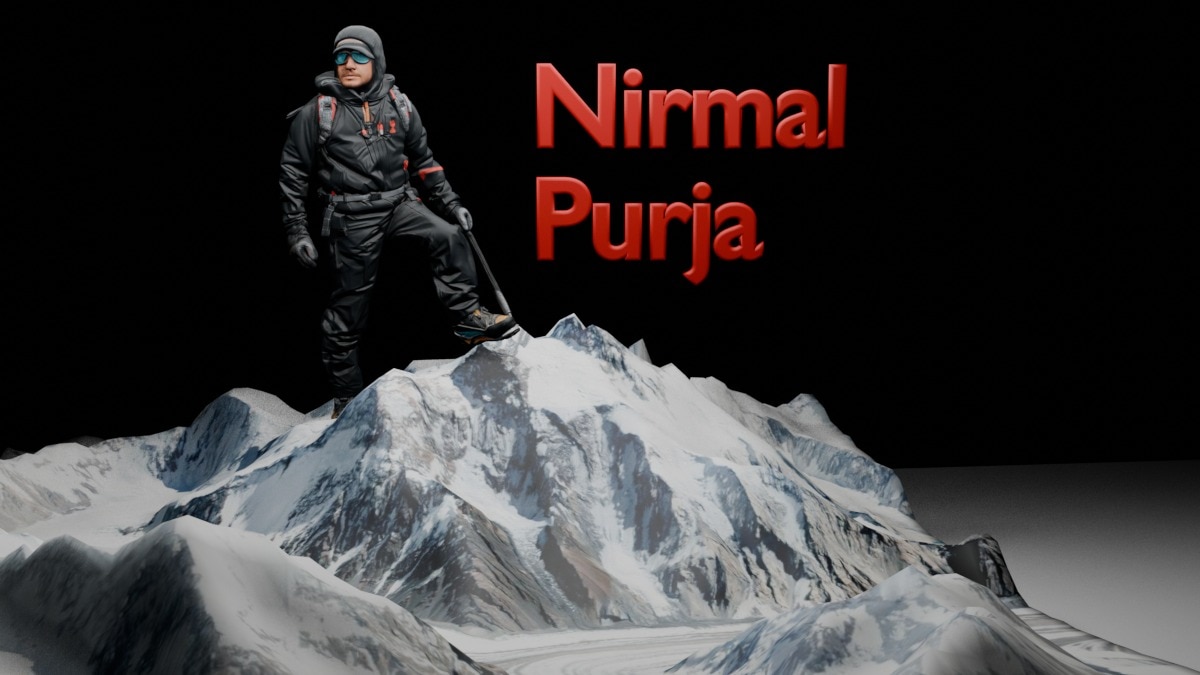
Nirmal Purja, the mountaineer whose death has left millions searching for his story. A 3D reconstruction of the final moments of Nirmal Purja On Broad Peak, he was attempting one of mountaineering’s toughest climbs and chasing a record that could have rewritten history.India Today’s 3D reconstruction follows the 10 climbers final ascent and shows how the avalanche swept Purja more than 2000 feet down the mountain, that is, roughly the height of two Eiffel Towers stacked vertically. On July 30, the mountain had something else in store. Nirmal Purja, a.k.a Nimsdai, was a former Gurkha soldier and UK Special Forces operator who rose to global prominence in 2019 after climbing the world's 14 highest peaks in just 189 days, shattering the previous record. The feat later inspired the Netflix documentary, “14 Peaks: Nothing Is Impossible”.Since then, Purja had climbed all 14 of the world's 8,000 metre peaks twice. His record breaking 2019 challenge relied on bottled oxygen for most ascents, but in 2024 he completed the entire set again without supplemental oxygen. In 2026, he set out to become the first mountaineer to climb all 14 peaks twice without bottled oxygen. Broad Peak would have been the 13th summit in that unprecedented second no oxygen circuit.The danger was already apparent. Worsening weather forced experienced mountaineers David Klein and Ian Overton to turn back, according to reports. Purja and his team, however, pressed on, believing the summit remained within reach. At 5:33 a.m., his GPS tracker placed him near Camp 2 — 6,166 metres up. Purja was carrying a Garmin tracker that transmitted his location for nearly four hours after he left the base camp. These signals formed the basis of India Today’s reconstruction. The first recorded ping placed him near Camp 2 at 5:33 a.m. Pakistan time, or 6:03 a.m. IST, at an altitude of 6,166 metres, or 20,231 feet. He and his team climbed steadily for hours, pushing toward a summit that stood at 8,051 metres. Over the next 90 minutes, the team continued its steady ascent. By 7:03 a.m., Purja’s tracker placed him at 6,430 metres, a gain of roughly 264 metres from Camp 2. Then, an avalanche. Just before 9:00 a.m., the garmin device carried by Purja and Al-Harthy both pinged at around 6,660 metres.Tracker data indicates the avalanche likely struck shortly after 9:00 a.m., at around 6,600 to 6,660 metres, on the route between Camps 2 and 3. About 30 minutes later, Purja’s tracker registered more than 2,000 feet below its previous position. The GPS signal of Nadhira Al-Harthy, an Omani mountaineer climbing with the same team, also vanished from the upper slopes and later reappeared more than a vertical mile lower.Purja’s next signal placed his tracker down roughly 6,050 metres. What followed became the most haunting part of the search: the device appeared to move about 49 metres sideways while descending another 44 metres, and it continued transmitting through the night and into the following morning. For a few hours, that movement raised the possibility that Purja had survived the fall and was trying to reposition himself, perhaps waiting for rescuers. Elite Exped co-founder Mingma David initially held on to that hope, telling colleagues that Nims’s location was still moving. But tracker data alone cannot prove that Purja himself was moving; the movement of the device or ordinary GPS drift could produce similar readings.In an Instagram post published before the climb, Purja said Broad Peak was a late addition to the expedition. “Broad Peak, I ask for nothing but safe passage up and back down,” he wrote.Even as the Garmin tracker continued to transmit, reaching there was an entirely different challenge. The climbers were stranded on steep terrain above 6,000 metres, where bad weather limited helicopter access and recovery teams struggled to approach safely. Unlike Nepal, Pakistan does not routinely carry out long-line helicopter rescues at such altitudes, according to expedition officials. Across the Karakoram, warmer conditions are making snow and ice increasingly unpredictable Broad Peak is itself undergoing rapid change, bringing new and less predictable risks with every climbing season. The peak lies in the Karakoram, within the wider Hindu Kush Himalaya cryosphere, where warming is altering snow, ice and permafrost conditions. ICIMOD estimates that the region lost about 12 per cent of its glacier area and 9 per cent of its ice reserves between 1990 and 2020. For climbers, these shifts can mean more unstable slopes, erratic snowfall and narrower windows of safe passage, though this particular avalanche has not been directly linked to climate change.Please rotate your deviceWe don't support landscape mode yet. Please go back to portrait mode for the best experience
The Last Trek: Reconstructing Nirmal Purja's final moments
Full Article
Original Source
Read the full article at Indiatoday →KhanList aggregates and links to publicly available news content. We do not host full articles from third-party sources. Always verify important information with original sources.