
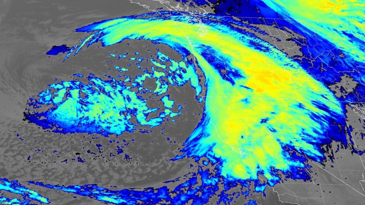
This El Niño winter is starting off with a bang. The first major atmospheric river of the season is battering the West Coast with deluging rain, heavy mountain snow, and an isolated tornado threat. The intense storm is the latest in a series of atmospheric rivers that drenched the Pacific Northwest last week and into the weekend. This one will have a wider impact, with California bearing the brunt of its force. Precipitation is also likely to reach Nevada, Utah, and western Colorado, potentially bringing some much-needed drought relief to the parched region, meteorologists Ben Noll and Matthew Cappucci report for the Washington Post. According to the National Weather Service, the atmospheric river will continue to drive active weather across California and the Pacific Northwest today. Forecasters expect the heaviest rainfall along the coast and in the foothills, and parts of central and southern California face an increased risk of flash flooding on Wednesday and Thursday, respectively. The storm could also dump up to 4 feet (1.2 meters) of snow in the Sierra Nevada range, with additional accumulating snow expected across parts of the Intermountain West and the Rocky Mountains. Last week’s storms already jumpstarted the Sierra Nevada snowpack, delivering nearly a foot (30 centimeters) to Donner Pass and forcing an Interstate 80 closure. This week, moderate to heavy snow and gusty winds could again lead to hazardous travel conditions and reduced visibility, the NWS warns. In California’s Central Valley, strong to severe thunderstorms could take shape Thursday afternoon, according to local meteorologist Chris Nunley. If the right combination of conditions develop, “isolated large hail, strong wind gusts, and perhaps a brief funnel—or possibly a tornado—would be possible,” he wrote in a Facebook post. “However, persistent clouds or rain could limit daytime heating and substantially reduce the risk so this will be closely monitored.” Earlier this week, a pair of waterspouts formed over San Francisco Bay, fueled by cold, moist air moving over unusually warm sea surface temperatures. Indeed, the waters off the Pacific Coast—and especially California—have been breaking temperature records for weeks due in large part to the super El Niño. A wet and wild winter for SoCal? In Southern California, the most notable aspect of this storm will be how quickly the rain could fall, with most of the total accumulation dropping within just a few hours, University of California Agriculture and Natural Resources climate scientist Daniel Swain told the Los Angeles Times in an email. According to Swain, that’s because the moderately strong cold front will interact with excessive moisture and heat along the coast due to a record-breaking marine heat wave. “This extra ‘juice’ might be a bit of a signature of storms during our very strong El Niño winter this year to an even greater extent than we’ve seen during historical very strong [El Niño] events,” he wrote. El Niño tilts the odds toward wetter-than-normal winter conditions for Southern California, so more drenching storm systems are likely on the way for this region. However, the historical probability of landfalling atmospheric rivers over California does not significantly change during an El Niño year. “It’s important to stress that even though we see these general patterns during El Niño and La Niña years, there is still a lot of variability and not every event is going to follow the general pattern,” climate scientist Julie Kalansky explained in a recent blog post for the University of California San Diego’s Scripps Institution of Oceanography. “So, the declaration of an El Niño doesn’t guarantee that Southern California is going to have a wet, stormy winter, but it does stack the deck in that direction.” El Niño is still strengthening, and its most significant impacts won’t arrive until January through March. But the severe soggy weather pattern currently affecting the West Coast could offer a taste of what’s to come.
Super El Niño’s First Major Atmospheric River Slams California With Rain, Feet of Snow, and a Possible Tornado
Full Article
Original Source
Read the full article at Gizmodo →KhanList aggregates and links to publicly available news content. We do not host full articles from third-party sources. Always verify important information with original sources.