
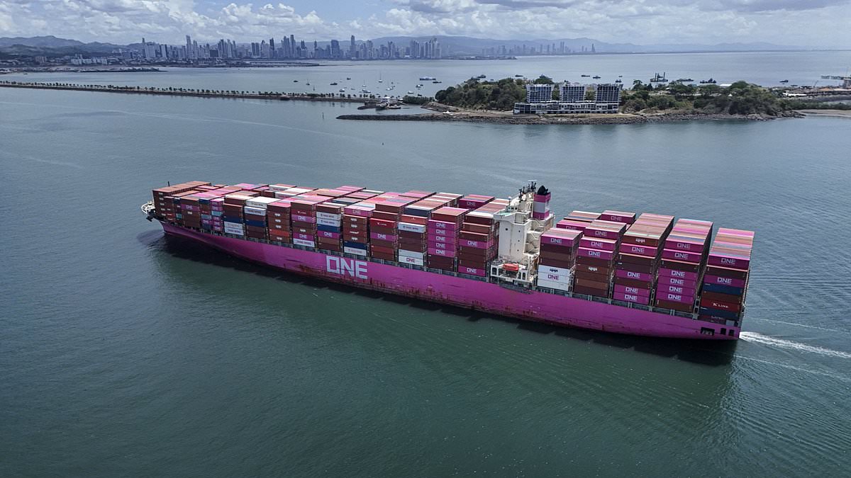
READ MORE: Super El Niño is EVOLVING, models confirmSee more Daily Mail on Google - save us as a Preferred Source Published: 08:33 EDT, 21 August 2026 | Updated: 08:33 EDT, 21 August 2026 The Panama Canal has been forced to cut the number of ships passing through – thanks to the Super El Niño. From 3 September, the number of vessels allowed through the waterway each day will fall from 36 to 34. It will then drop to just 32 from 15 September. According to the Panama Canal Authority, this is due to low water levels in two artificial lakes that feed the canal. 'Despite the arrival of the rainy season in Panama, and the water–saving measures implemented by the Panama Canal to mitigate the adverse effects of the El Niño event, current watershed conditions, including below–expected precipitation in the Canal watershed, require additional action to support the long–term sustainability of transit operations,' it explained. This isn't the only measure the authorities have been forced to take. The canal has already implemented other water conservation measures, such as lowering the maximum draft – the vessel's depth in the water – for the largest ships. The Panama Canal has been forced to cut the number of ships passing through – thanks to the Super El Niño The news comes shortly after scientists warned that Super El Niño is evolving and could become one of the strongest events on record Central America is in the throes of a severe drought driven by the Super El Niño – a weather pattern that warms surface temperatures in the central and eastern equatorial Pacific Ocean, triggering worldwide changes in winds, atmospheric pressure and rainfall.In the area of the canal, rainfall from May to August is down 34 per cent from its historical average, according to the authority. Worryingly, it added that the Super El Niño could reduce it even more.'The Panama Canal will continue to closely monitor weather conditions, watershed inflows, and lake levels,' it explained. 'Should additional operational adjustments become necessary, the canal will provide customers with timely updates. 'Because weather conditions are changing more rapidly than originally anticipated, the Panama Canal will make every reasonable effort to announce any future adjustments as far in advance as possible. 'However, the timing of such announcements will depend on evolving conditions and the availability of updated information.'The impact of the new measures could be far–reaching, as the Panama Canal handles five per cent of global maritime trade and around 40 per cent of US container traffic. The impact of the new measures could be far–reaching, as the Panama Canal handles five per cent of global maritime trade and around 40 per cent of US container trafficThe news comes shortly after scientists warned that Super El Niño is evolving and could become one of the strongest events on record.New measurements show that El Niño conditions are strengthening across the tropical Pacific, with sea surface temperatures (SST) showing a steady upward trend.Models reveal a 'clear and sustained increase', with the latest data showing the sea surface in this region is now 2.7°C above average.And the majority of indicators are pointing towards a 'very strong event' that could have far–reaching impacts across the globe.'The 2026 El Niño event continues to intensify across the central–eastern equatorial Pacific,' a blog written by Columbia University's Center for Climate Systems Research team reads.'The traditional Niño 3.4 index shows a clear and sustained increase, with the most recent seasonal mean reaching +1.51 °C during May–July 2026 and the July monthly value increasing to +2.03 °C.'The latest weekly Niño 3.4 index, centered on August 12, 2026, reached +2.7 °C.'Together, these observations indicate that El Niño is strengthening further and evolving toward a very strong event.'WHAT IS THE EL NINO PHENOMENON IN THE PACIFIC OCEAN?El Niño and La Niña are the warm and cool phases (respectively) of a recurring climate phenomenon across the tropical Pacific - the El Niño-Southern Oscillation, or 'ENSO' for short.The pattern can shift back and forth irregularly every two to seven years, and each phase triggers predictable disruptions of temperature, winds and precipitation. These changes disrupt air movement and affect global climate. ENSO has three phases it can be: El Niño: A warming of the ocean surface, or above-average sea surface temperatures (SST), in the central and eastern tropical Pacific Ocean. Over Indonesia, rainfall becomes reduced while rainfall increases over the tropical Pacific Ocean. The low-level surface winds, which normally blow from east to west along the equator, instead weaken or, in some cases, start blowing the other direction from west to east. La Niña: A cooling of the ocean surface, or below-average sea surface temperatures (SST), in the central and eastern tropical Pacific Ocean. Over Indonesia, rainfall tends to increase while rainfall decreases over the central tropical Pacific Ocean. The normal easterly winds along the equator become even stronger.Neutral: Neither El Niño or La Niña. Often tropical Pacific SSTs are generally close to average.Source: Climate.gov
Super El Niño could delay your deliveries: Panama Canal is forced to cut the number of ships passing through because of drought caused by the climate event
Full Article
Original Source
Read the full article at Dailymail →KhanList aggregates and links to publicly available news content. We do not host full articles from third-party sources. Always verify important information with original sources.