
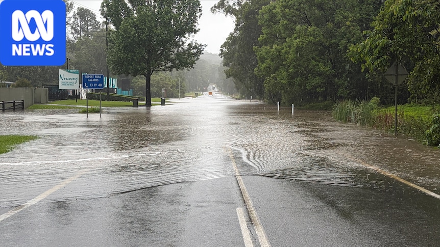
Topic:WeatherPosted Mon 26 Oct 2026 at 5:46amMon 26 Oct 2026 at 5:46am, updated Mon 26 Oct 2026 at 6:04amMon 26 Oct 2026 at 6:04amFlash flooding is possible across south-east Queensland, including on the Sunshine Coast, which has had intense rain in recent days. (ABC News: Janel Shorthouse)Flash flooding, large hail and wind gusts of up to 90 kilometres an hour are possible for south-east Queensland with two rounds of storms forecast for Monday.Multiple warnings are in place across the state, including two for severe thunderstorms, after days of heavy rain. Flooding along Widgee Creek, along the Wide Bay Highway near Gympie, on Sunday morning. (Supplied: Infinity Flights Photography)Bureau of Meteorology senior meteorologist Felim Hanniffy said storms were forecast across Brisbane, Gold Coast and Sunshine Coast during the morning rush with another round possible in the afternoon and early evening."There is a risk of severe storms around the south-east, broadly possible for areas like the Sunny Coast, Brisbane, the Gold Coast and likely for areas west of Ipswich and across eastern Darling Downs," he said."Depending on how the first round of storms go through in the morning that could reduce the severity risk for some areas as well."A flooded bridge over Sandy Creek just outside Clermont on Sunday. (Supplied: Jess Keyte)Mr Hanniffy said there was also the chance of very dangerous thunderstorms in inland areas during the afternoon and early evening.Severe storms are likely across the Lockyer Valley, Scenic Rim and South Burnett on Monday, according to the bureau.The recent wet weather, which has seen more than 200 millimetres of rain fall within six hours in some areas, combined with more intense falls, could lead to flash flooding in some areas.On Sunday, an alert for flash flooding for Clermont was lifted. (Supplied: Action Helicopters Capella)Mr Hanniffy said the severe storm risk was driven by a stagnant humid air mass that has persisted for more than a week.He said it was likely the storm risk would ease in parts of the south-east over the coming days with some uncertainty over if it would return later in the week."Brisbane, the Gold Coast and the Sunshine Coast should see conditions ease by Tuesday but certainly some areas in south-east Queensland, particularly inland areas like Wide Bay-Burnett, will still maintain that severe storm risk into Tuesday," he said.
Storms set to bring flash flooding, large hail to south-east Queensland
Full Article
Original Source
Read the full article at Abc →KhanList aggregates and links to publicly available news content. We do not host full articles from third-party sources. Always verify important information with original sources.