
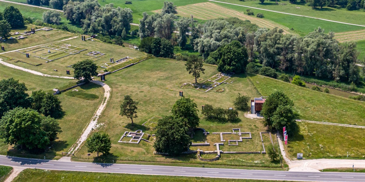
The Danube Limes was the Roman Empire’s frontier along the Danube River, and part of it is now a UNESCO World Heritage Site. Its forts and watchtowers once stretched for hundreds of miles through Roman provinces and guarded the empire against raids from across the river. Civilian settlements grew up around them. Today, most of those fortifications are crumbling ruins. But the Danube Limes was also hiding something bigger: an entire city that had been lost for nearly 2,000 years.Since 2015, a team of researchers from several fields has been studying a roughly six-mile stretch of the frontier between the Austrian towns of Enns and St. Pantaleon-Erla. In Roman times, this area formed the northern border of the province of Noricum. Geophysical surveys there have now revealed a previously unknown city near the hamlet of Stein. It covered about 62 to 74 acres and was carefully planned, with a grid of streets like a modern city’s. Its most impressive feature was an amphitheater that could seat about 8,000 spectators. The city appears to have been founded next to a military garrison around 80 C.E. and abandoned about a century later. The researchers found no signs of destruction, so the residents probably left in an orderly way rather than being driven out by enemies.The discovery also revives an old question: could this be the lost Roman city of Claudivium? Claudius Ptolemy, the second-century Greco-Roman astronomer, mathematician, and geographer, mentioned Claudivium and gave its coordinates, and the new site fits them. Ptolemy also described a river flowing in from the north. That could be the Aist, a tributary that joins the Danube near the site. The timing fits, too. The name Claudivium disappears from historical records after about 180 C.E., around the time this city was abandoned.The answer may lie in the city’s layout. Over three years, archaeologist Mario Wallner of GeoSphere Austria and his colleagues scanned the site with ground-penetrating radar and magnetometry. These tools picked up a network of buried roads that can’t be seen from the surface, and the team used the data to map the city.“The combined, interpretative mapping revealed a well-planned settlement with a regular street system that defines individual residential neighbourhoods (insulae),” Wallner and his co-authors wrote in a 2025 study published in ArchéoSciences. “The orientation of the residential neighborhoods and streets are aligned with the auxiliary fort, which represents the dominant administrative unit in this area of the Danube Limes.”That fort helps explain why the city was there. With an earlier timber-and-earth fort, it probably controlled a crossing point on the Danube near where the Aist flows in. That river was an important trade route to lands outside the empire. About four miles west was Lauriacum, the Roman town that is now Enns. Thanks to its legionary fortress and its spot on the Danube trade route, it was one of the most important cities in Noricum.The evidence suggests the new city was wealthy as well. According to University of Innsbruck archaeologist Gerald Grabherr, its amphitheater was about the same size as the one at Carnuntum, a major Roman center farther down the Danube. Researchers have recovered about 640 coins. To the northwest is a large cemetery filled with graves, burial mounds, and other burial structures. Some of these are large enough to suggest they held wealthy people.So why would anyone leave such a thriving city? The timing offers a strong clue. In 180 C.E., Emperor Marcus Aurelius died, and his son Commodus took the throne. Commodus became known as a tyrant, and his reign is often said to mark the end of the Pax Romana. Early in his rule, however, he signed a peace treaty that ended the Marcomannic Wars. Since 166 C.E., Rome had been fighting the Germanic Marcomanni and Quadi along the Danube, along with Sarmatian peoples from the east. Once peace came, Rome reorganized its defenses along the frontier. It concentrated its forces at the more defensible Lauriacum and gave up the settlement at Stein. The residents didn’t go far. The same kinds of bronze-casting tools and clothing pins found at the site have also turned up at Lauriacum, which suggests that craftspeople moved their workshops there.While there are good reasons to speculate, we still can’t be certain about the city’s identity. Archaeologists have’t found any inscriptions bearing the name Claudivium at the site, and the closest thing to written evidence so far is a set of bronze military diplomas, which certified the service of Roman soldiers.“[This] geophysical survey has, literally, only scratched the surface,” Rebecca Jones, co-chair of the International Congress of Roman Frontier Studies, said in a statement. “[It also] demonstrates what huge scientific potential still lies in the ground.”Elizabeth Rayne is a creature who writes. Her work has appeared in Popular Mechanics, Ars Technica, SYFY WIRE, Space.com, Live Science, Den of Geek, Forbidden Futures and Collective Tales. She lurks right outside New York City with her parrot, Lestat. When not writing, she can be found drawing, playing the piano or shapeshifting.
Scientists May Have Found a Lost Roman City—and It Could Solve an Ancient Mystery
Full Article
Original Source
Read the full article at Popularmechanics →KhanList aggregates and links to publicly available news content. We do not host full articles from third-party sources. Always verify important information with original sources.