West Fork Rio Santa Barbara Trail, Carson National Forest, New Mexico Photo: bjul/Shutterstock Distance: 20.4 miles RT Elevation gain: +/- 3,497 feet Difficulty: Strenuous Tucked within the Pecos Wilderness of Carson and Santa Fe National Forests just south of Taos, the West Fork Rio Santa Barbara Trail follows a steady climb through wide meadows and dense aspen groves, with the Rio Santa Barbara murmuring below. Early fall offers both live wildflower displays (typically July–August) and golden aspens late in the season. The trail gently ascends via switchbacks, opening to broad views of the Sangre de Cristo peaks, including Chimayosos. Extend your hike toward the Santa Barbara Divide and Truchas Lakes if time allows — these areas reward with alpine panoramas, though camping is sparse above treeline and prohibited within 300 feet of lakes. Where to stay: Base yourself in Taos, less than an hour’s drive from the trailhead, where art, history, and mountain culture come together. Check out Matador’s selection of Taos Airbnbs for nearby options. Goose Creek Falls, McCall, Idaho Distance: 3 miles RT Elevation gain: +/- 700 feet Difficulty: Easier-moderate Evergreen firs, spruces, and pines rise above lower foliage that flares with fall color on this trail in the Payette National Forest near Brundage Mountain Resort. Summer sees plenty of traffic here, so fall is the better season if you want the forest to yourself. Starting from the Last Chance Campground, the trail crosses small creeks and winds along well-marked paths before reaching the 60-foot Goose Creek Falls. A short scramble down to the river gives you the best perspective, looking up at the water plunging through a basalt canyon. In October, the larches add a burst of yellow to the already colorful mix. Where to stay: Make your base in McCall, just minutes from the trailhead, with cabins and mountain retreats that put you close to both the forest and Payette Lake. Options range from angular A-frames with loft bedrooms and big windows that look into the pines, to renovated lake cabins with decks facing the water and short walks into town for dinner. South Cottonwood Creek Trail, Bozeman, Montana Distance: 5 miles RT Elevation gain: +/- 550feet Difficulty: Easier-moderate Not to be outdone by aspens in fall, bright orange cottonwoods light up dense forests and expansive meadows on this easy trail in the Gallatin Range just outside Bozeman. If you hit the trail on a warm fall day, South Cottonwood Creek runs alongside nearly the entire way, offering spots to cool your feet. While you might not break a sweat with fewer than 500 feet of elevation gain, you can extend the outing by connecting to the History Rock or Blackmore trails. Those spurs make the area as good for a casual afternoon walk as for a longer overnight in Hyalite Canyon. Where to stay: Bozeman is the natural base for this hike, less than 20 minutes from the trailhead. On the outskirts of town, there’s a two-bedroom place with a covered deck facing the Bridger Mountains, reclaimed timbers sourced from Glacier National Park, and custom furniture that makes the interior as striking as the views. If you’d rather stay central, there is a recently built townhome just a couple of blocks from Main Street with a chef’s kitchen, a soaking tub, and windows that frame both city streets and mountain views. It’s close enough to walk to dinner or ride the provided cruiser bikes to breweries and galleries. Mount Sentinel: The “M” Trail, Missoula, Montana Distance: 1.7 miles RT Elevation gain: +/- 650 feet Difficulty: Moderate Short, steep, and beloved by locals, the climb to the “M” is Missoula’s go-to workout hike. From the trailhead behind the University of Montana, the path zigzags straight up the west face of Mount Sentinel. The trail climbs 11 switchbacks that gain 620 feet in well under a mile, making it more difficult that the statistics would appear. It’s quick but not easy; the grade is steep enough that plenty of people run it to train. The payoff comes fast, though. The campus drops away within minutes, and by the time you reach the giant concrete “M,” the view has opened to take in all of Missoula, the Clark Fork River winding through town, and mountains stretching north and south. In fall, the valley below turns gold and orange, with the cottonwoods along the river leading the way. The “M” has been on the mountain since 1908, when students first laid it out in stone. The concrete version came later. Where to stay: Instead of staying in Missoula, base yourself in Stevensville, about half an hour from the trailhead. This stunning Airbnb is set on 10 acres at the edge of the Sapphire Mountains and gives you both privacy and big-sky views across the Bitterroot Valley. With two bedrooms and space for four guests, it works for couples or families looking to balance a day on the “M” Trail with evenings away from the city. From here, you’re well placed to explore the small towns of the valley or head south into the Bitterroot National Forest. Taggart Lake-Bradley Lake Loop, Grand Tetons, Wyoming Distance: 5.5 miles RT Elevation gain: +/- 600 feet Difficulty: Moderate This hike offers a huge payoff for relatively little work. Glacial lakes reflect craggy Teton peaks, including Grand Teton itself, which towers nearly 14,000 feet over sagebrush flats and patches of forest that flame yellow and orange with autumn aspens. Along the way, keep an eye out for moose grazing near the lakeshore or black bears working the berry patches. Panoramic views of the Tetons stretch across both Bradley and Taggart Lakes, making this one of the park’s most scenic lake hikes. Bear spray is a must here, as the trail cuts directly through prime wildlife habitat. One thing to know for a fall trip: the northern segment of the Taggart Lake Trail is closed through November 15, 2026 for rehabilitation, so the usual loop isn’t fully connected. The trailhead and parking area stay open, and both lakes are still reachable on marked alternate routes. The reroute is longer and steeper, adding roughly a mile. Check current conditions on the Grand Teton NPS site before you go. Where to stay: The trailhead sits just outside Moose, but most visitors base themselves in nearby Jackson, where rentals range from modern townhouses in walking distance of the square to bigger lodges looking onto the Elk Refuge. Teton Village is another option, especially later in the season when Jackson Hole Mountain Resort begins operating. See Matador’s Airbnbs near Grand Teton National Park for more ideas on both sides of the state line. Fern Lake Trail, Rocky Mountain National Park, Colorado Distance: 7.6 miles RT Elevation gain: +/- 1,400 feet Difficulty: Strenuous The Fern Lake Trail offers beautiful views of the valley below as it winds along the Big Thompson River before reaching The Pool, a turbulent confluence of Fern Creek and the river. The path then climbs past 60-foot Fern Falls before continuing to Fern Lake. At the northern shore you’ll see 12,000-foot Notchtop and Knobtop Mountain, while a short walk to the east side opens up a clear view of nearly 13,000-foot Stones Peak. The Fern Lake Trailhead sits in Rocky Mountain National Park’s Bear Lake Road Corridor, which needs a timed-entry reservation on top of the park entrance pass through mid-October. Reserve the “Timed Entry + Bear Lake Road” permit at recreation.gov (required roughly 5 a.m. to 6 p.m., generally late May through October 18 in 2026) — and book early, since fall dates go fast. Where to stay: Estes Park is the closest town to this trailhead, with rentals that put you within minutes of the park entrance. Options range from hillside cabins with wraparound decks to downtown apartments within walking distance of restaurants and shops. For more, see Matador’s guide to Airbnbs in the Estes Park area, which also includes stays on the Grand Lake side of the park. Royal Arch Trail, Boulder, Colorado Distance: 3.5 miles RT Elevation gain: +/- 1,400 feet Difficulty: Moderate-strenuous Cooler autumn days should give you more privacy on this heavily trafficked trail to the red rock arch. It may be short, but it’s no cakewalk. You’ll gain 1,400 feet of elevation through a grassy meadow and pine forest as you hike up along the base of the Flatirons. When you reach the flagstone staircase, scramble up and take in the reward: sweeping views of golden leaves spread across the Boulder Valley. Where to stay: For a base in Boulder itself, the historic Hotel Boulderado is a standout. Opened in 1909 as the city’s first luxury hotel, it remains a landmark building on the National Register of Historic Places and a member of Historic Hotels of America. A renovation in 2018 refreshed the common areas, though the Victorian-style rooms still keep their original charm. The location, just off Pearl Street, means you can walk to Bramble & Hare for a Michelin-recognized dinner, grab a beer at Bohemian Biergarten, or head downstairs to the hotel’s own speakeasy, License No. 1. The hotel was also one of Matador’s managing editor Nickolaus Hines’s favorites of 2024. Crater Lake Trail, Aspen/Snowmass, Colorado Distance: 3.6 miles RT Elevation gain: +/- 700 feet Difficulty: Moderate The Maroon Bells are often called the most photographed peaks in North America, and most of those photos come from the same easy spot: the shoreline of Maroon Lake, a few minutes from the parking area, where the twin peaks throw a near-perfect reflection at first light. That’s the hike-free payoff. But to leave the crowd behind, you’ll need to keep going. The Crater Lake Trail climbs from Maroon Lake through aspen and spruce, crosses a long talus field, and opens onto closer, quieter views of Maroon Peak (14,163 feet), North Maroon Peak (14,019 feet), and Pyramid Peak (14,026 feet) — three of Colorado’s fourteeners standing almost directly overhead. Crater Lake sits at the end, right at the foot of the Bells, and reflects them nearly as well as its more famous neighbor, usually with a fraction of the people. One catch for a fall trip: from mid-May through late October you can’t just drive up to the Maroon Bells. You’ll need either a timed parking reservation for your own car or a seat on the RFTA shuttle from Aspen Highlands, and the road is shuttle-only from 8 a.m. to 5 p.m. Late-September dates, when the aspens turn gold, are the first to sell out — book through visitmaroonbells.com as far ahead as you can. Where to stay: Aspen is the closest base, with rentals that run from slopeside condos to sprawling mountain houses. See Matador Network’s roundup of Aspen Airbnbs for stays that match the town’s glamorous mountain reputation. More like this
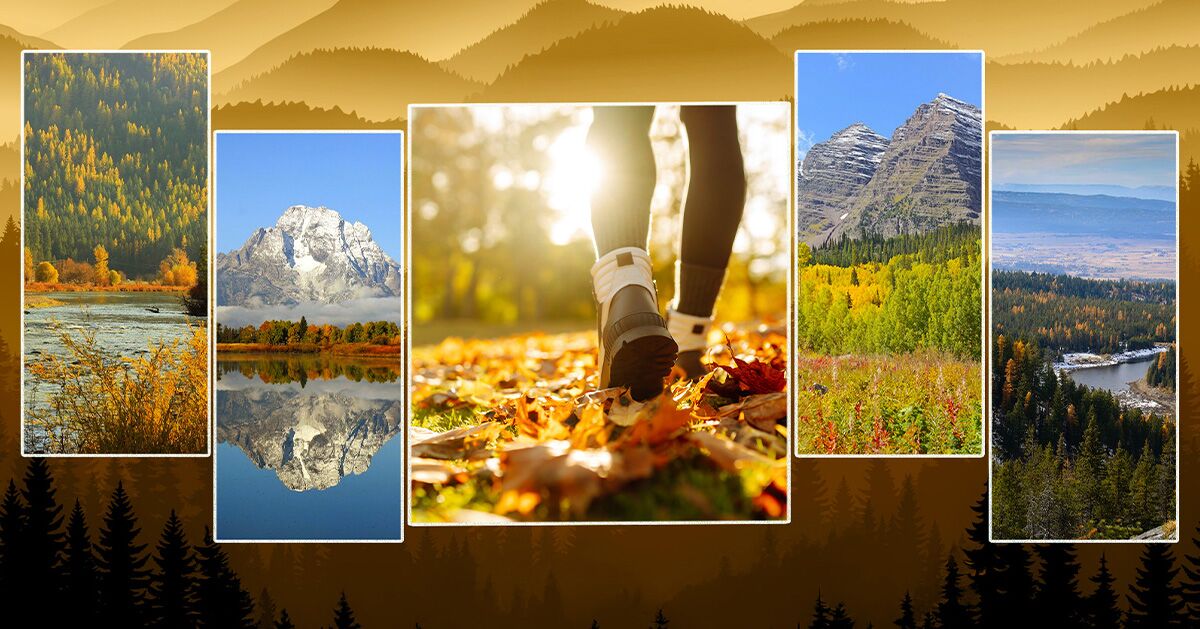
Rocky Mountain hikes for foliage
Full Article
Original Source
Read the full article at Matadornetwork →KhanList aggregates and links to publicly available news content. We do not host full articles from third-party sources. Always verify important information with original sources.