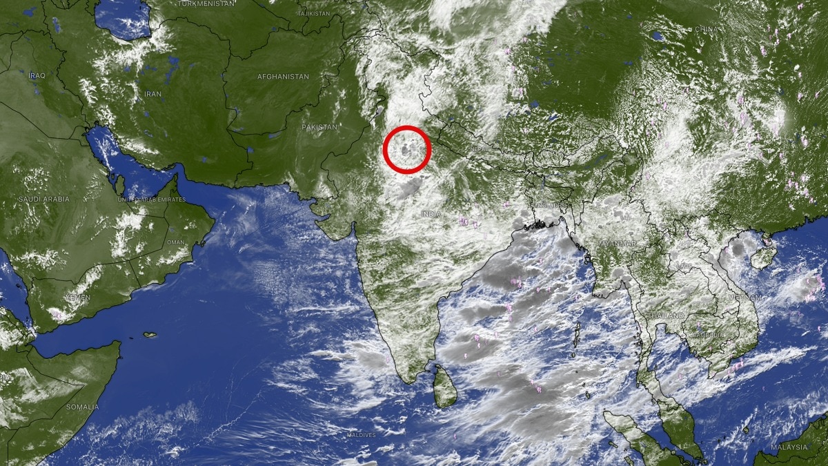
Delhi-NCR stayed under a red alert on Friday as heavy monsoon rain spread from Noida and Faridabad across the region. Forecasters said a monsoon trough, twin cyclonic circulations and a Western Disturbance are driving the spell.The current spell is being fuelled by a rare combination of multiple weather systems working together over north India. (Photo: Windy)Delhi and the National Capital Region (NCR) remained under a red alert on Friday as intense monsoon showers lashed several parts of the region, prompting warnings of waterlogging, traffic disruptions, and localised flooding.Heavy rain began over Noida and Faridabad before spreading rapidly towards Delhi, Gurugram and Ghaziabad, with forecasters predicting more downpours through Friday.Weather experts said the current spell is being fuelled by a rare combination of multiple weather systems working together over north India.At the surface, the monsoon trough, the main rain-bearing axis of the southwest monsoon, currently stretches from Ganganagar through Gwalior, Sidhi, Jamshedpur and Digha before extending into the east-central Bay of Bengal. Its position across northern India is helping channel abundant moisture into the Delhi-NCR region. Adding to the rain is a persistent upper-air cyclonic circulation over southwest Uttar Pradesh, extending up to 5.8 km above mean sea level. This system is enhancing upward motion in the atmosphere, allowing rain-bearing clouds to grow rapidly over Delhi and adjoining areas. Meteorologists have also identified another upper-air cyclonic circulation over southeast Uttar Pradesh between 4.5 km and 5.8 km altitude.The interaction between these two circulations is strengthening convection, resulting in widespread thunderstorms and heavy rainfall across the region.Further intensifying the weather is an active Western Disturbance moving through the middle and upper troposphere north of latitude 29°N. Although Western Disturbances are more commonly associated with winter weather, their interaction with the active monsoon can significantly boost rainfall by injecting additional moisture and atmospheric instability.According to forecasters, heavy rain that developed over Faridabad and Noida is expected to expand across most parts of Delhi, Gurugram and Ghaziabad, with another surge of rain-bearing clouds likely during the afternoon and evening hours.With the ground already saturated from previous showers, authorities have urged residents to avoid unnecessary travel, remain alert for waterlogging in low-lying areas, and follow weather advisories as the intense monsoon spell is expected to continue through Friday.- EndsPublished By: Sibu Kumar TripathiPublished On: Aug 7, 2026 11:08 IST
Red alert: How multiple weather systems have combined to drench Delhi-NCR?
Full Article
Original Source
Read the full article at Indiatoday →KhanList aggregates and links to publicly available news content. We do not host full articles from third-party sources. Always verify important information with original sources.