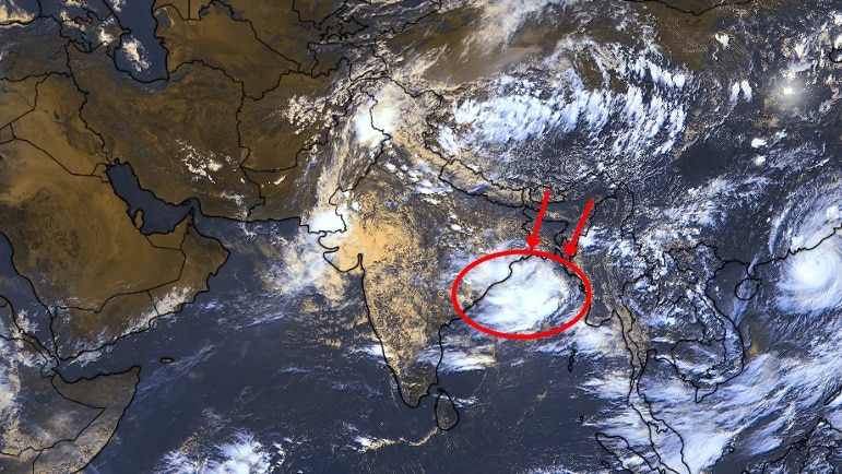
A low-pressure area has formed over the northwest Bay of Bengal near the West Bengal-Odisha coast, setting the stage for widespread rainfall across Odisha over the next few days, the India Meteorological Department (IMD) said on Saturday, July 25.According to the weather office, the system, which developed under the influence of a cyclonic circulation over southwest Bengal and adjoining Bangladesh, is expected to intensify further over the next two days.As it becomes more organised, it is likely to boost monsoon activity across eastern India, particularly over Odisha's coastal and interior districts.The IMD has forecast heavy to very heavy rainfall in several parts of the state till Monday, accompanied by strong winds and rough sea conditions. Vehicles ply on a road amid rain, in Cuttack, Odisha. (Photo: PTI) ORANGE ALERT FOR MULTIPLE DISTRICTSThe Meteorological Centre in Bhubaneswar has issued an orange alert for Cuttack, Keonjhar, Dhenkanal and Angul districts, warning of heavy to very heavy rainfall.A yellow alert has also been issued for 16 districts, including Puri, where heavy rain is expected between Saturday and Sunday morning. The Special Relief Commissioner's office has directed district collectors in the alerted regions to remain prepared for possible waterlogging, landslides, mudslides, lightning and strong winds as the weather system strengthens. A satellite image shows forecast weather in Odisha on July 26. (Photo: Windy) Low-pressure systems over the Bay of Bengal are a common feature during the southwest monsoon and often play a key role in delivering widespread rainfall over eastern and central India.Depending on their movement and intensity, they can also trigger spells of intense rain, especially in Odisha, West Bengal, Chhattisgarh and neighbouring states.FISHERMEN WARNED OF A SEA TURNING ROUGHThe IMD has also issued a marine warning, advising fishermen not to venture into the sea along and off the Odisha coast from July 25 to 27. Those already out at sea had been asked to return to the coast as early as possible. An auto-rickshaw makes its way on a road amid rain, in Cuttack, Odisha. (Photo: PTI) The weather office has forecast squally conditions with wind speeds of 40-50 kmph over the coastal waters during this period. Sea conditions are expected to remain very rough as the low-pressure area strengthens.The latest system comes as the southwest monsoon remains active over large parts of the country, with several states witnessing above-normal rainfall in recent days.The IMD said the evolving low-pressure area will continue to influence weather across Odisha through Monday, keeping the risk of heavy rainfall, gusty winds and rough seas high.- EndsPublished By: India Today Web Desk Published On: Jul 25, 2026 14:30 IST
Rain in Odisha till Monday, IMD issues alerts: Is Bay of Bengal to blame?
Full Article
Original Source
Read the full article at Indiatoday →KhanList aggregates and links to publicly available news content. We do not host full articles from third-party sources. Always verify important information with original sources.