
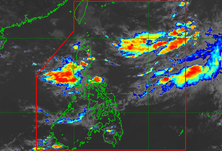
PHILIPPINE WEATHER. Satellite image as of September 7, 2026, 4 pm. PAGASA Zambales could be the most affected province in the next 24 hours, says PAGASA on Monday afternoon, September 7 The southwest monsoon will continue to bring rain to Luzon and the Visayas. Two low pressure areas could form during the week of September 7 to 13. This is AI-generated. Read the article for full context. Report any errors. MANILA, Philippines – The southwest monsoon or habagat will continue to trigger rain in Luzon and the Visayas in the second week of September, raising the risk of more floods and landslides. The Philippine Atmospheric, Geophysical, and Astronomical Services Administration (PAGASA) said on Monday afternoon, September 7, that Zambales could experience heavy to intense rain in the next 24 hours. A handful of provinces may have moderate to heavy rain within 48 hours, but beyond that period, nearly 30 areas — including Metro Manila — could already be affected by significant rainfall. Here is PAGASA’s 72-hour rainfall outlook as of 5 pm on Monday: Monday afternoon, September 7, to Tuesday afternoon, September 8 Heavy to intense rain (100-200 millimeters): Zambales Moderate to heavy rain (50-100 mm): Pangasinan, Tarlac, Pampanga, Bataan, Cavite, Batangas, Occidental Mindoro, Antique Tuesday afternoon, September 8, to Wednesday afternoon, September 9 Moderate to heavy rain (50-100 mm): Isabela, Aurora, Zambales, Bataan, Cavite, Batangas, Occidental Mindoro Wednesday afternoon, September 9, to Thursday afternoon, September 10 Heavy to intense rain (100-200 mm): Occidental Mindoro Moderate to heavy rain (50-100 mm): Pangasinan, La Union, Benguet, Nueva Vizcaya, Quirino, Aurora, Zambales, Bataan, Tarlac, Pampanga, Nueva Ecija, Bulacan, Metro Manila, Rizal, Cavite, Batangas, Laguna, Quezon, Oriental Mindoro, Marinduque, Romblon, Palawan, Camarines Norte, Camarines Sur, Albay, Catanduanes, Aklan, Antique On Monday evening, other areas in Luzon and Western Visayas not mentioned above are expected to see scattered rain and thunderstorms, while the rest of the Visayas may have isolated rain showers or thunderstorms, still due to the southwest monsoon. All affected areas should stay on alert for floods and landslides. For now, there are no low pressure areas (LPAs) or potential tropical cyclones being monitored inside or outside the Philippine Area of Responsibility (PAR). But PAGASA said two LPAs might form during the week, with one of them possibly east of the Philippines and the other located west of the country. The latter could have a high chance of developing into a tropical cyclone. The weather bureau expects two or three tropical cyclones to develop within or enter PAR in September. The next three local tropical cyclone names are Queenie, Rosal, and Samuel. – Rappler.com How does this make you feel? Loading
Rain from southwest monsoon to persist in second week of September
Full Article
Original Source
Read the full article at Rappler →KhanList aggregates and links to publicly available news content. We do not host full articles from third-party sources. Always verify important information with original sources.