
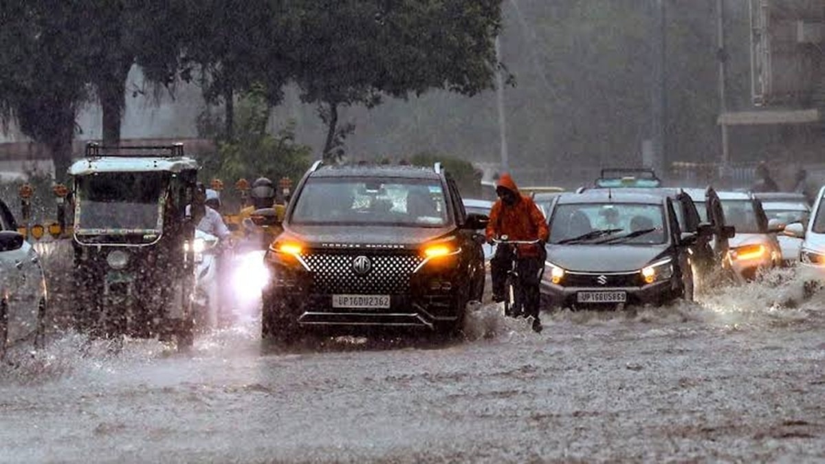
The IMD said a western disturbance, in the form of a cyclonic circulation over north Pakistan and adjoining areas, persists between 3.1 km and 4.5 km above mean sea level.Multiple interacting weather systems are contributing to the likelihood of rain. (Photo: PTI)New Delhi,Oct 29, 2026 15:39 ISTDelhi is bracing for another spell of unsettled weather, with thunderstorms, lightning, rain and possible hail expected across several parts of the national capital.The India Meteorological Department (IMD), in its district-level nowcast issued at 3:08 pm on Thursday, has flagged the possibility of moderate thunderstorms accompanied by lightning and hail in parts of Delhi, while other areas may experience thunderstorms with moderate rain.The nowcast is valid until 6:08 pm on October 29. According to the bulletin, moderate thunderstorms with lightning and hail are very likely over parts of Central Delhi, New Delhi, South West Delhi, West Delhi and North Delhi.Thunderstorms accompanied by lightning and moderate rain are likely over parts of South East Delhi, East Delhi, Shahdara, Central Delhi, North East Delhi, South Delhi, North West Delhi and West Delhi. Light rain or light thunderstorms accompanied by lightning and winds of 30-40 kmph are also likely over parts of South East Delhi, East Delhi and South Delhi.The warning comes as a combination of western disturbances and cyclonic circulations continues to influence weather conditions across north India.WESTERN DISTURBANCE DRIVES CHANGING WEATHER The IMD said a western disturbance, in the form of a cyclonic circulation over north Pakistan and adjoining areas, persists between 3.1 km and 4.5 km above mean sea level.An associated trough in the middle and upper tropospheric westerlies is also extending.An induced upper-air cyclonic circulation lies over south Punjab and adjoining areas at around 1.5 km above mean sea level. Another western disturbance over Jammu and adjoining areas has merged with the larger system.Meanwhile, a cyclonic circulation over Haryana and adjoining Uttar Pradesh has shifted to north Haryana and neighbouring areas, at around 0.9 km above mean sea level.These interacting weather systems are contributing to the likelihood of rain, thunderstorms and lightning across the national capital and surrounding regions.TEMPERATURES LIKELY TO DIPThe weather department has forecast a fall of 2-4 degrees Celsius in maximum temperatures over the next two days, followed by a rise of 2-3 degrees Celsius thereafter.Cloud cover and rainfall are expected to keep daytime temperatures relatively subdued.Residents should remain cautious during thunderstorms, avoid taking shelter under trees, stay away from exposed areas during lightning and secure loose objects that could be displaced by gusty winds.While the district-level bulletin flags red- and orange-category conditions in parts of Delhi, the broader regional forecast reported on Thursday has included a yellow alert for Delhi-NCR.- Ends
Rain coming: IMD issues red alert, heavy shower to hit Delhi-NCR today
Full Article
Original Source
Read the full article at Indiatoday →KhanList aggregates and links to publicly available news content. We do not host full articles from third-party sources. Always verify important information with original sources.