
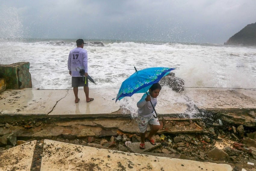
Hurricane Polo is poised to make landfall this afternoon in Baja California Sur after moving across the Pacific as a major cyclone. Although it is expected to lose some strength before reaching the peninsula, authorities warn that it will remain a powerful hurricane, bringing the risk of destructive winds, torrential rains, flooding and dangerous surf. At 9:45 a.m., Polo remained a Category 3 storm with maximum sustained winds of approximately 185 kilometers per hour and gusts of up to 220 kilometers per hour, the National Water Commission (Conagua) reported. The eye of the storm was located 140 km southwest of Santa Rosalía, moving northeastward. Hurricane Polo is only a few hours away from possibly becoming the FIRST known Major Hurricane to make landfall on the western coast of Mexico’s Baja California peninsula. Usually, the ocean temps this far north are too lukewarm to sustain CAT 3+ intensity (which is why the… pic.twitter.com/KRGGogI4PA — Backpirch Weather (@BackpirchCrew) September 28, 2026 Forecasters expect it to make landfall in central Baja California Sur, and subsequently make a second landfall in Sonora before moving across the northwestern mainland, potentially affecting parts of Sinaloa and Chihuahua. The state government suspended in-person school and work activities this Monday and Tuesday. Beyond strong wind gusts, intense rainfall is expected in Baja California Sur. According to the U.S. National Hurricane Center, the state could see rainfall totals of between 100 and 200 millimeters, with isolated areas potentially receiving up to 250 millimeters. Authorities have called on residents of affected areas to take extreme precautions, as this rainfall could trigger flash floods, surging streams, and landslides, particularly in rugged terrain, on rural roads, and in areas near watercourses. Hurricane #Polo Advisory 32A (11 AM MST, Mon Sep 28): NOAA Hurricane Hunters Investigating Polo. Conditions Deteriorating Over Portions of Baja California as Life-Threatening Winds and Flash Floods Expected to Occur Soon. https://t.co/NyUGSIFCuo — NHC Pacific (@NHC_Pacific) September 28, 2026 Surf associated with Polo could also trigger rough seas, rip currents and potential coastal flooding. Authorities advise avoiding beaches, piers and jetties, as well as refraining from boating activities even if it does not appear to be raining or the system’s center is still far away. The ports of Cabo San Lucas, San José del Cabo, San Carlos, Bahía Magdalena and Loreto have been closed to small craft, in addition to other maritime restrictions. When and where is Polo expected to make landfall? Head of the National Civil Protection Coordination Laura Velázquez said in a live broadcast during President Claudia Sheinbaum’s morning press conference that Polo is expected to make landfall in the municipality of Comondú between 4 p.m. and 6 p.m. local time today. The cyclone will make a second landfall as a Category 1 hurricane on the central coast of Sonora late on Monday or early on Tuesday. Velásquez called on residents to remain calm and to anticipate power and internet outages for a period that could extend through midnight. Rachel intensifies into tropical storm off southeastern coast Meanwhile, south of the country, Tropical Storm Rachel, which was moving 13 km/hr approximately 370 km south-southwest of Acapulco, Guerrero, at 8:27 this morning, is bringing winds of up to 95 kilometers per hour and heavy rains to Guerrero, Oaxaca and Michoacán. Federal authorities activated prevention and surveillance zones for tropical storm winds from Punta San Telmo, Michoacán, to Cabo Corrientes, Jalisco. Rachel is currently traveling west-northwest and is not expected to make landfall. With reports from La Jornada, CBS News, El Financiero and NMás
Polo will make landfall in Baja California Sur today. What you need to know
Full Article
Original Source
Read the full article at Mexiconewsdaily →KhanList aggregates and links to publicly available news content. We do not host full articles from third-party sources. Always verify important information with original sources.