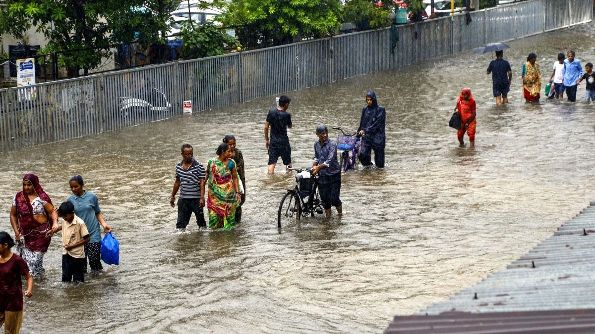
There is a kind of day the monsoon keeps in reserve for when it wants to remind the country who is really in charge. Monday, July 27, will be that day, though not everywhere at once.Off the coast of West Bengal, a knot of cloud that gathered strength through the weekend is no longer a loose, disorganised smear on the satellite picture. It has tightened into a depression, sitting near latitude 20.6 degrees north and longitude 88.4 degrees east, roughly 130 kilometres southeast of Sagar Island.The India Meteorological Department (IMD) expects it to deepen further, into what forecasters call a deep depression, and to cross the coast between Paradip and Sagar Island around the forenoon or noon of Monday.In the 24 hours before that, Jagatsinghpur in Odisha had already taken 33 centimetres of rain, a wall of water in a single day. That is the scale of what will move inland on Monday, even as large parts of the country stay largely untouched. WHY WILL SOME STATES DROWN WHILE OTHERS STAY DRY MONDAY?Three systems will be working in tandem, and where they sit decides who gets the rain and who does not.The monsoon trough, the long belt of low pressure that normally runs from the Thar Desert to the Bay of Bengal, will stay south of its usual position on Monday, precisely the alignment that hands rain to central and eastern India rather than the far north. IMD's 24-hour flash flood guidance flags moderate risk across more than a dozen Odisha and Chhattisgarh districts, and in some places of Assam, as the depression moves inland on Monday. (Photo: PTI) Alongside it will sit an east-west shear zone, a line near 23 degrees north where winds at different heights blow in different directions, forcing air upward and turning that lift into thunderstorms. It will run across the country's waist, linking the Bay of Bengal depression in the east to a second, quieter low over west Rajasthan in the west.That second low will stay shallower and less dramatic, but it will keep leaning towards the Arabian Sea, drawing in the moisture that keeps Gujarat's skies loaded. Everywhere that trough and shear zone do not reach, the country stays comparatively rain-starved on Monday.WHERE WILL THE HEAVIEST RAIN FALL ON MONDAY?Odisha will remain the epicentre. The IMD expects heavy to very heavy rainfall with isolated extremely heavy falls through Monday, alongside a real risk of flash floods and waterlogging in low-lying districts.A separate flash-flood outlook lists Anugul, Balangir, Cuttack, Jagatsinghpur, Khordha, Puri and more than a dozen other Odisha districts, plus Baloda Bazar, Dhamtari, Korba, Mahasamund and Raipur in neighbouring Chhattisgarh, as areas of moderate risk through Monday. Gujarat will receive extremely heavy rain Monday. (Photo: PTI) Gangetic West Bengal will see heavy to very heavy rain, and Chhattisgarh will join the extremely heavy category as the system pushes further inland.Out west, Gujarat, Saurashtra and Kutch, Konkan, Goa and Madhya Maharashtra will all stay under fairly widespread to widespread rain, with isolated very heavy spells, the Arabian Sea moisture feed doing its quiet, unglamorous work of keeping the west coast soaked.WHICH PARTS OF INDIA WILL STAY DRY ON MONDAY?Delhi-NCR will stay comparatively gentle by comparison, generally cloudy with a spell of very light to light rain in the morning and another overnight, winds touching 20 to 30 kilometres an hour, and temperatures hovering in the mid-thirties by day, nowhere close to the deluge further east.Punjab, Haryana and West Rajasthan will see only isolated to scattered showers on Monday, a mild footnote next to what Odisha and Chhattisgarh are bracing for. Delhi-NCR will stay comparatively dry on Monday, with only light rain expected, a sharp contrast to the deluge further east. (Photo: PTI) Himachal Pradesh, Uttarakhand and Jammu and Kashmir will remain under fairly widespread to widespread rain, with the terrain itself doing part of the damage, moist air forced upslope tends to wring out far more rain over hills than it ever does over flat ground, raising landslide and flash-flood risk through the week.In the south, Kerala and coastal Karnataka will stay fairly widespread and wet, while coastal Andhra Pradesh and Yanam will face something sharper: a thundersquall, winds suddenly gusting to 70 kilometres an hour, on Monday. Interior Karnataka and Tamil Nadu, further from the coast, will see only scattered activity.WHAT SHOULD PEOPLE ON THE COAST DO ON MONDAY?The IMD's warning for the north Bay of Bengal is blunt. Squally winds will strengthen to 55 to 65 kilometres an hour, gusting to 75, from Monday morning through Tuesday.The sea itself will turn rough to very rough along the Odisha, West Bengal and north Andhra Pradesh coasts through Monday, and fishermen have been told, plainly, not to venture into the northwest Bay until July 29.- EndsPublished By: Radifah KabirPublished On: Jul 26, 2026 19:31 IST
Odisha, Chhattisgarh and Gujarat to be drenched, Delhi to stay dry Monday
Full Article
Original Source
Read the full article at Indiatoday →KhanList aggregates and links to publicly available news content. We do not host full articles from third-party sources. Always verify important information with original sources.