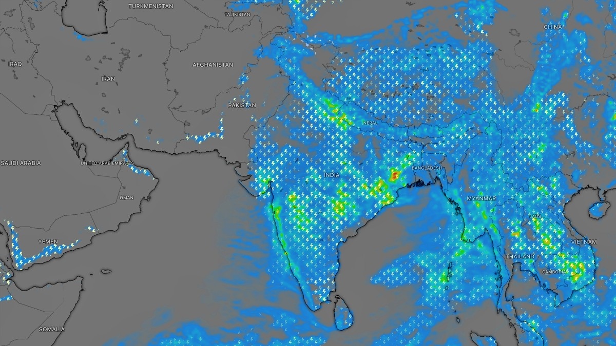
A monsoon depression is forming over the Bay of Bengal and is set to spread heavy rain across much of India this week. Forecasters say the wet spell could cut rainfall deficits but raise localised flooding and landslide risks.The depression is forecast to travel west-northwest after making landfall. (Photo: Windy)India's southwest monsoon is set to enter its most active phase of the season this week, with weather satellites capturing the first signs of a long-awaited monsoon depression brewing over the Bay of Bengal.Meteorologists say the system, coupled with a favourable shift in the monsoon axis across north India, is expected to trigger widespread heavy rainfall across large parts of the country over the next several days.Latest thermal infrared imagery from the INSAT-3DS satellite shows dense cloud bands consolidating over the northwestern Bay of Bengal, marking the early stages of the season's first monsoon depression.Wind pattern analysis also indicates a well-defined cyclonic circulation that is expected to move inland, drawing vast amounts of moisture deep into the Indian mainland. The depression is forecast to travel west-northwest after making landfall, bringing widespread rain to eastern, central and northern India between July 27 and July 31. Weather experts say the system will coincide with the passage of the western arm of the monsoon trough across the plains of north India, a combination often associated with some of the season's heaviest rainfall episodes.The immediate impact is expected across Delhi, Haryana, Chandigarh, Uttar Pradesh, Uttarakhand and Himachal Pradesh, where fairly widespread heavy rain is likely on July 28 and 29.While the most intense spell is expected during these two days, scattered showers are forecast to continue across the region for the remainder of the week.Central and eastern India are also in line for a soaking. Odisha, Jharkhand, West Bengal, Chhattisgarh, Madhya Pradesh and Maharashtra are expected to witness widespread monsoon rainfall from July 27 to July 31, with several areas likely to record heavy to very heavy precipitation.The rainfall is expected to provide a boost to agriculture in regions that have experienced intermittent dry spells over recent weeks.The latest India Meteorological Department rainfall map still shows pockets of rainfall deficiency across parts of north, east and peninsular India. However, meteorologists believe the upcoming wet spell could substantially reduce these deficits by the end of the month.Meanwhile, Gujarat, which has already witnessed multiple rounds of torrential rain this monsoon, is expected to see rainfall intensify once again by next weekend as the depression weakens inland and moisture-rich southwesterly winds strengthen over western India.The formation of a monsoon depression is considered one of the key drivers of India's seasonal rainfall. These systems transport enormous quantities of moisture from the Bay of Bengal into the heart of the country, often producing prolonged periods of heavy rain and helping revive monsoon activity after brief pauses.With the season's first depression finally taking shape and atmospheric conditions aligning across the subcontinent, forecasters believe the coming week could deliver the most widespread and intense monsoon spell of 2026, bringing relief to rain-deficient regions while also raising the risk of localised flooding, waterlogging and landslides in vulnerable areas.- EndsPublished By: Sibu Kumar TripathiPublished On: Jul 27, 2026 14:57 IST
Monsoon to unleash most intense spell, satellite captures first signs
Full Article
Original Source
Read the full article at Indiatoday →KhanList aggregates and links to publicly available news content. We do not host full articles from third-party sources. Always verify important information with original sources.