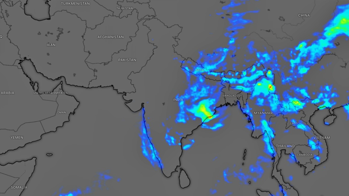
India's monsoon has entered a prolonged break phase, pushing the seasonal rainfall deficit to 24% below normal. Forecast rain later this month may aid sowing and water supplies, but flood risks remain in the hills.The weakening monsoon is reflected in daily rainfall data. (Photo: Windy)India's southwest monsoon has slipped deeper into a prolonged dry spell, with the country's cumulative seasonal rainfall now standing 24% below normal between June 4 and July 16, according to the latest India Meteorological Department (IMD) data.The nationwide rainfall deficit has widened steadily over the past week as monsoon activity weakened across large parts of northern, central and peninsular India. Weather experts warn the deficit could deteriorate further, touching 30% below normal by July 20, before a significant revival is expected during the final ten days of the month.The latest rainfall maps show large swathes of Rajasthan, Gujarat, Uttar Pradesh, Bihar, Jharkhand, Telangana, Andhra Pradesh, Karnataka and Assam reporting deficient rainfall during the season so far. Only parts of central India, Maharashtra, Odisha, West Bengal and a few northeastern states remain close to or above their normal rainfall levels.The weakening monsoon is reflected in daily rainfall data as well. After an active spell in early July, rainfall across the country has fallen sharply, dropping well below the long-term average during the second week of the month as the monsoon entered a "break" phase. Meteorologists attribute the lull to the monsoon trough shifting close to the Himalayan foothills, reducing rainfall over much of central and northern India.The absence of strong low-pressure systems over the Bay of Bengal further weakened moisture transport into the mainland, leaving many regions under hot and humid conditions instead of widespread rain.However, weather models indicate the dry spell is nearing its end.A low-pressure area developing over the Bay of Bengal, together with the southward shift of the monsoon axis, is expected to trigger a broad revival of rainfall beginning this weekend.The first phase of the comeback is forecast to affect Uttar Pradesh and Uttarakhand from Saturday, bringing widespread moderate to heavy rainfall. By Sunday and Monday, the rain belt is expected to expand westwards into Punjab, Chandigarh, Haryana, Delhi-NCR and eastern Rajasthan, with several areas likely to experience heavy to very heavy rainfall.The revival could prove crucial for agriculture, as recent monsoon weakness has slowed kharif sowing, reduced soil moisture and widened rainfall deficits across several farming states.A sustained wet spell would also help improve reservoir inflows, replenish groundwater and ease concerns over water availability.While the expected rains are welcome, meteorologists have also cautioned that the intense rainfall could increase the risk of flash floods, landslides and isolated cloudburst events, particularly across Uttarakhand and Himachal Pradesh, where rainfall accumulations are forecast to be exceptionally high.If current forecasts hold, the final ten days of July could dramatically alter the monsoon's trajectory, reversing much of the current rainfall deficit and restoring a more typical seasonal pattern across north, east and central India.- EndsPublished By: Sibu Kumar TripathiPublished On: Jul 17, 2026 07:00 IST
Monsoon to return, but damage is done: Rain deficit at 24%, recovery unlikely
Full Article
Original Source
Read the full article at Indiatoday →KhanList aggregates and links to publicly available news content. We do not host full articles from third-party sources. Always verify important information with original sources.