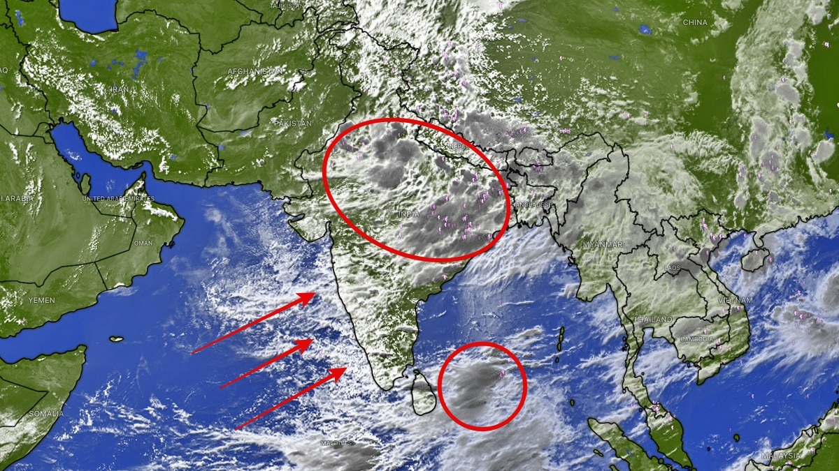
Satellite images show the monsoon sustaining itself with locally formed rain systems across India. The phase may bring short-term relief to rain-deficit northern states before a possible break next week.Satellite images captured on the evening of August 4 reveal widespread cloud cover. (Photo: Windy)India's southwest monsoon is currently running on its own momentum, with satellite imagery showing a vast swathe of the country under active rain-bearing systems that have developed entirely within the subcontinent, without any significant support from external weather disturbances.Meteorologists say the monsoon is now being sustained by a series of "made in India" weather systems, a phase where local atmospheric conditions are driving rainfall instead of relying on moisture-laden depressions from the Bay of Bengal or other external influences.Satellite images captured on the evening of August 4 reveal widespread cloud cover stretching across eastern and northern India as the monsoon trough deepens from West Bengal to Punjab. The trough, a low-pressure belt that forms the backbone of the Indian monsoon, is expected to strengthen further over the next 36 hours.Forecasters expect a low-pressure system (LPS) to develop south of Haryana, which could intensify rainfall activity across large parts of north and east India. The strengthening trough and the emerging low-pressure area are likely to keep the monsoon active over the coming two to four days. Regions expected to receive widespread rainfall include Delhi-NCR, Haryana, Uttar Pradesh, Punjab, Chandigarh, Bihar, Jharkhand, Chhattisgarh, West Bengal, Odisha, northeast Rajasthan, and several states in the Northeast.The forecast comes as a relief for Delhi-NCR and Haryana, where rainfall has remained patchy despite the active monsoon season.Weather experts believe these areas could witness one or two widespread spells over the next few days, helping ease the rainfall deficit.However, meteorologists caution that the improvement may be short-lived. Current weather models indicate the possibility of a long break in monsoon activity beginning early next week, raising concerns for northern India, where seasonal rainfall remains significantly below normal.Even with the expected showers over the next few days, experts warn that the rainfall may not be sufficient to erase the accumulated deficit across several northern states.If the projected monsoon break materialises, it could once again slow the recovery of reservoirs, agriculture and groundwater recharge during the crucial second half of the rainy season.For now, satellite observations suggest the monsoon has entered a self-sustaining phase, generating enough atmospheric energy over the Indian landmass to keep rain clouds active without depending on weather systems arriving from outside the region.- EndsPublished By: Sibu Kumar TripathiPublished On: Aug 5, 2026 07:00 IST
Monsoon sustaining without outside help as dark rain clouds shroud India
Full Article
Original Source
Read the full article at Indiatoday →KhanList aggregates and links to publicly available news content. We do not host full articles from third-party sources. Always verify important information with original sources.