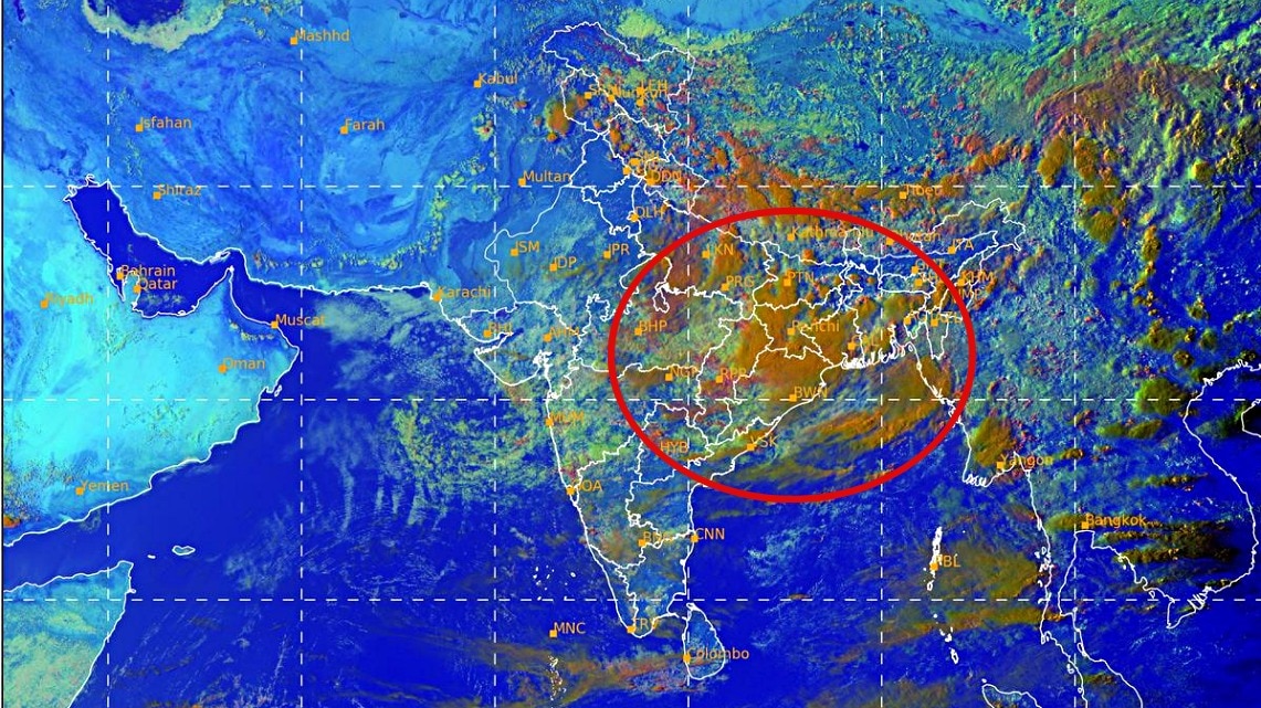
The southwest monsoon is set to revive between August 20 and 24, with a fresh spell of rain building over eastern and central India. The shift could improve seasonal rainfall in deficit states while raising the risk of flooding and thunderstorms in vulnerable areas.The revival is being driven by a low-pressure area moving inland from the Bay of Bengal. (Photo: IMD)After a brief lull in rainfall activity across parts of northern and western India, the southwest monsoon is preparing for a fresh surge, with meteorologists forecasting an active spell between August 20 and August 24.Satellite imagery from the India Meteorological Department (IMD) shows extensive clouding and convective activity over eastern and central India, signalling a renewed phase of widespread rainfall.The revival is being driven by a low-pressure area moving inland from the Bay of Bengal and the expected oscillation of the monsoon trough, a key feature that controls the distribution of rainfall across the country during the season. According to weather experts, the coming days could bring some of the most significant monsoon activity of the month for Uttar Pradesh, Bihar, Jharkhand, West Bengal, Odisha and Chhattisgarh, where repeated spells of moderate to heavy rainfall are expected.Over the next 48 hours, the heaviest rain is likely to be concentrated over eastern and central Uttar Pradesh and the foothills of Uttarakhand, raising the risk of localised flooding, waterlogging and rising river levels in vulnerable areas. The IMD satellite imagery on Monday afternoon showed dense cloud bands stretching across eastern India, with intense thunderstorm clusters developing over parts of Uttar Pradesh, Bihar, Jharkhand and adjoining regions. These cloud formations are expected to intensify further as moisture-laden winds from the Bay of Bengal feed the weather system.The changing weather pattern also marks the end of a relatively drier phase experienced in parts of Punjab, Haryana and Delhi-NCR, where northwesterly dry winds had temporarily reduced humidity levels.As the monsoon trough shifts southward and then oscillates northward later this week, rainfall activity is expected to spread gradually into north India.Meteorologists say the period between August 20 and 24 could prove crucial for seasonal rainfall totals, particularly in states that continue to report deficits. The fresh spell may help improve rainfall distribution across the Indo-Gangetic plains and parts of central India.Residents in eastern and northern states have been advised to monitor local forecasts and weather warnings as the active monsoon phase returns, bringing the possibility of heavy downpours, thunderstorms and gusty winds through the weekend.- EndsPublished By: Sibu Kumar TripathiPublished On: Aug 18, 2026 07:30 IST
Monsoon set for another revival: Rain to cover East India from this date
Full Article
Original Source
Read the full article at Indiatoday →KhanList aggregates and links to publicly available news content. We do not host full articles from third-party sources. Always verify important information with original sources.