
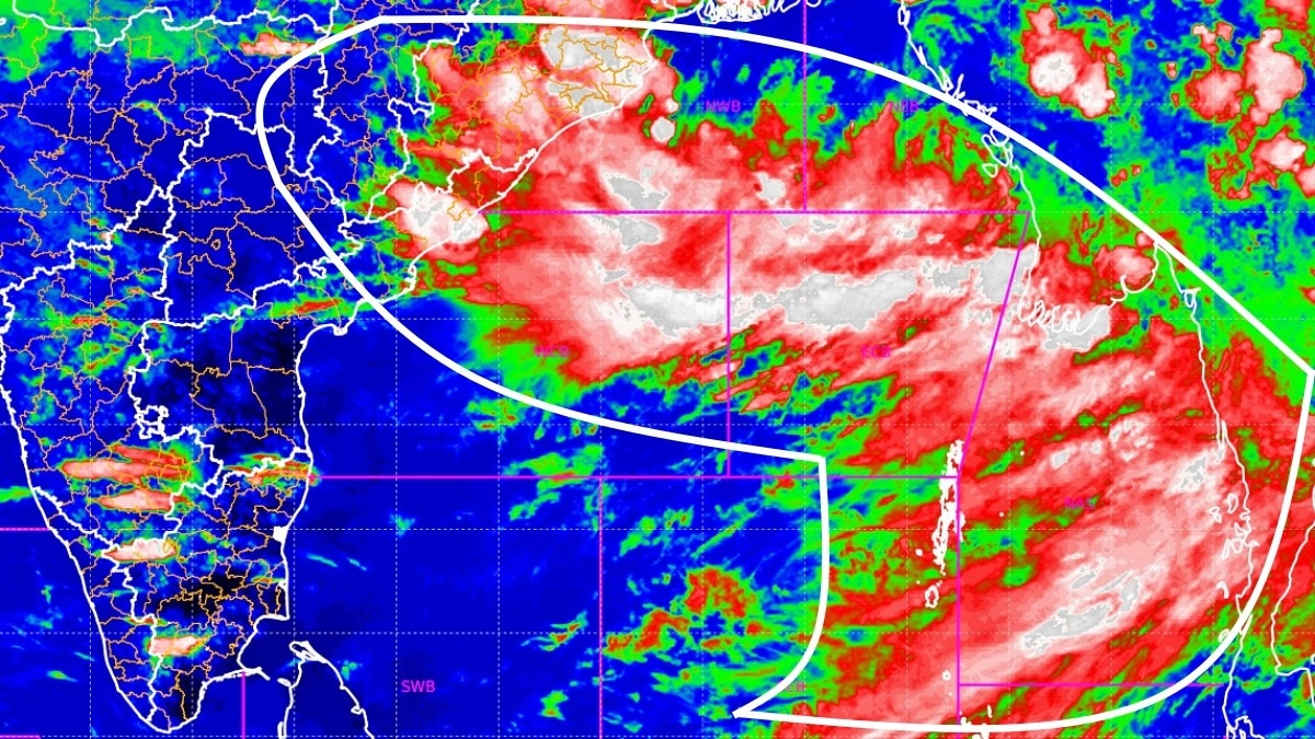
A fresh low-pressure area is likely to form over the northwest Bay of Bengal around August 12. Its development could sustain widespread monsoon activity despite the emerging El Niño threat.The developing system could become another important engine for the monsoon. (Photo: IMD)India’s monsoon is showing little sign of slowing down, with a new low-pressure system expected to develop over the northwest Bay of Bengal around August 12, potentially triggering another spell of heavy rainfall across eastern and northern parts of the country.According to the latest weather update, an upper-air cyclonic circulation is currently positioned over the northwest Bay of Bengal and adjoining areas, extending into the middle levels of the atmosphere. Under its influence, a low-pressure area is likely to form around August 12.The developing system could become another important engine for the monsoon, particularly over Odisha, where the India Meteorological Department (IMD) has forecast heavy to very heavy rainfall between August 12 and 14. The system could also help maintain widespread monsoon activity over parts of central and eastern India as it develops and moves inland.Another important feature supporting the ongoing rainfall is the monsoon trough, which remains active and is positioned south of its normal location in the lower levels of the atmosphere. This southward positioning is significant because the monsoon trough acts as a major corridor for rain-bearing systems across India. Its location can determine which regions receive sustained rainfall and where the monsoon remains relatively subdued.The Western Himalayan region is also expected to remain active, with isolated heavy to very heavy rainfall likely during the week. This raises the possibility of intense rainfall episodes over parts of Himachal Pradesh, Uttarakhand and Jammu & Kashmir and adjoining mountainous areas.Meanwhile, a shear zone is running across central and adjoining north Peninsular India. The feature extends through the lower and middle levels of the atmosphere and tilts southward with height, adding another layer of atmospheric instability and moisture convergence.The combination of the active monsoon trough, the shear zone and the developing Bay of Bengal system suggests that India’s monsoon remains firmly active despite concerns over the emerging El Nio threat.For now, the Bay of Bengal remains the key area to watch. If the expected low-pressure area develops as forecast, it could provide the monsoon with another fresh pulse of rainfall just when signs of weakening activity were beginning to emerge.The next few days will determine how effectively this new system translates into rainfall across India.- EndsPublished By: Sibu Kumar TripathiPublished On: Aug 11, 2026 07:30 IST
Monsoon refuses to slow down: Amid El Nino threats, new system to power rain
Full Article
Original Source
Read the full article at Indiatoday →KhanList aggregates and links to publicly available news content. We do not host full articles from third-party sources. Always verify important information with original sources.