
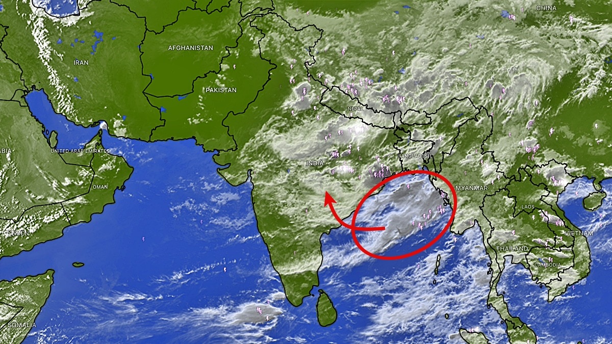
Satellite imagery has shown a fresh build-up of rain-bearing clouds over the Bay of Bengal and eastern India. The system could strengthen into a depression and trigger another active monsoon spell.The developing system is expected to pump moisture deep into the Indian mainland. (Photo: Windy)Just when parts of northwest India appeared set for a brief monsoon break, fresh satellite imagery has revealed a renewed build-up of rain-bearing clouds over eastern India and the Bay of Bengal, signalling that the monsoon still has plenty of fuel left in the tank.Latest INSAT-3DS thermal infrared images show widespread convective cloud activity stretching from the Bay of Bengal into eastern and central India.The cloud mass is associated with a Well Marked Low Pressure Area currently located over the northwest Bay of Bengal and adjoining West Bengal-North Odisha coasts. According to the India Meteorological Department (IMD), the system was observed over the region at 2:30 pm IST on August 16 and is expected to strengthen further as it moves northwestwards."The low-pressure area is very likely to concentrate into a Depression on August 17," the IMD said, indicating a fresh pulse of monsoon activity over large parts of the country. The developing system is expected to pump moisture deep into the Indian mainland, triggering widespread rainfall across eastern, central and parts of northern India through the coming week.Weather models suggest that the monsoon trough could once again shift southward as the system moves inland, reviving rain activity over several regions that had recently turned drier.The immediate impact, however, will be felt along the eastern coastline. The IMD has warned of squally weather with wind speeds of 40-50 kmph, gusting up to 60 kmph, over the northwest and adjoining west-central Bay of Bengal between August 16 and 18.Sea conditions are forecast to remain rough to very rough, prompting authorities to issue advisories for fishermen."Fishermen are advised not to venture into the northwest and adjoining west-central Bay of Bengal and along and off the coasts of West Bengal, Bangladesh, Odisha and north Andhra Pradesh from August 16 to 18," the weather agency said.With a fresh depression likely to emerge from the Bay and satellite imagery showing a rapidly evolving cloud shield, the message from the skies is clear: the 2026 southwest monsoon is far from over, and another active spell of rain is already taking shape.- EndsPublished By: Sibu Kumar TripathiPublished On: Aug 17, 2026 07:30 IST
Monsoon not over yet: Satellite spots Bay of Bengal alive with rain
Full Article
Original Source
Read the full article at Indiatoday →KhanList aggregates and links to publicly available news content. We do not host full articles from third-party sources. Always verify important information with original sources.