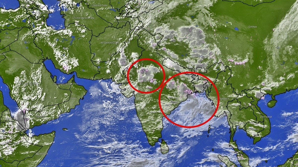
Successive Bay of Bengal systems are likely to keep the monsoon active through the second half of August. Their strength and track could decide whether August avoids a sharp rainfall deficit.The next 15 days could particularly favour east, northeast and central India. (Photo: Windy)India's monsoon is set for a more active second half of August, with a succession of weather systems likely to develop over the Bay of Bengal and move inland, sustaining rainfall activity across large parts of eastern, central and northern India.A low-pressure system or depression is likely to continue developing over the Bay of Bengal through August 27-30, according to the latest weather outlook. These systems are expected to provide a steady supply of moisture and keep the monsoon active over east, central and north India for the remainder of the month.The next 15 days could particularly favour east, northeast and central India, with a significant increase in rainfall activity expected across several states. Uttar Pradesh, eastern Madhya Pradesh, Chhattisgarh, Odisha, Jharkhand, Bihar and West Bengal, along with the northeastern states, are likely to see more frequent and widespread rainfall as successive systems move inland from the Bay of Bengal.The expected sequence of low-pressure systems is important because August has so far delivered a mixed monsoon performance. While several regions have received substantial rainfall, others continue to face deficits. The new systems could therefore help prevent the month from slipping into a large rainfall deficit. However, the big question remains whether the increased activity will be enough to erase the existing rainfall shortfall.The backdrop is particularly challenging because of an unfavourable El Nino environment, which can disrupt the normal circulation patterns that support India's southwest monsoon.Even with repeated low-pressure systems, the amount of rainfall they produce will determine whether the accumulated deficit can be significantly reduced.For now, however, the forecast points towards a sustained monsoon spell rather than a prolonged dry phase.The Bay of Bengal is expected to remain the key rain engine for the rest of August, repeatedly generating systems that can travel inland and spread moisture across the northern and central plains.The focus over the coming two weeks will therefore shift towards Uttar Pradesh, eastern Madhya Pradesh, Chhattisgarh, Odisha, Jharkhand, Bihar, West Bengal and northeast India.If these systems strengthen and move along favourable tracks, they could deliver widespread rainfall and prevent August from ending on a severely deficient note.The monsoon may not completely recover its deficit, but the coming 15 days could ensure that August does not turn into a major rainfall crisis.- EndsPublished By: Sibu Kumar TripathiPublished On: Aug 13, 2026 07:30 IST
Monsoon getting fresh supplies: Multiple systems to keep pumping rain
Full Article
Original Source
Read the full article at Indiatoday →KhanList aggregates and links to publicly available news content. We do not host full articles from third-party sources. Always verify important information with original sources.