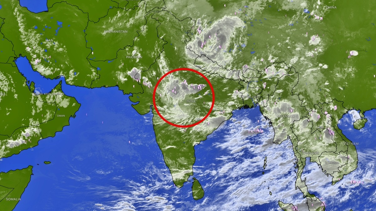
Satellite imagery shows monsoon cloud cover retreating across large parts of India and the Bay of Bengal. The shift has revived concerns that El Nino may be steering the season into another subdued phase.The latest satellite signals do not necessarily mean that the monsoon has collapsed. (Photo: Windy)India’s monsoon appears to be losing some of its recent strength, with satellite imagery showing a noticeable reduction in cloud cover across large parts of the country and even over the Bay of Bengal.The changing pattern has raised fresh concerns that El Nino could be beginning to influence the Indian monsoon after weeks of relatively active rainfall.At present, the low-pressure system (LPS) over central India remains the primary weather system generating clouds and rainfall. Its influence is largely concentrated over central parts of the country, while large areas elsewhere are beginning to see a decline in monsoon activity.One of the more significant signals is the reduction in cloud cover over the Bay of Bengal, a key moisture source for the Indian monsoon. A decrease in organised cloud activity over the Bay of Bengal can indicate weakening moisture transport towards the Indian landmass, potentially limiting the formation and movement of rain-bearing systems. The monsoon axis is also shifting southwards. This change is likely to push the most active rainfall zone away from the northern plains, bringing mainly dry weather back to Delhi-NCR, Haryana, Punjab and Uttar Pradesh.While isolated areas could still receive rain, the showers are expected to be short-lived. Moderate rainfall may occur at a few places, particularly during the afternoon and evening hours, but a widespread spell of rain is not currently expected across the region.The emerging pattern comes at a time when scientists and weather watchers are closely tracking the development of El Nino conditions in the Pacific Ocean. El Nino is typically associated with changes in atmospheric circulation that can weaken or disrupt the Indian summer monsoon, although its influence varies from one event to another.The latest satellite signals do not necessarily mean that the monsoon has collapsed. India continues to have active rainfall-producing systems, particularly over central India. However, the rapid reduction in cloud cover and weakening activity over the Bay of Bengal suggest that the monsoon may be entering another subdued phase.For northern India, the immediate takeaway is a return to hotter and largely dry conditions, punctuated by occasional localised showers.The key question now is whether the weakening cloud shield is temporary, or the first clear sign that El Nino is beginning to regain control over India’s monsoon.- EndsPublished By: Sibu Kumar TripathiPublished On: Aug 10, 2026 07:30 IST
Monsoon clouds begin to disappear as El Nino eyes a comeback over India
Full Article
Original Source
Read the full article at Indiatoday →KhanList aggregates and links to publicly available news content. We do not host full articles from third-party sources. Always verify important information with original sources.