
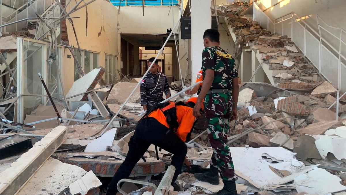
Rescuers inspect a heavily damaged building at L. Say port following an earthquake in Sikka, East Nusa Tenggara province, Indonesia, on August 15, 2026. | Photo Credit: Indonesian Search and Rescue Agency via Reuters A magnitude 6 earthquake struck Minahassa Peninsula, Indonesia, on Sunday (August 16, 2026), the German Research Centre for Geosciences said.The quake was at a depth of 77 km (47.85 miles), GFZ said.Sharing the details in a post on X, the National Center for Seismology said that the earthquake of magnitude 6.0 struck the Gulf of Tomini. As per the NCS, the earthquake occurred at a depth of 68 kilometres at 21:55 IST.It said, “EQ of M: 6.0, On: 15/08/2026 21:55:18 IST, Lat: 0.174 N, Long: 120.312 E, Depth: 68 Km, Location: Gulf of Tomini.”EQ of M: 6.0, On: 15/08/2026 21:55:18 IST, Lat: 0.174 N, Long: 120.312 E, Depth: 68 Km, Location: Gulf of Tomini. For more information Download the BhooKamp App https://t.co/5gCOtjdtw0@DrJitendraSingh@OfficeOfDrJS@tummalasrini@GSuresh_NCS@ndmaindiapic.twitter.com/tN9C6m59B9— National Center for Seismology (@NCS_Earthquake) August 15, 2026This comes as a magnitude 6.5 quake struck Indonesia on Saturday afternoon (August 15, 2026), hours after a devastating 7.7-magnitude quake in the morning killed more than 40 people, CBS News reported.Authorities issued a tsunami warning and urged coastal residents to move to higher ground but later lifted the warning when Indonesia’s meteorological agency said monitoring showed no significant sea-level changes that posed a threat to coastal communities. Some smaller tsunamis were reported.(With Reuters, AP and ANI inputs) Published - August 16, 2026 02:40 am IST
Magnitude 6.0 earthquake strikes Minahassa Peninsula; third to strike Indonesia
Full Article
Original Source
Read the full article at Thehindu →KhanList aggregates and links to publicly available news content. We do not host full articles from third-party sources. Always verify important information with original sources.