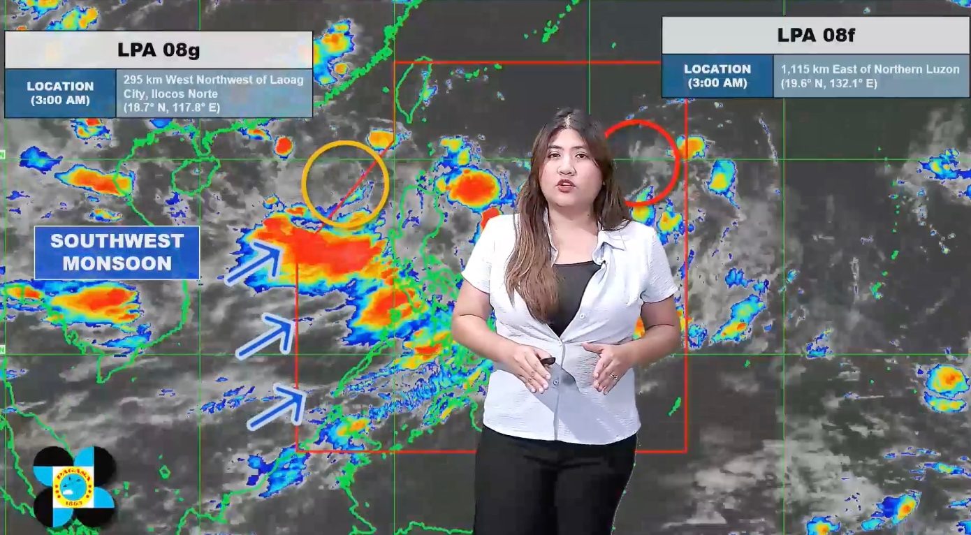
FORECAST. PAGASA Weather Specialist Veronica Torres explains the bureau's 5 am forecast for two low pressure areas and the southwest monsoon on August 18, 2026. PAGASA The southwest monsoon continues to affect Luzon and the Visayas on Tuesday, August 18, while PAGASA is now monitoring two low pressure areas, one of which could soon develop into a tropical depression The southwest monsoon is again expected to bring moderate to intense rain on Tuesday, August 18. Two low pressure areas are being monitored — one inside the Philippine Area of Responsibility, and the other outside PAR. This is AI-generated. Read the article for full context. Report any errors. MANILA, Philippines – The southwest monsoon or habagat will dump more rain in Luzon and the Visayas on Tuesday, August 18, with nearly half of Luzon told to brace for significant rainfall during the day. This would pose more problems for many areas, including Metro Manila, which had been inundated by flash floods on Monday, August 17. Here is the updated three-day rainfall outlook from the Philippine Atmospheric, Geophysical, and Astronomical Services Administration (PAGASA), issued at 5 am on Tuesday: Tuesday, August 18 Heavy to intense rain (100-200 millimeters): Benguet, La Union, Pangasinan, Zambales, Bataan, Cavite, Batangas, Occidental Mindoro Moderate to heavy rain (50-100 mm): Metro Manila, Ilocos Sur, Abra, Tarlac, Pampanga, Bulacan, Nueva Ecija, Laguna, Rizal, Oriental Mindoro, Antique Wednesday, August 19 Heavy to intense rain (100-200 mm): Benguet, La Union, Pangasinan, Zambales, Bataan, Occidental Mindoro Moderate to heavy rain (50-100 mm): Ilocos Sur, Tarlac, Pampanga, Bulacan, Nueva Ecija, Metro Manila, Cavite, Laguna, Batangas, Rizal, Oriental Mindoro Thursday, August 20 Moderate to heavy rain (50-100 mm): Ilocos Norte, Ilocos Sur, La Union, Benguet, Pangasinan, Zambales, Bataan, Tarlac, Pampanga, Occidental Mindoro For Tuesday, the southwest monsoon will also bring scattered rain and thunderstorms to the rest of Luzon, the rest of Western Visayas, and the Negros Island Region, as well as isolated rain showers or thunderstorms to Central Visayas and Eastern Visayas. Amid persistent rain, authorities are still closely monitoring the water levels of dams and rivers. In Metro Manila, the Marikina River’s water level had returned to normal by early Tuesday morning, at 14.8 meters as of 5:58 am. On Monday, it had reached 16.9 meters, equivalent to the second alarm, which means preemptive evacuation is advised for residents who may be affected if the river overflows. The water level of the La Mesa Dam in Quezon City was at 79.69 meters as of 5 am on Tuesday — still above its critical level of 79.50 meters but below its spilling level of 80.15 meters. Excess water from the dam would flow into the Tullahan River, and possible flooding could affect communities in Quezon City, Caloocan City, Malabon City, Navotas City, and Valenzuela City. Mindanao is not affected by the southwest monsoon and will continue to have hot and humid conditions, but there may be localized thunderstorms. Meanwhile, as of 2 am on Tuesday, the low pressure area (LPA) being monitored inside the Philippine Area of Responsibility (PAR) already has a high chance of developing into a tropical depression within 24 hours. The LPA was last spotted 1,115 kilometers east of Northern Luzon at 3 am. If it becomes a tropical depression, it would be given the local name Neneng. The potential Neneng is projected to head for Taiwan, which is inside PAR. Another LPA just formed outside PAR, too. It was located 295 kilometers west northwest of Laoag City, Ilocos Norte, as of 3 am on Tuesday. The second LPA has a medium chance of developing into a tropical depression in the next 24 hours, but PAGASA Weather Specialist Veronica Torres said it is not expected to enter PAR. The weather bureau previously said potential tropical cyclones may enhance the southwest monsoon during the week. PAGASA expects up to four tropical cyclones to develop within or enter PAR in August. There have already been two during the month — Tropical Depression Luis and Tropical Storm Maymay (Kujira). The southwest monsoon, Luis, and Maymay combined have left at least 23 people dead, 17 injured, and one missing, according to the National Disaster Risk Reduction and Management Council (NDRRMC). The bad weather in August has affected nearly 5 million people or 1.43 million families across 10 regions, based on NDRRMC data. So far, the estimated cost of damage to infrastructure is pegged at P3.4 billion, while the estimated cost of damage to agriculture is over P689 million. – Rappler.com How does this make you feel? Loading
Luzon still faces moderate to intense monsoon rain; LPA may become Neneng
Full Article
Original Source
Read the full article at Rappler →KhanList aggregates and links to publicly available news content. We do not host full articles from third-party sources. Always verify important information with original sources.