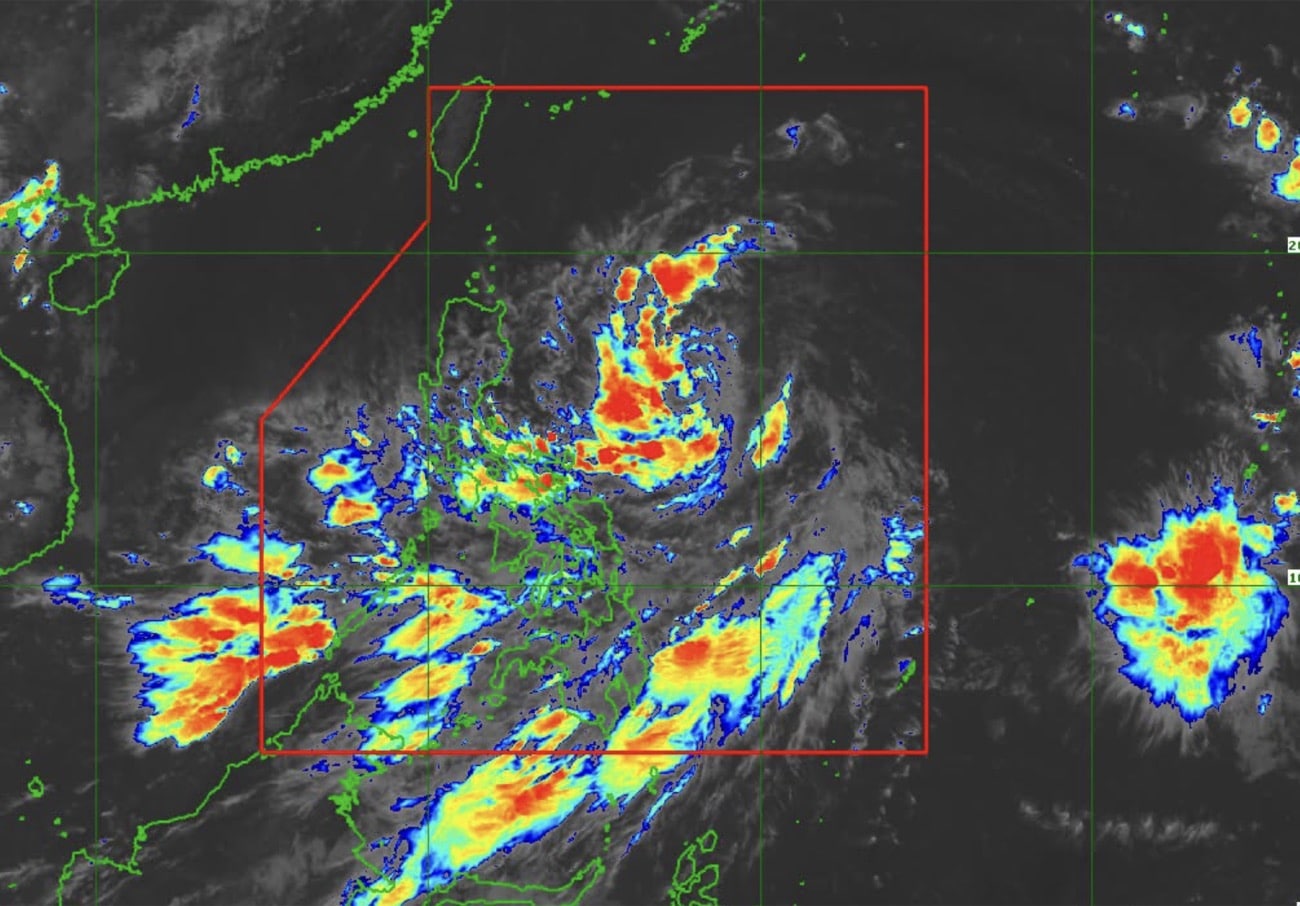
Image grabbed from Pagasa Facebook page showing Tropical Depression Kiyapo’s track July 23, Thursday. MANILA, Philippines — Over 6,900 barangays nationwide face high risk of flooding and rain-induced landslides over the next three days due to Tropical Depression Kiyapo, the Office of Civil Defense (OCD) warned Thursday. According to the Philippine Atmospheric, Geophysical and Astronomical Services Administration, Kiyapo, located 875 kilometers east of Northern Luzon as of 11 a.m, is forecast to further intensify into a tropical storm. Based on the Department of Environment and Natural Resources’ Mines and Geoscience Bureau list of hazard-prone areas, the National Capital Region held the largest number of barangays susceptible to rain-induced landslides and flooding, with 1,359 affected. Article continues after this advertisement READ: Pagasa: Wind Signal No. 1 raised over parts of N. Luzon due to Kiyapo Region 1 followed next with around 1,142 barangays at risk of similar hazards, succeeded by Region 7 with 861 barangays The other affected regions are as follows: Region 10 (857 barangays) Region 12 (622 barangays) Region 2 (579 barangays) Cordillera Administrative Region (524 barangays) Region 11 (269 barangays) Region 6 (223 barangays) BARMM (181 barangays) Region 4-B (145 barangays) Negors Island Region (88 barangays) Region 9 (70 barangays) Region 4-A (19 barangays) Region 13 (8 barangays) The OCD advised the public to remain alert and take necessary precautions, primarily those in the listed towns or in downstream areas. /mr Your subscription could not be saved. Please try again. Your subscription has been successful.
Kiyapo putting 6,947 barangays at risk of landslides, floods — OCD
Full Article
Original Source
Read the full article at Newsinfo →KhanList aggregates and links to publicly available news content. We do not host full articles from third-party sources. Always verify important information with original sources.