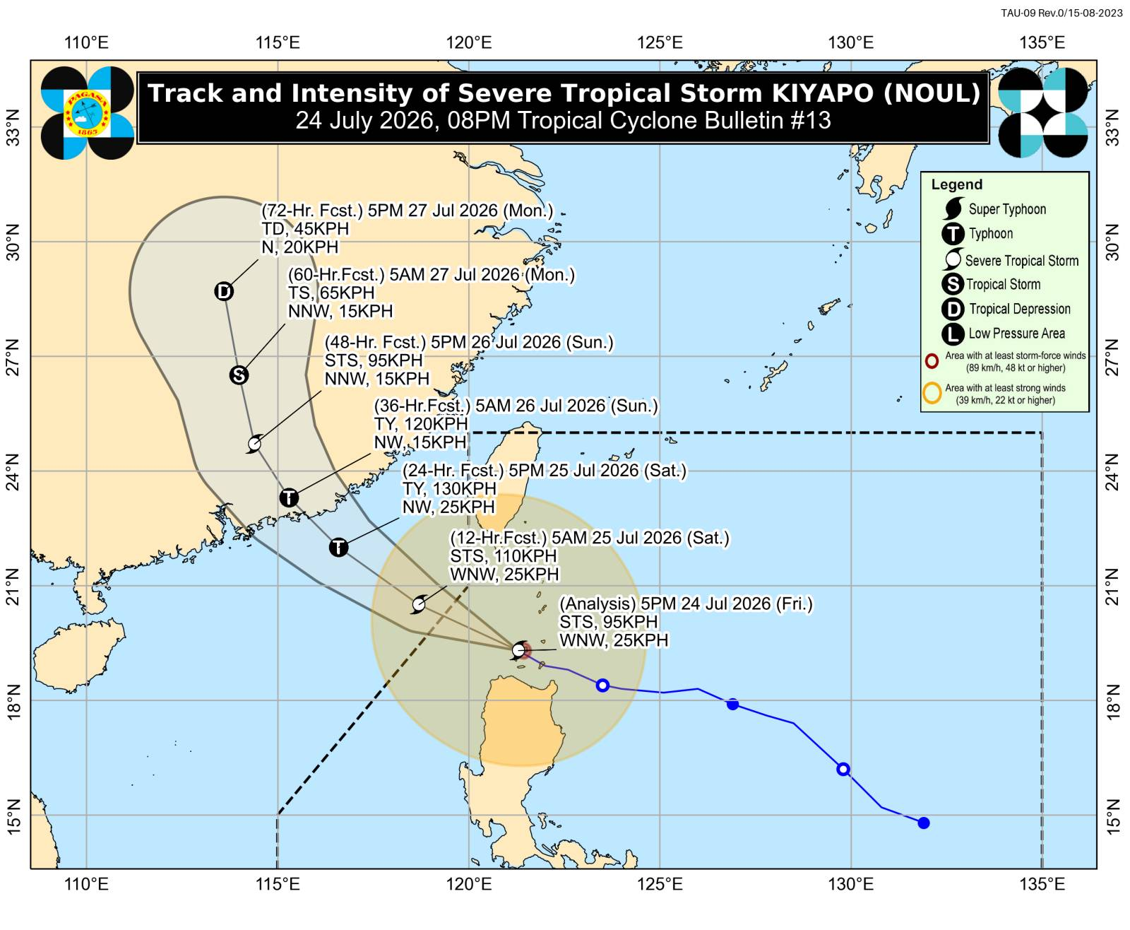
MANILA, Philippines — Tropical Cyclone Wind Signal (TCWS) No. 3 was now raised over western portion of Babuyan Islands as Kiyapo intensified into a severe tropical storm on Friday evening, the state weather bureau said. In its 8 p.m. weather bulletin, the Philippine Atmospheric, Geophysical, and Astronomical Services Administration (Pagasa) said Kiyapo was last located over the coastal waters of Calayan Island in Calayan, Cagayan as of 7 p.m. READ: Kiyapo gains strength after making landfall over Camiguin Islands Article continues after this advertisement Kiyapo was packing maximum sustained winds of 95 kilometers per hour (kph) and gusts of up to 130 kph, while moving west-northwestward at 25 kph. TCWS No. 3 was raised over the western portion of the Babuyan Islands, particularly Calayan Island, Dalupiri Island and Fuga Island, where wind speeds of 89 to 117 kph pose a moderate to significant threat to life and property. Meanwhile, TCWS No. 2 was hoisted over the following areas, with potential minor to moderate threat to life and property (62 kph to 88 kph wind speeds): Batanes Rest of Babuyan Islands Northern portion of mainland Cagayan (Santa Ana, Gonzaga, Santa Teresita, Camalaniugan, Aparri, Ballesteros, Abulug, Pamplona, Sanchez-Mira, Claveria, Santa Praxedes, Buguey, Allacapan, Lal-Lo, Gattaran, Baggao, Lasam) Northern portion of Apayao (Luna, Santa Marcela, Calanasan, Pudtol, Flora) Northern portion of Ilocos Norte: Pagudpud, Dumalneg, Adams, Bangui, Burgos, Vintar) Pagasa said these areas could experience winds of 62 to 88 kph, posing a minor to moderate threat to life and property. READ: Sea travel halted for small vessels in Antique as Kiyapo intensifies Article continues after this advertisement The following areas under TCWS No. 1, where wind speeds range from 39 kph to 61 kph with potential minimal to minor threat to life and property: Rest of mainland Cagayan Isabela Quirino Nueva Vizcaya Rest of Apayao Abra Kalinga Mountain Province Ifugao Benguet Rest of Ilocos Norte Ilocos Sur La Union Northern and central portions of Aurora (Dilasag, Casiguran, Dinalungan, Dipaculao) Pagasa also said that Kiyapo is forecast to intensify while moving over the West Philippine Sea, adding that “it may undergo rapid intensification and may reach typhoon category before making landfall over southern mainland China.” Article continues after this advertisement The bureau then said that Kiyapo will exit the Philippine area of responsibility by late Friday evening or early Saturday morning. /dp Your subscription could not be saved. Please try again. Your subscription has been successful.
Kiyapo intensifies into severe tropical storm; Signal No. 3 raised
Full Article
Original Source
Read the full article at Newsinfo →KhanList aggregates and links to publicly available news content. We do not host full articles from third-party sources. Always verify important information with original sources.