
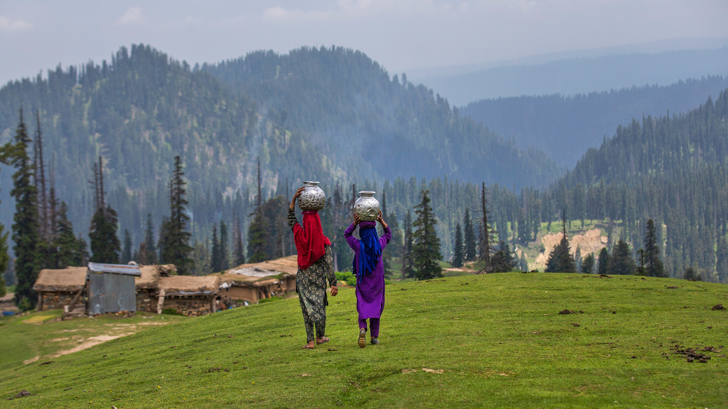
Research in the Sindh Basin in Kashmir’s Ganderbal district, in the northwestern Himalayas, has identified the elevations where many springs receive their water.The challenge now is whether conservation efforts will protect those landscapes, or continue focusing on the springs themselves.Experts say restoring Kashmir’s springs require protecting the landscapes that replenish groundwater, not just improving spring outlets. Shafeeqa, a 40-year-old resident of Cherwan village in Ganderbal district, north of Srinagar in Kashmir Valley, remembers a spring that once flowed with enough force to make diverting its water toward agricultural fields a difficult task. During her teenage years, she recalls, the water rushed so powerfully that her brother was once carried along by the current. Over the past 5-6 years, however, Shafeeqa said the spring’s flow has diminished step by step. What was once a dependable source of water has become a reminder of how much the village may be losing. “Nature has blessed us with a great source, but it is we who have destroyed it with our own hands,” she said. Shafeeqa says she believes climate change has contributed to the spring’s decline. Research in the Sindh Basin lends support to her concern, although the reasons springs lose their flow can vary from one location to another. The answer may lie some distance uphill, beyond the spring’s visible outlet and in the landscapes where rainwater and melting snow seep into the ground. Springs are an essential water source for communities in the Kashmir Himalaya, particularly in mountain settlements where rivers run through deep valleys and are difficult to access. Their water supports households, livestock and agriculture. But changes in spring flow can threaten all three. A Kashmiri Muslim man prays beside a stream on the outskirts of Srinagar, 2020. Image by AP Photo/Mukhtar Khan. A 2023 study in Environment, Development and Sustainability by researchers at the University of Kashmir examined spring discharge in the Sindh Basin. The study found that the discharge of many springs had declined, with some drying up. The researchers investigated the relationship between spring flow, temperature, precipitation, snow cover, land use and major development projects. Their findings linked spring decline to climate variability, including rising temperatures and earlier snowmelt and land use changes. In subsequent research, lead author and hydrogeologist Hilal Ahmad Sheikh sought to identify where springs receive their water. That study, published in 2025 in the Journal of Earth System Science, combined field investigations, geographic information system (GIS) mapping and stable water isotope analysis to map potential spring recharge areas in the Sindh Basin of the Kashmir Himalaya. Using field investigations, the researchers examined the springs and surrounding landscape, while GIS mapping allowed them to combine information about factors such as elevation, slope and land cover. They also analyzed stable isotopes — naturally occurring forms of hydrogen and oxygen found in water. Because their proportions can vary with conditions such as elevation and precipitation, these isotopes can provide clues about where water originated and how it reached a spring. Together, these methods helped the researchers identify landscapes that may be important for replenishing the basin’s springs. The study identified an elevation range of approximately 1,750-2,875 meters (5,741-9,432 feet) above sea level as an important zone for spring recharge. The isotope results broadly supported the recharge areas identified by the GIS model, helping researchers narrow down where water feeding many springs may enter the ground. The distinction matters. A spring is where groundwater emerges, not necessarily where it enters the ground. Water may infiltrate through soil, vegetation and permeable rock higher up before traveling underground to emerge lower down. Disturbances in those recharge areas can affect the water reaching a spring, even when the outlet itself remains untouched. A frozen mountain stream that’s stopped just short of joining the Sindh River. Image by shankar s. via Flickr (CC BY 2.0). Recharge areas are the landscapes where precipitation, including rain and snowmelt, infiltrates the ground and contributes to groundwater. That water can travel through soil, sediments and rock before emerging at a spring farther downhill. “When you stand at a spring, you see groundwater emerging, but you cannot see where it comes from,” Sheikh told Mongabay. Sheikh said the findings could help guide decisions about protecting recharge areas and where interventions to improve infiltration might be appropriate. “The elevation band between 1,750 and 2,875 meters is therefore important: Protecting and managing the landscape within it may help sustain springs,” he said. The study does not establish an exact recharge boundary for every spring. Individual springs can have different geological settings and groundwater pathways, and some may receive water from outside the identified elevation band. Nevertheless, the findings provide a basis for investigating the landscapes that sustain springs and assessing how they are changing. However, the study points to a practical challenge, as identifying potential recharge areas is only the first step. Conservation also requires understanding what is happening in those areas and whether water can continue to infiltrate the ground. Suhail Ahmad Lone, a hydrogeologist and assistant professor at University of Kashmir who was not involved in the study, has studied groundwater systems in Kashmir. He said researchers need to understand a spring’s seasonal behavior, geology and recharge sources before drawing conclusions about why its flow has declined. “If you have the data of a spring from the last two or three years, the first thing you would try to do is study its fluctuations,” Lone told Mongabay in an interview. Verinag Spring basin in Anantnag district. This spring is a source of the Jhelum River. Image by Shyamal Chandra Ghosh via Wikimedia Commons (CC BY-SA 4.0). According to Lone, a spring’s behavior depends partly on the geology beneath it. Springs associated with alluvial sediments, karewa deposits, karst formations and hard rock can behave differently, making it important to understand local conditions before deciding how to restore them. Lone said researchers should compare discharge measurements with precipitation records and investigate where the groundwater originates. Without that information, it is difficult to determine whether climate, land use change or another factor is responsible for a particular spring’s decline. “We cannot directly pin it on climate change. We cannot directly claim that it is happening because of anthropogenic activities,” he said, adding that researchers need to examine the evidence before identifying the cause. Long-term monitoring is particularly important for distinguishing between seasonal fluctuations and sustained changes in discharge. “Repeated measurements can help establish whether a spring’s behavior is changing alongside rainfall and snowfall patterns or whether other disturbances may be involved,” Lone said. The distinction between a spring’s recharge area and its flow matters in Cherwan, where Shafeeqa describes a decline over several years but does not comprehend its cause. Historical flow measurements, if available, and further investigation into ground water movement and distribution could help determine whether the spring’s changes are consistent with regional trends or reflect local conditions. Lone also cautioned against treating recharge maps as exact representations of every groundwater pathway. “GIS modeling is a [research] technique and it can help a person make maps and other things. But observational data, that is very important,” he said. Lone said understanding individual springs requires field observations and measurements over time, rather than relying on a model alone. The landscape uphill can also be affected by road building, excavation and expanding settlements. In some locations, groundwater flows through relatively shallow sediments, making it vulnerable to disturbances that alter underground pathways. While the condition of a spring’s recharge area can influence how much water reaches it, changes in climate can also affect its flow. Shifts in snowfall and precipitation patterns may alter how water enters the ground and replenishes springs, particularly those that depend on recharge at lower elevations. “We are experiencing less snowfall in the low altitudes from the last five years due to the climate change, which again is one of the factors responsible for the springs drying up in Kashmir, which have recharge potential at lower altitudes,” he added. Kashmiri shepherd boys carrying plastic containers walk toward a spring to collect water in Tosamaidan, southwest of Srinagar, 2021. Image by AP Photo/Dar Yasin. Lone described a case in the Kashmir Valley involving springs associated with shallow groundwater in alluvial sediments. In an area where these springs depended on nearby groundwater flows, excavation reaching around 10 meters (33 feet) reportedly altered the hydraulic gradient — the force that drives groundwater movement — and affected the water supplying the springs. He said excavation and the disturbance of sediments could be among the reasons some springs dry up in Kashmir. But further examination of the specific site is needed to strongly establish any connection between excavation and drying springs as noted in Lone’s example. The broader concern, however, is that construction decisions can affect groundwater systems even when the consequences are not immediately visible at the surface. Geologists and hydrogeologists who understand local conditions should assess developmental projects before they are executed. According to Lone, measures such as vegetation restoration, check dams and rainwater-harvesting structures may help slow runoff and give water more time to infiltrate into the ground. Their effectiveness of such measures depends on where and how they are used. For Momin, another resident of Cherwan, the spring’s decline is also evident in how it has been used over time. Momin told Mongabay that villagers once brought fishes to the spring and kept them there because its flow was dependable. He recalled that the fish began dying during autumn and winter, when the water flow frequently weakened. He also said that even in summer, the spring no longer flows as strongly as it did in earlier years. The Sindh River flows through Manigam, a village in the Ganderbal district. Image by Kashmir Pictures via Flickr (CC BY 2.0). Shafeeqa’s and Momin’s accounts describe changes in the spring’s flow and in the ways people remember and use it. What has caused the decline is, however, more complex than just periodic fluctuations. The findings from the Sindh Basin could help direct future interventions toward the areas where springs receive their water, rather than concentrating only on the outlets, Sheikh said. He said that improving a spring outlet or installing a storage tank would not restore its flow if the groundwater feeding it continued to decline. Efforts to improve a spring’s appearance should be guided by surveys that identify suitable locations and assess the permeability of the underlying rocks and sediments. The challenge now is whether relevant actors are translating scientific findings into conservation decisions. In July, the Jammu and Kashmir Integrated Watershed Management Programme and the University of Kashmir signed an agreement to prepare detailed project reports for springshed rejuvenation, including hydrogeological assessments and recharge-zone mapping. For residents such as Shafeeqa and Momin, the issue is not simply whether scientists restore a spring. It is whether the water will continue to flow when their village needs it. The Journal of Earth System Science research offers a way to begin looking for answers uphill. Whether that knowledge leads to better protection of the landscapes that sustain springs remains an open question. For Sheikh, the findings point to a shift in how spring restoration should be approached: from focusing only on the water source to protecting the landscape that replenishes it. When asked where the government should focus its investment to restore a declining spring, Lone offered a simple answer, “I would definitely tell them to go uphill.” Banner image: Kashmiri shepherd girls walk back home after collecting water from a nearby spring in Tosamaidan, southwest of Srinagar, 2021. Image by AP Photo/Dar Yasin. Kashmir’s water bodies have declined for decades. Is conservation keeping pace? Citations: Sheikh, H. A., Bhat, M. S., Alam, A., Ahsan, S., & Shah, B. (2023). Evaluating the drivers of groundwater spring discharge in Sindh basin of Kashmir Himalaya. Environment, Development and Sustainability, 26(10), 25645-25667. doi:10.1007/s10668-023-03700-4 Sheikh, H. A., Bhat, M. S., Jeelani, G., Alam, A., Ahsan, S., & Shah, B. (2025). Identification of potential spring recharge areas in the himalayan catchment using the AHP model and stable water isotopes. Journal of Earth System Science, 134(2). doi:10.1007/s12040-025-02541-1 Credits Topics
Kashmir’s springs are drying up. Scientists say saving them starts uphill
Full Article
Original Source
Read the full article at News →KhanList aggregates and links to publicly available news content. We do not host full articles from third-party sources. Always verify important information with original sources.